The week starts relatively calm over the North Sea under influence of a strong high-pressure area. This high shifts slowly west, allowing low pressure areas to move south via Scandinavia. As a result, winds will start blowing from a northwesterly direction, meanwhile gradually increasing. Waves are expected to increase as well.
Synoptic overview
A robust high-pressure system dominates the North Sea resulting in relatively calm conditions for the larger part of the North Sea. The main center of this high-pressure system north of Scotland is gradually shifting west and this movement allows for low-pressure areas to move south via Scandinavia, causing the wind over the whole North Sea to change to a northerly direction and to increase at times. As we approach the weekend, the high-pressure area shifts south, and low pressure over Scandinavia deepens, leading to a steady increase in winds from a northwesterly direction. The confidence of this is quite high, as the European and the American model predict the same developments.Wind and waves
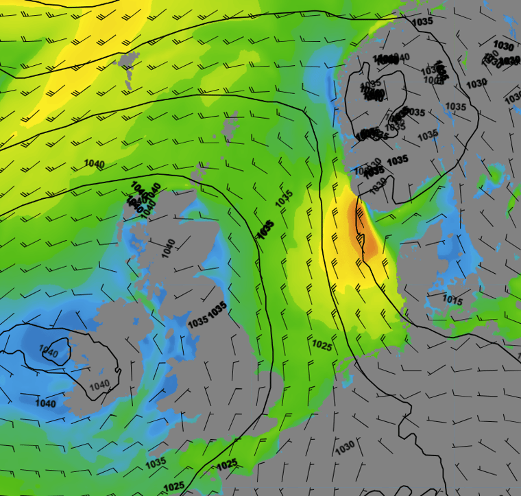
Figure 1 depicts both wind speed and wind direction on Wednesday at 00UTC. Moderate to fresh northerly winds blow over the North Sea. Easterly winds can be found over the southern part of the North Sea. This results in waves around 1.0 meter in the central part of the North Sea, with waves around 2.0 meter in the southern North Sea and in the northern North Sea.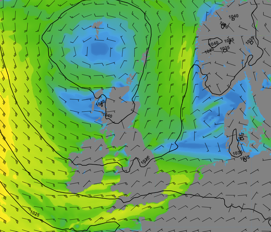 Figure 1: Wind speed and wind direction according to GFS on Wednesday at 00 UTC.
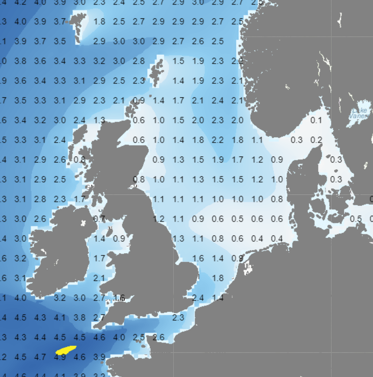 Figure 2: Significant wave height and wave direction (wave model based on GFS) on Wednesday at 00 UTC.
Figure 3 illustrates the intensified north to northwesterly winds over the North Sea later this week. As the high-pressure area shifts southwest and low pressure area’s move south via Scandinavia, winds over the North Sea might temporarily reach gale force.
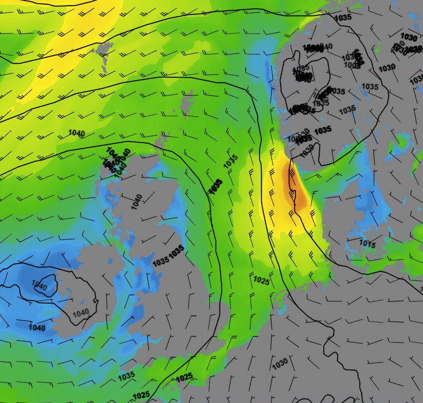 Figure 3: Wind speed and wind direction according to GFS on Friday at 12 UTC.
Waves will gradually increase as well, as a result of the increasing winds. They are expected to increase to about 2.0 meter in the southern North Sea and to 4.0-5.0 meter in the northern North Sea (see Figure 4) during the weekend.
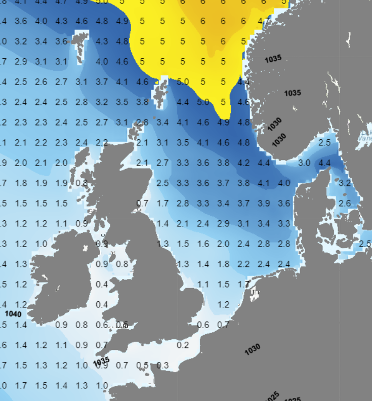 Figure 4: Significant wave height and wave direction (wave model based on GFS) on Saturday at 12 UTC.
Conclusion
The week commences with relatively calm conditions, influenced by high pressure over the North Sea. However, as this high-pressure system shifts away in the course of the week, low pressure intensifies over Scandinavia, leading to a rise in northwesterly winds and increasing waves across the North Sea. There are indications that low pressure will gain more influence over the entire North Sea at the beginning of the following week.Always up-to-date
Like this weather briefing? Our monthly newsletter gives you even more insights. Think about the marine weather phenomena, updates about our ever-evolving forecasting products and the latest and most relevant marine weather briefing. Subscribe to receive our Infoplaza marine newsletter once a month.