The week begins with unsettled weather as Storm Henk brings strong winds and high waves. Wind and waves are expected to gradually decrease starting tomorrow. However, confidence in the weather forecast remains low in the coming days, and unexpected developments might still lead to temporary increases in wind and waves. A pattern change is anticipated over the coming weekend when high pressure becomes the dominant factor over the North Sea.
Synoptic overview
An active low over Wales tracks NE into the North Sea today, becoming more or less stationary afterwards. Meanwhile, another low pressure area is more or less stationary W of Scotland. A new secondary low is expected over the English Channel on Thursday. This low will move NE via the Netherlands on Friday. The complex system with low pressure area’s over the UK and the North Sea is expected to move SE during the weekend. At the same time, high pressure builds over the UK and over Scandinavia.Wind and waves
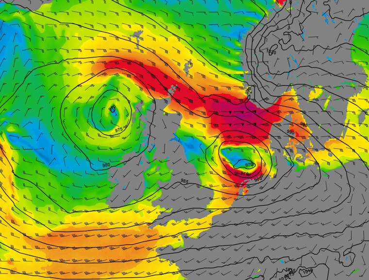
Figure 1 depicts both wind speed and wind direction on Wednesday at 00UTC. At this time, Storm Henk has reached the German Bight, causing an easterly storm over Fisher and a westerly storm just north of the Netherlands. Simultaneously, strong gale winds are present west of the Shetlands and in Viking, around the low-pressure area to the west of Scotland. Figure 1: Wind speed and wind direction according to GFS on Wednesday at 00 UTC.
Figure 2 illustrates the significant wave height (Hs) and wave direction on Wednesday at 00UTC. The stormy winds contribute to wave heights reaching 7.0-9.0 meters in Fisher, Forties, and the West of Shetland area. Waves in the southern North Sea are also expected to rise to 3.0-5.0 meters.
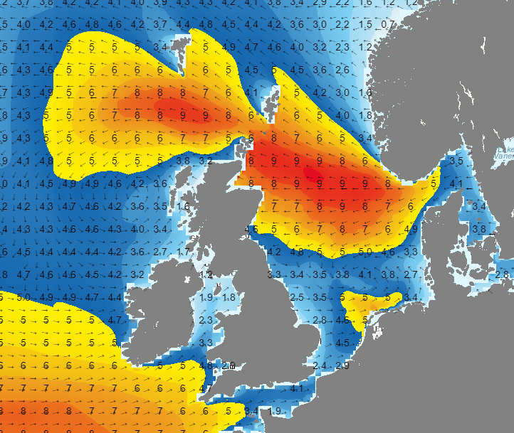 Figure 2: Significant wave height and wave direction (wave model based on GFS) on Wednesday at 00 UTC.
Starting tomorrow, both wind and waves are expected to gradually decrease as the low-pressure areas slowly fill. The third low moving northeast via the English Channel is not anticipated to be very active. Concurrently, a ridge of high pressure begins to build west of the UK, with pressure over Scandinavia also increasing. Figure 3 illustrates the wind conditions at the beginning of the weekend, with a moderate breeze expected over the larger part of the North Sea.
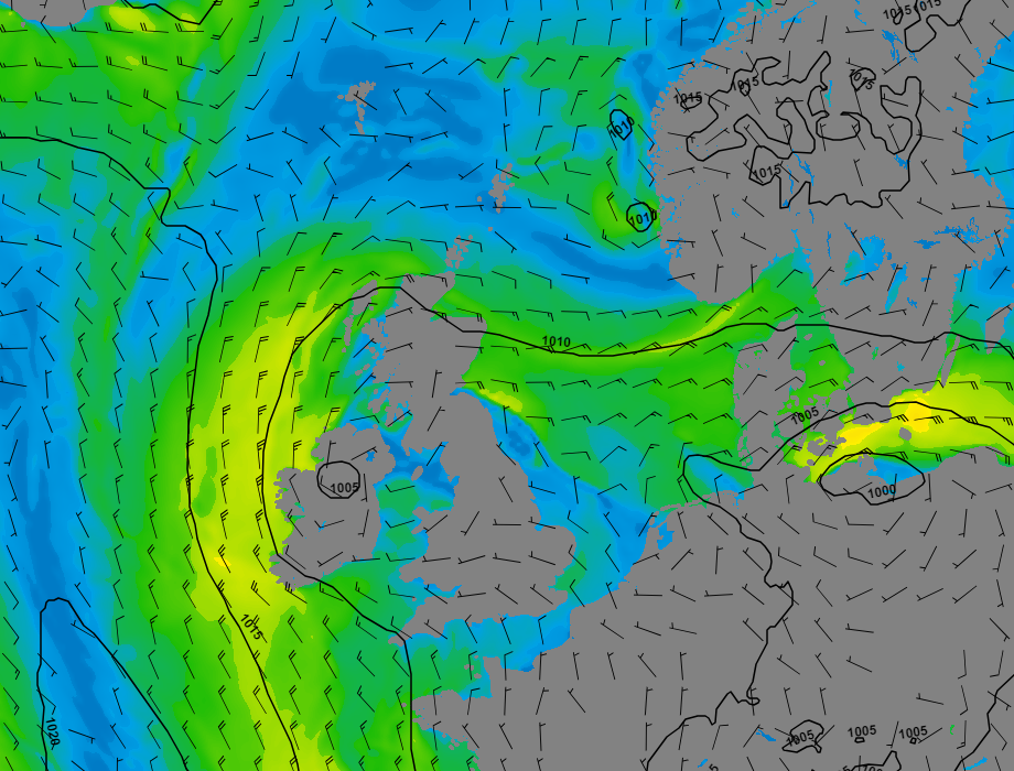 Figure 3: Wind speed and wind direction according to GFS on Saturday at 00UTC.
As a result, waves will decrease as well and are expected to be between 1.0 and 2.0 meters over almost the entire North Sea.
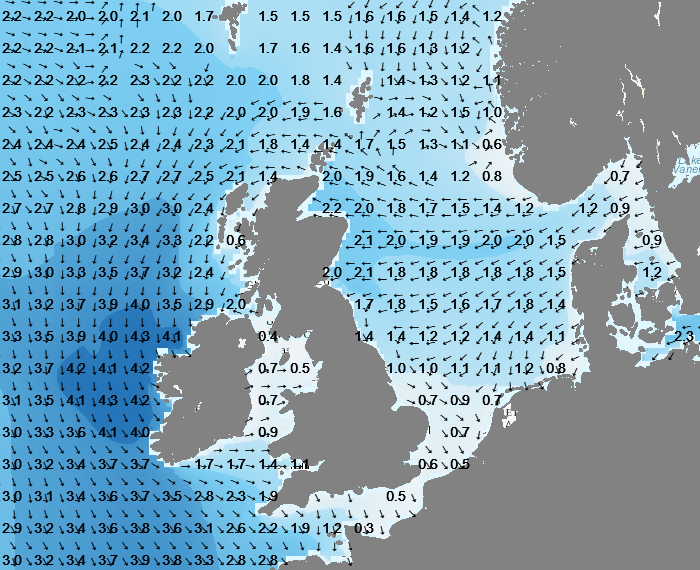 Figure 4: Significant wave height and wave direction (wave model based on GFS) on Saturday at 00 UTC.
Conclusion
The start of the week is characterized by highly variable weather. Storm Henk brings severe conditions and might result in waves up to 9.0 meter in some parts of the North Sea. From tomorrow, conditions will slowly calm down. However, unexpected developments might still result in shortly higher wind and waves. Conditions will change coming weekend as high pressure is expected to become dominant over the North Sea.Always up-to-date
Like this weather briefing? Our monthly newsletter gives you even more insights. Think about the marine weather phenomena, updates about our ever-evolving forecasting products and the latest and most relevant marine weather briefing. Subscribe to receive our Infoplaza marine newsletter once a month.