Weather conditions in a large part of the North Sea are currently relatively calm, but they are expected to deteriorate rapidly on Wednesday as a frontal trough moves through the region. Over the following days, a low-pressure system will linger over the North Sea, resulting in a lower pressure gradient, reduced wind speed, and smaller waves. As we head into the weekend, pressure is anticipated to rise over Scandinavia while a deep Atlantic low gradually approaches the UK.
Synoptic overview
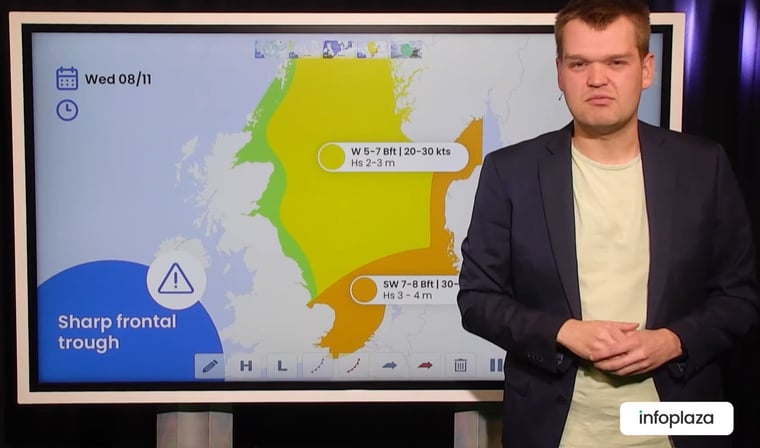
Today, a broad trough covers the North Sea, resulting in relatively calm conditions due to a low pressure gradient. However, in the southern parts of the trough, there is a strong SW'ly flow, leading to unsettled conditions with active showers near the Dutch coast and over the German Bight.On Wednesday, a deep Atlantic low (970 hPa) moves eastwards towards Scotland, bringing an associated frontal trough that sweeps east-northeast over the North Sea, creating unfavorable working conditions.
By Thursday, the low-pressure system arrives near Scotland and continues to swirl over the UK and the North Sea in the following days. The low will gradually fill (995 hPa by Friday) and become complex, resulting in a reduction of the pressure gradient, leading to lower wind speeds and smaller waves. Due to the nearby low-pressure area, showers and associated wind gusts will persist over the region.
Over the weekend, pressure is expected to rise over Scandinavia, potentially extending a ridge over the North Sea. Meanwhile, a deep low is expected well west of the UK (950 hPa), slowly tracking eastwards towards Ireland. This will maintain unsettled conditions, although precise developments for the North Sea remain uncertain at this time.
Video briefing at the end of this article
Wind and waves
Today, the wind is mostly moderate to fresh, ranging from 3-5 Bft. Strong winds (6 Bft) are observed only in the southern North Sea. Wave heights will be limited to mostly 1-2 meters, with higher significant wave heights (2-3 meters) in the southeastern part of the North Sea (see Figure 1).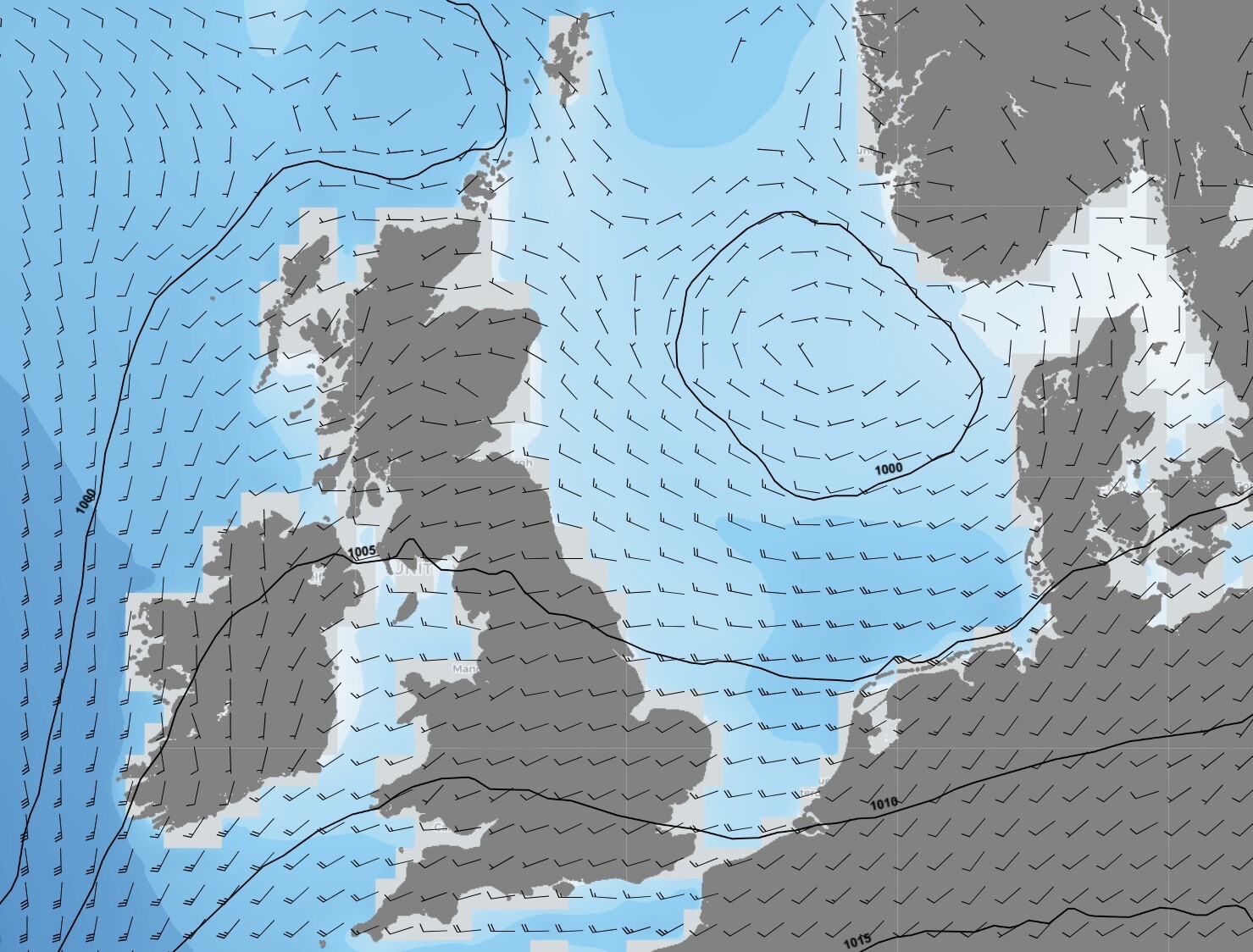 Figure 1: Wind speed, direction and wave height on Tuesday Nov 7th at 18 UTC according to the ECMWF model.
On Wednesday, as the frontal trough sweeps through the North Sea, wind speeds are expected to increase to near gale or gale force, reaching 7 or 8 Bft. This will be accompanied by waves up to 4 meters (see Figure 2).
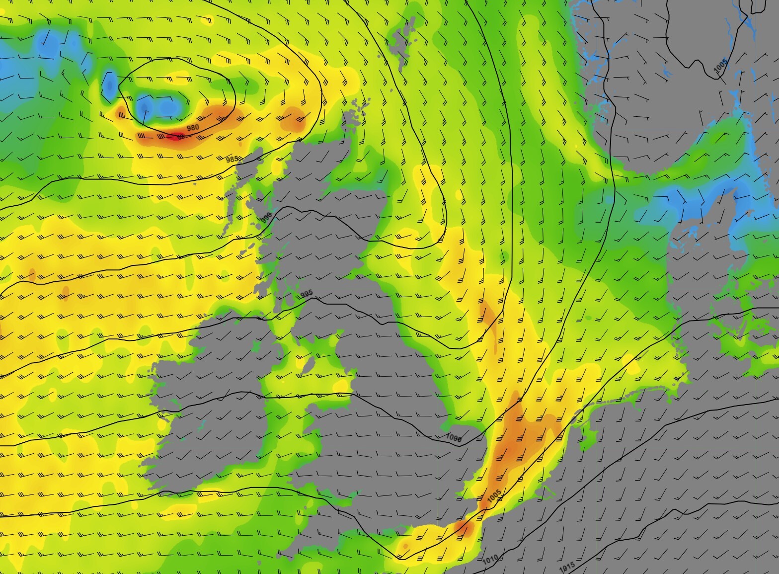 Figure 2: Wind speed and direction on Wednesday Nov 8th at 12 UTC according to the ECMWF model.
Thursday and Friday see the low-pressure system swirling over the UK and the North Sea while becoming more complex. The pressure gradient decreases, resulting in wind speeds dropping to mostly moderate to fresh, accompanied by waves ranging from 1-2 meters (see Figure 3).
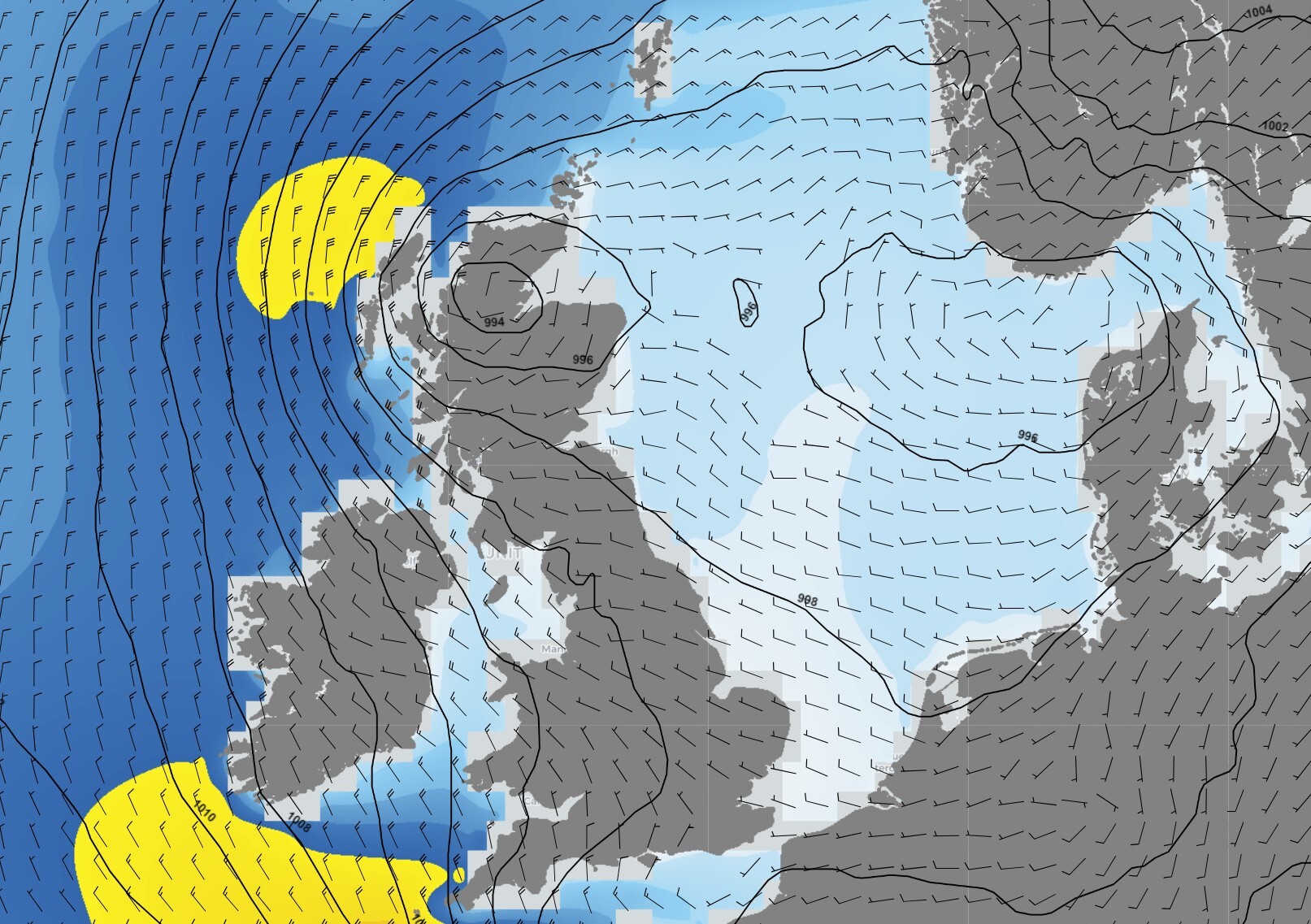 Figure 3: Wind speed, direction and wave height on Friday Nov 10th at 12 UTC according to the ECMWF model.
Over the weekend, a weak ridge is expected to build over the area, leading to a brief period of calm conditions and improvement. Wind speeds will generally remain moderate to fresh, ranging from 3-5 Bft, but over the central North Sea, easterly winds may occasionally increase to strong (6 Bft). Significant wave heights are expected to be around 1-2 meters, with up to 3 meters in the central North Sea. Concurrently, pressure is dropping west of Ireland (see Figure 4).
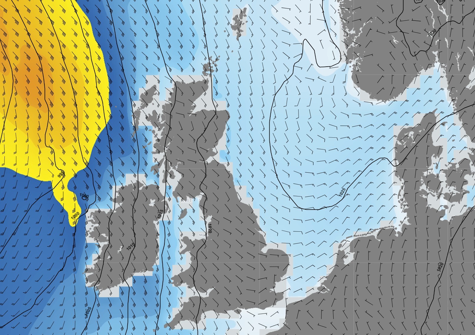 Figure 4: Wind speed, direction and wave height on Sunday Nov 12th at 12 UTC according to the ECMWF model.
Conclusion
Unsettled conditions are expected to persist as low-pressure systems dominate the North Sea's weather for a significant portion of the week. Wednesday will bring an active frontal trough with strong winds and high waves. While a weak ridge may provide somewhat more settled conditions over the weekend, a new deep low is approaching from the west.All the insights into marine weather
We just launched our new resources page. Here you will find special content like videos, webinar and whitepapers that will guide you to a decision point. Use these expert insights to improve your business or simply get your knowledge about the marine weather up-to-date.