
Synoptic overview
A low-pressure area is currently located to the west of Ireland. An associated front is moving today from south to north across the North Sea. Simultaneously, the low-pressure area is moving towards Scotland. The low consists of several small low-pressure centers. One of these centers will reach the northern North Sea on Thursday and linger there. Another center will move on Friday across the central part of the North Sea towards the east. The center above the northern North Sea will subsequently move southeastward and reach the western part of Denmark on Saturday morning. Meanwhile, a weak high-pressure ridge is situated over the UK. This ridge will move eastward later on Saturday and leave the North Sea in the evening. At the same time, a deep low-pressure area has formed to the west of Ireland. This system will again move eastward and reach the southern North Sea on Sunday. This system will bring variable weather once again. Additionally, this system and the complex low-pressure system from Thursday and Friday will traverse over parts of the North Sea, making the forecast very uncertain in some places.Wind and waves
Figure 1 shows the earlier mentioned separate low pressure cores over the northern North Sea and Scotland. As a result, a strong southwesterly flow is present over a large part of the North Sea. The Figure shows wind gusts up to 80 km/h over the southern half of the North Sea. Due to the strong winds, Hs will be ranging from 3-4.5m over a large part of the North Sea. Hs will be lower along the east coast of the UK due to its relatively sheltered location during southwesterly winds.
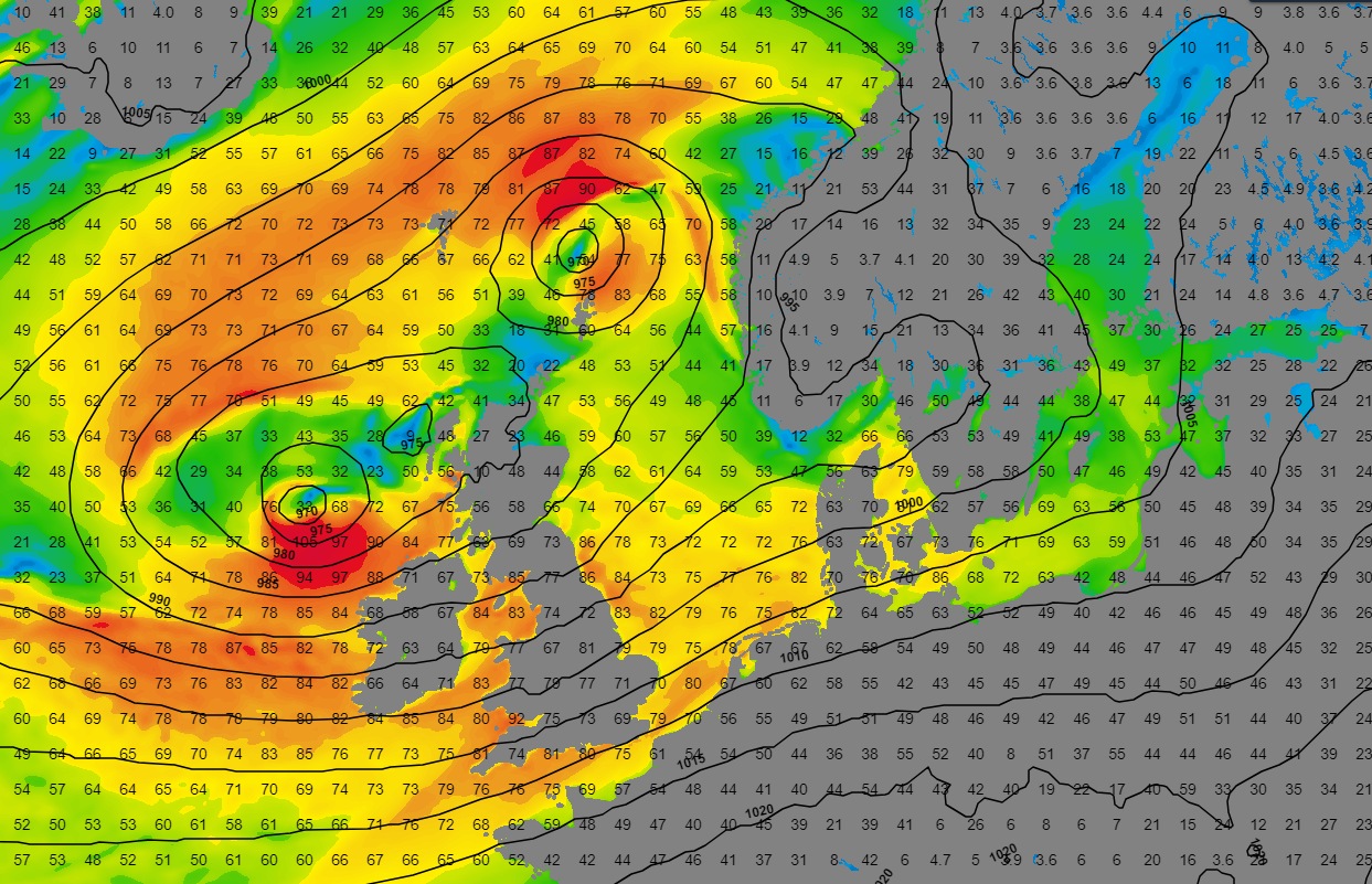 Figure 1: Wind speed (km/h) and wind direction according to GFS on Thursday at 12UTC.
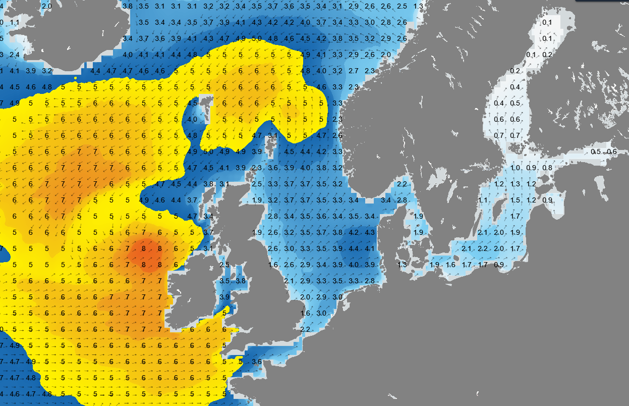 Figure 2: Significant wave height and wave direction according to GFS on Thursday at 12UTC.
The earlier mentioned weak mobile ridge that passes over the North Sea brings some more stable weather on Saturday but is quickly followed by the next low pressure area. This low can be seen in Figure 3. The exact position of the low pressure area is still uncertain. GFS (Figure 3) shows a more northerly position compared to ECMWF. Nonetheless, both models forecast strong winds (gusts up to 70-90 km/h) and Hs of 3-4.5 meters over most parts of the North Sea.
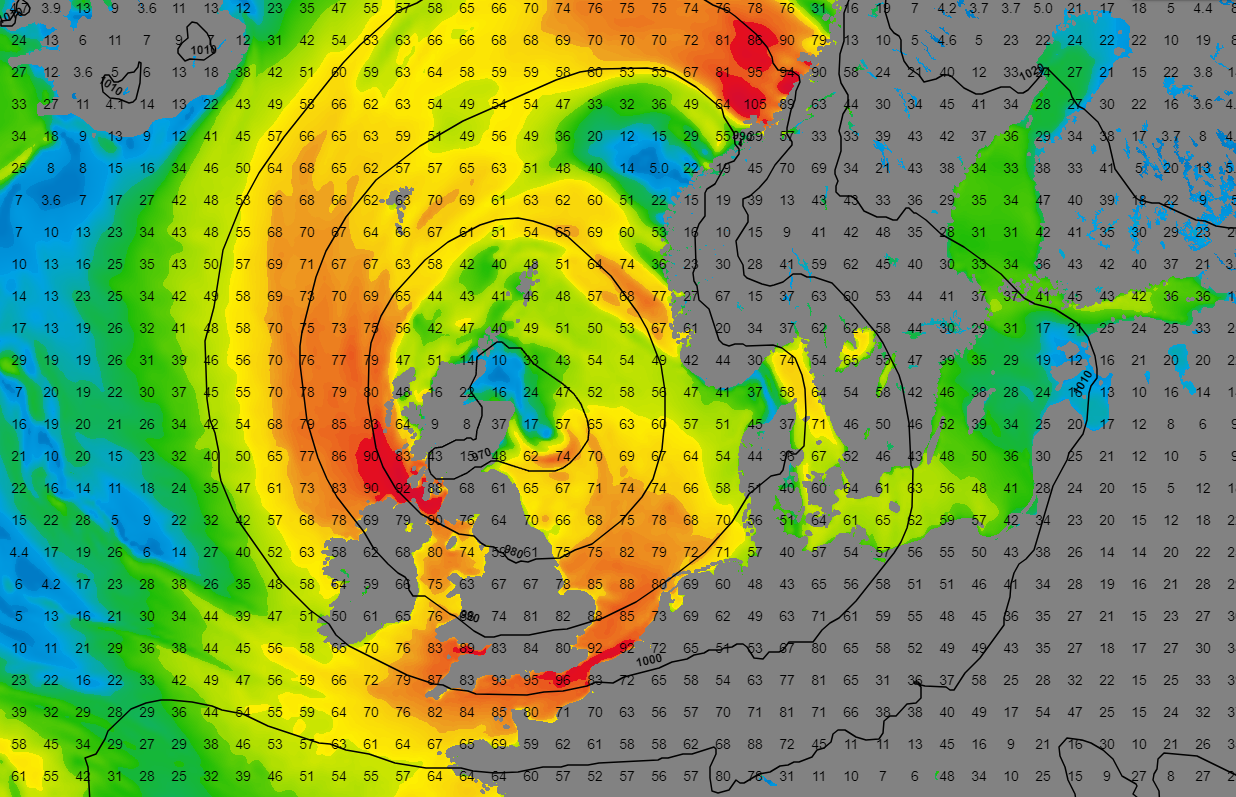 Figure 3: Wind speed and wind direction according to GFS on Sunday at 12UTC.
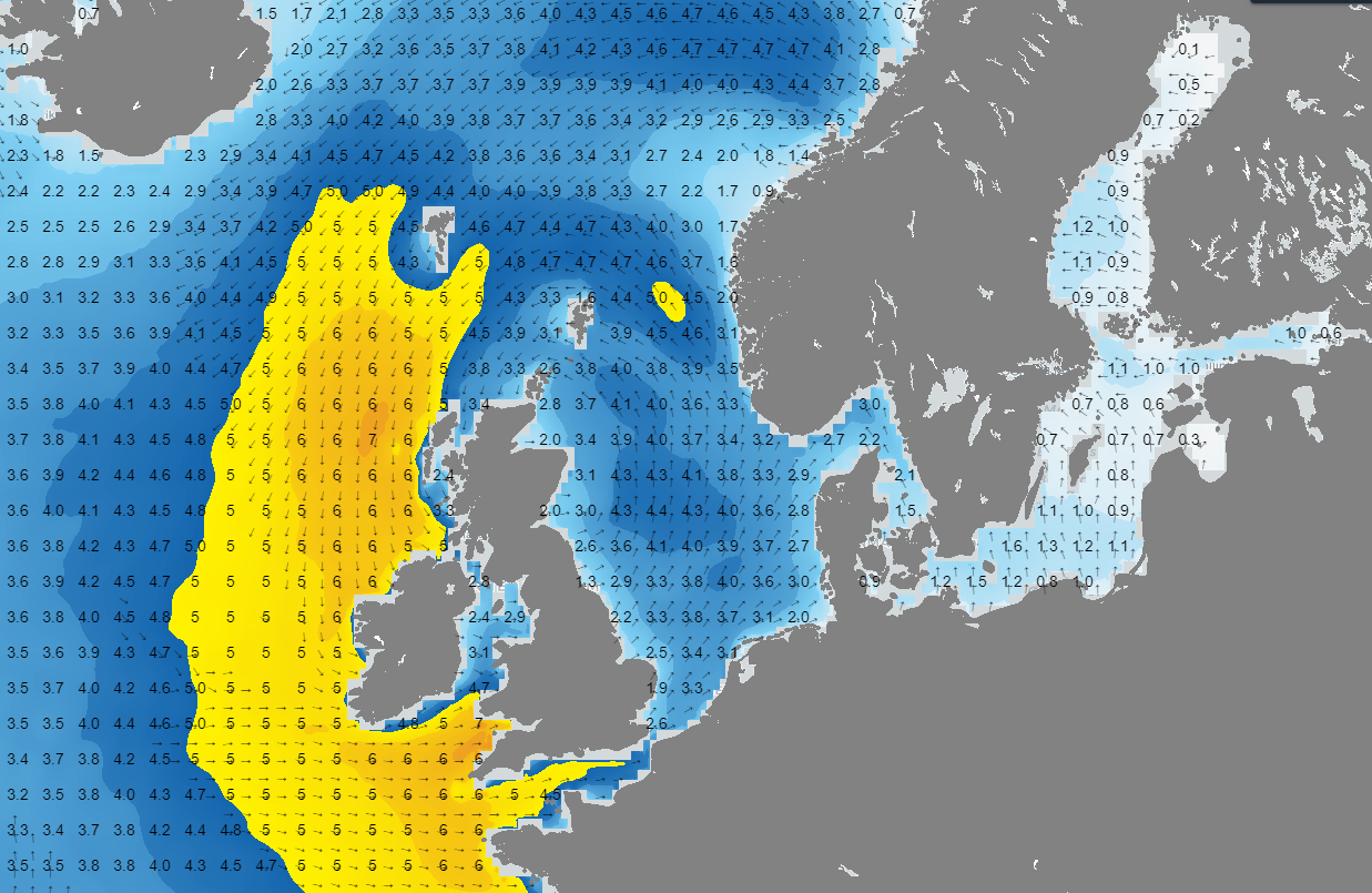 Figure 4: Significant wave height and wave direction according to GFS on Sunday at 12UTC.
Conclusion
The coming days are characterized by variability. The wind is occasionally strong, with significant wave heights around 3-4.5 meters over large parts of the North Sea. Due to the southwest wind, waves along the east coast of the UK are lower. In the night to Saturday and during Saturday, it temporarily calms down a bit due to a weak high-pressure ridge. On Sunday, an active low-pressure system moves into the North Sea. This low will once again bring strong winds and high waves. The exact position of the low's center is still uncertain. In short, the last week of 2023 will also end with variable weather.Always up-to-date
Like this weather briefing? Our monthly newsletter gives you even more insights. Think about the marine weather phenomena, updates about our ever-evolving forecasting products and the latest and most relevant marine weather briefing. Subscribe to receive our Infoplaza marine newsletter once a month.


