Several low-pressure cores are moving from the United Kingdom across the southern North Sea towards Denmark. These systems often bring wind, waves, and rain with them. However, the exact position of these low-pressure areas is sometimes still uncertain. A small shift to the north or south can make a significant difference in the weather at your location. Over the northern North Sea, high pressure is more prevalent. Over the weekend, a large low-pressure system approaches the North Sea from the southwest.
Synoptic overview
A low-pressure (990hPa) area over Denmark is moving further eastward. Its associated trough is slowly dissipating over the southern North Sea. Concurrently, a weak high-pressure system over the Norwegian Sea is expanding across the northern North Sea.On Wednesday, another low-pressure system (1010hPa) tracks from the UK, across the Wadden Sea and the German Bight, towards Denmark. Its associated front dissipates again over the southern North Sea as high pressure begins to build from the south.
A new front reaches the far south of the North Sea on Friday. The associated low-pressure system (1005 hPa) is located between Iceland and Scotland. Simultaneously, a deep low-pressure system (975 hPa) forms over the Atlantic Ocean to the west of Ireland. Associated fronts develop over the North Sea during the weekend. The low reaches the North Sea on Sunday and gradually starts to dissipate. The exact position of the low is still highly uncertain.
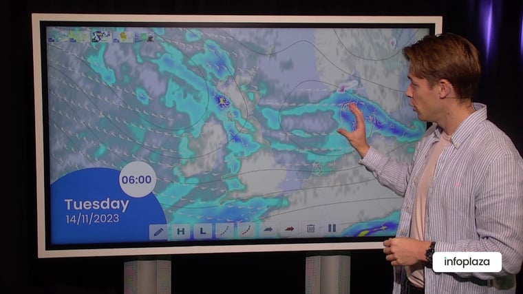
You will find a video briefing at the end of this article
Wind and waves
Figure 1 shows both wind speed and wind direction on Wednesday 09UTC. A minor low is situated in the German Bight. Associated frontal trough is located over the North Sea from the Wadden towards Scotland. Wind speeds within the frontal trough are weak. Just on the south side sustained wind gusts could peak up 6 Beaufort.Figure 2 shows the significant wave height according to GFS over the North Sea and the Atlantic Ocean on Wednesday at 09UTC. Due to the active weather from previous days, there is still quite some swell over large parts of the North Sea. Hs peaks to 3.5-4m over the middle and northern parts of the North Sea. Waves are a bit suppressed further south due to the sheltered location.
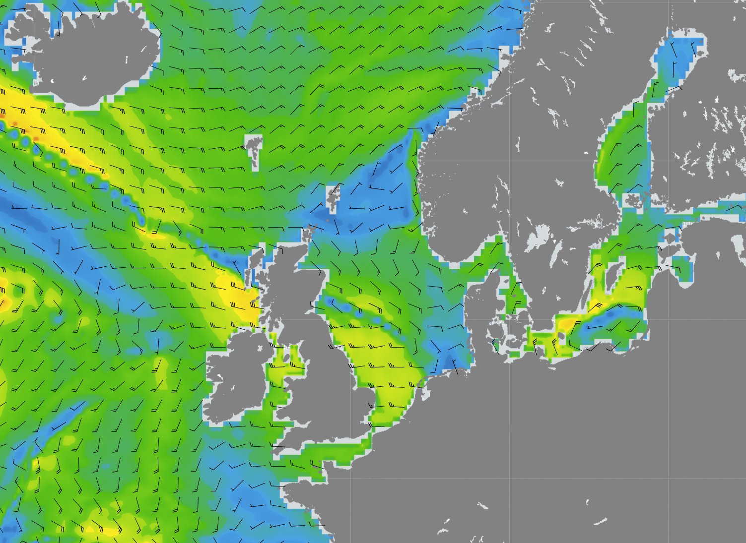 Figure 1: Wind speed and wind direction over the North Sea according to GFS on Wednesday at 09UTC.
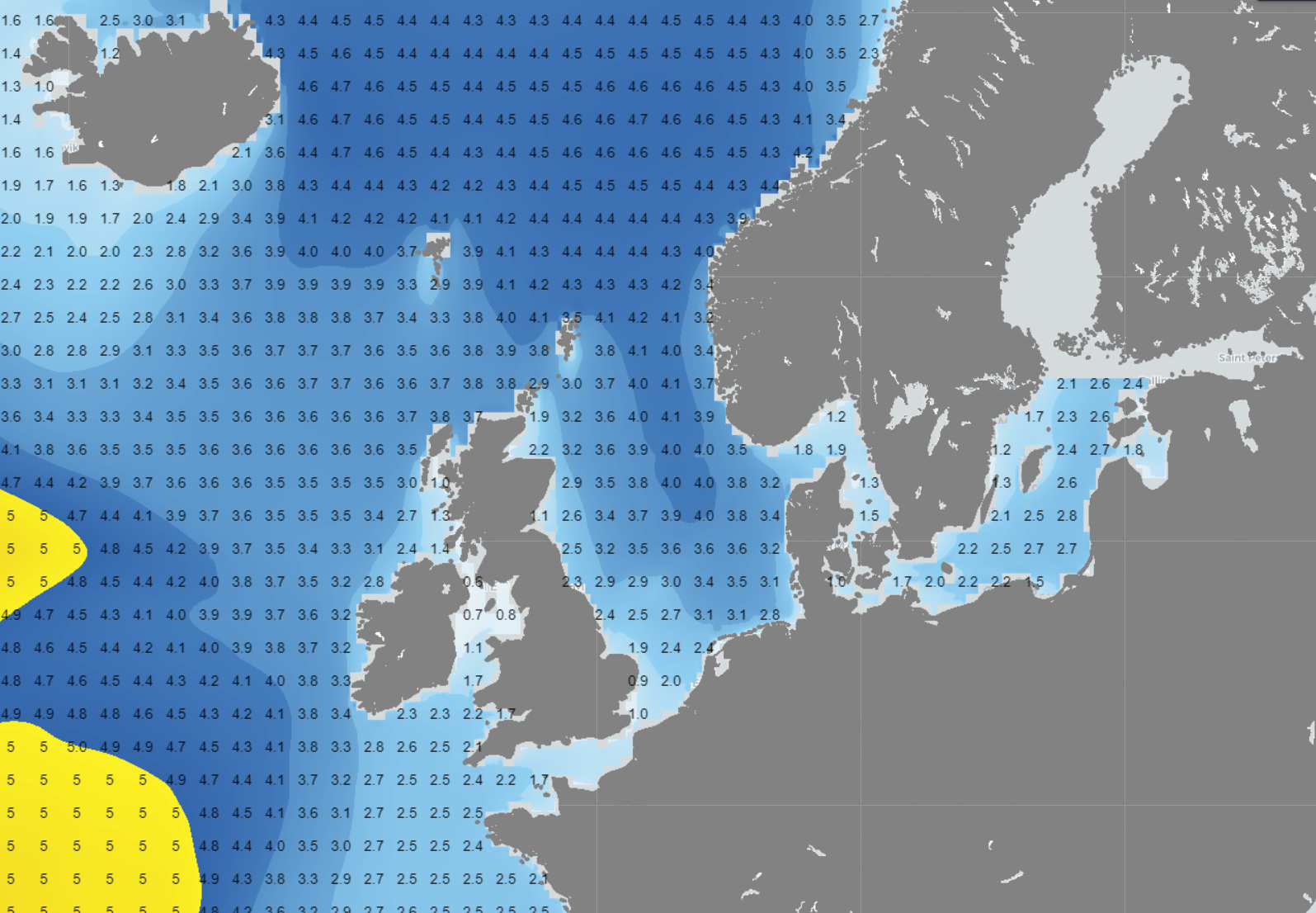 Figure 2: Significant wave height in the North Sea according to GFS on Wednesday at 09UTC.
Another minor low tracks E over the southern North Sea on Thursday. But due to a relatively weak pressure gradient, both wind and waves stay relatively calm.
The next major low is expected over the North Sea during the weekend. Associated warm front is located over the northern half of the North Sea on Saturday (Figure 3). Behind the warm front, the wind increases to 7/8 Beaufort. Significant wave height varies between 1.5 – 3m, with the lowest values over the far south of the North Sea.
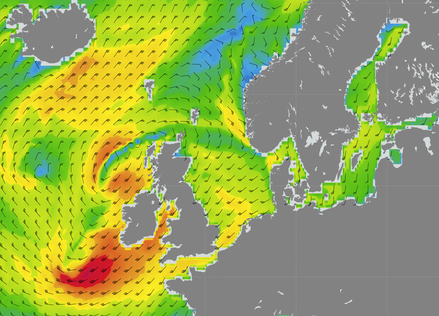 Figure 3: Wind speed and wind direction over the North Sea according to GFS on Saturday at 12UTC.
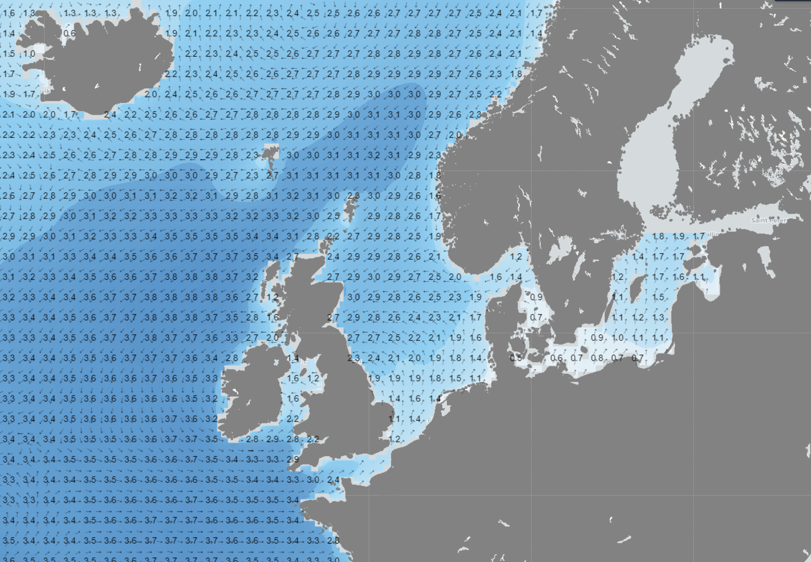 Figure 4: Significant wave height in the North Sea on Saturday at 12UTC.
Conclusion
This week will once again bring highly changeable weather. Several small low-pressure systems will bring wind, waves, and rain for much of the week. Later in the week, it will become somewhat calmer as high pressure over the Norwegian Sea gradually extends southward. Over the weekend, a new low-pressure system approaches from the southwest, bringing back the unsettled weather.
Always up-to-date
Like this weather briefing? Our monthly newsletter gives you even more insights. Think about marine weather phenomena, updates about our ever-evolving forecasting products, and the latest and most relevant marine weather briefing. Subscribe to receive our Infoplaza marine newsletter once a month. 


