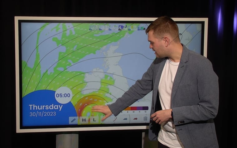
This week is characterized by various low-pressure areas moving southward over the North Sea. The systems are often small, making the exact forecast for a particular location complicated. Later in the week, most of the low-pressure systems move away to the south, and a northeast wind brings cold air. Over the weekend, uncertainty gradually increases as new low-pressure systems may form over the North Sea in the cold upper air.
Synoptic overview
High pressure is located north of Lapland and extends a ridge over the Norwegian Sea to Scotland. A small low-pressure system forms southwest of Norway and moves southeastward over the North Sea on Tuesday and into Wednesday night. After the departure of the low-pressure system, the wind shifts to the northeast, bringing cold air from Scandinavia into the North Sea. This pressure distribution, with high pressure over Greenland and Iceland and low pressure over the European mainland, will persist until the weekend. From the weekend onward, uncertainty in the forecast increases again. The high pressure over the far north of Europe weakens, allowing for the possibility of small low-pressure systems to form in the cold air above the relatively warm sea. It is not yet possible to predict the exact locations of these systems.There's a video briefing at the end of this article
Wind and waves
Figure 1 shows that the aforementioned low-pressure core moves over the southern North Sea during the night into Wednesday. Especially on the northern edge and southwest of the low-pressure core, the wind may briefly reach 6 Beaufort. Additionally, due to the eastern flow on the northern edge of the core, there is a relatively long stretch where the wind blows over the sea. As a result, significant wave height (Hs), especially on this side of the low, can increase to locally more than 3 meters. On the southern edge of the low, the fetch is shorter, limiting Hs to 1.5 meters there. Furthermore, the low (filled with cold air) brings wintery showers over a large part of the North Sea on Tuesday and in the night to Wednesday.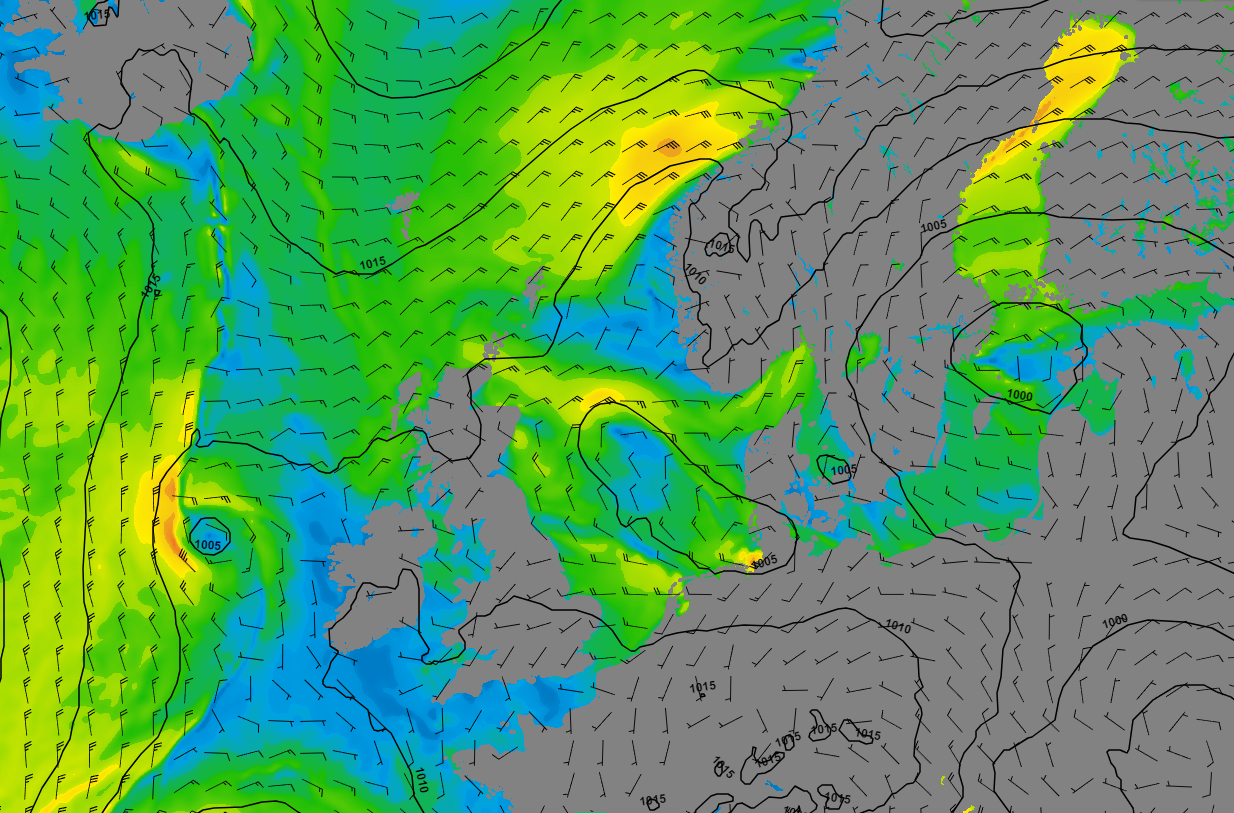 Figure 1: Wind speed and wind direction according to GFS on Wednesday 29 November at 00UTC.
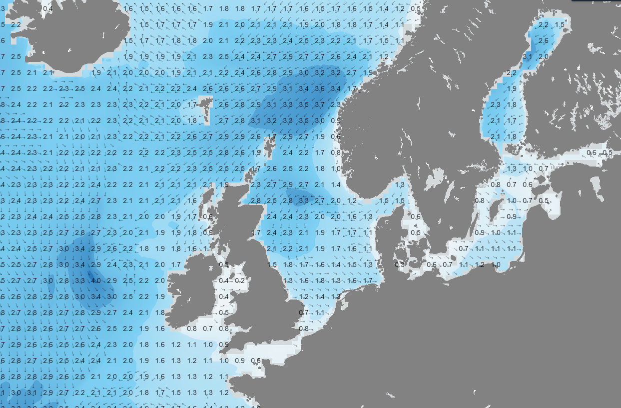 Figure 2: Significant wave height and wave direction according to GFS on Wednesday 29 November at 00UTC.
Figure 3 shows that on Friday, a low-pressure area from France continues to move further into Europe. Meanwhile, high pressure still exists over Greenland and Iceland. Between these two pressure systems, an east to northeast wind is blowing over the North Sea (force 5-6). Due to the easterly direction of the wind, the waves are largest on the east coast of the United Kingdom (significant wave height, Hs, up to 2.5 to locally 3 meters). However, it is possible that locally the waves may be slightly underestimated by the current model output. Currently, the seawater is still relatively warm, while the northeast wind brings in cold air from Scandinavia. Due to the significant temperature difference between the sea surface and the upper air, Hs may locally be slightly higher than what is shown in Figure 4. Furthermore, the large temperature difference between the sea surface and the upper air, makes air parcels to rise. As a result, there will be quite some wintery showers again over the North Sea from Thursday onward.
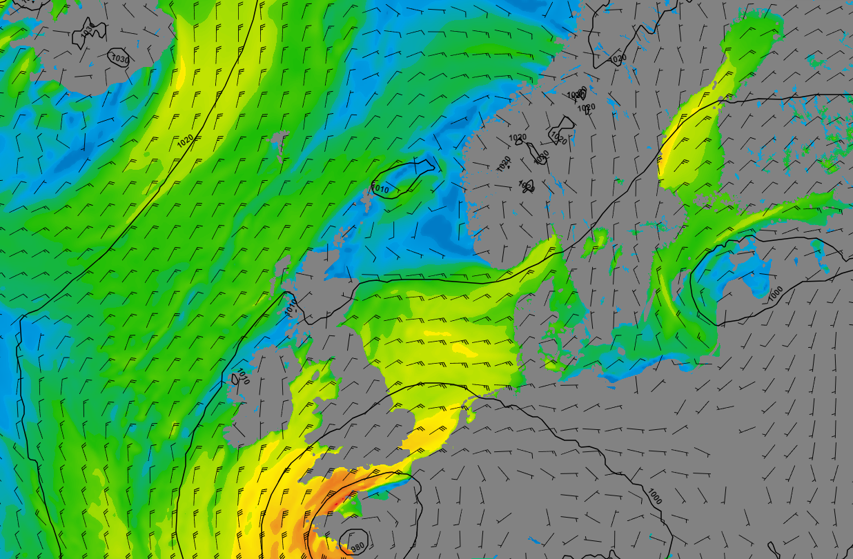 Figure 3: Wind speed and wind direction according to GFS on Friday the 1st of December at 12UTC.
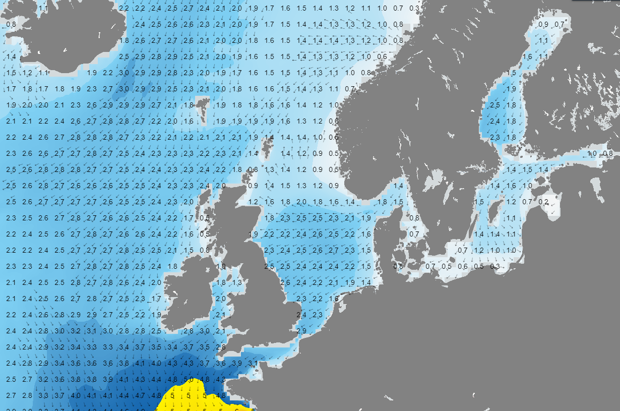 Figure 4: Significant wave height and wave direction on Friday the 1st of December at 12UTC.
Conclusion
Throughout a significant part of the week, cold air resides above the North Sea. The cold air, combined with the warm seawater, leads to the formation of small low-pressure areas and wintry showers. Wednesday is calmer over the North Sea. From Thursday onwards, wintry showers occur again. Due to the east to northeast wind, the highest waves (up to a maximum of 3 meters) are expected over the western half of the North Sea.
Always up-to-date
Like this weather briefing? Our monthly newsletter gives you even more insights. Think about marine weather phenomena, updates about our ever-evolving forecasting products, and the latest and most relevant marine weather briefing. Subscribe to receive our Infoplaza marine newsletter once a month.


