
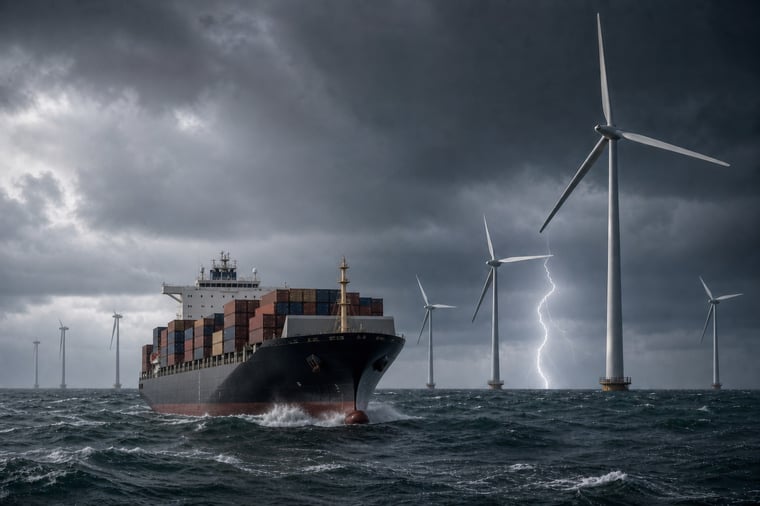
The North Sea becomes increasingly unsettled from Thursday as low pressure approaches from the southwest. Strong instability and increasing wind shear raise the risk of thunderstorms, particularly near the Belgian, Dutch and UK coastlines. This reduces the predictability of offshore work windows late Thursday and on Friday. In the western Pacific, Typhoon Saudel continues to create severe wind and wave conditions around Okinawa before gradually weakening over the East China Sea.
Offshore weather risk: impact on operations
- Risk: Thunderstorms may bring lightning, hail, heavy rain, sudden wind shifts, strong gusts and reduced visibility across parts of the North Sea, while Typhoon Saudel continues to produce severe winds and very high seas in the western Pacific.
- Timing: North Sea thunderstorm risk increases late Thursday, overnight into Friday and during Friday, while Saudel remains a major routing constraint through Wednesday and Thursday.
- Action: Keep flexibility in North Sea crane work, crew transfers, lifting and exposed maintenance, and maintain wide routing, port-call and towage margins around Saudel.
In short: workable periods remain in the North Sea, but planning confidence decreases from Thursday, while operations near Saudel require substantially larger safety margins.
Operational risk
Thunderstorms become the main limiting factor for many North Sea offshore activities toward the end of the week, with short-notice interruptions possible during crane work, crew transfers, lifting and exposed maintenance. Around Typhoon Saudel, severe winds, high seas and swell continue to restrict routing and may cause significant schedule disruption along the storm track.
Weather situation
North Sea
Low pressure over the Bay of Biscay moves north-northeast, passing the UK on Friday and reaching the northern North Sea during the weekend. Warm and humid air on the eastern side of the low creates substantial instability, with CAPE locally reaching around 2,000 J/kg. The highest values are forecast along the Belgian and Dutch coastlines and into the German Bight.
Later on Thursday and on Friday, vertical wind shear reaches around 25–45 kts. Combined with strong instability and increasing synoptic forcing, this creates conditions in which strong thunderstorms may develop late Thursday, overnight into Friday and during Friday. The highest risk is close to the Belgian, Dutch and UK coastlines. Hail and severe wind gusts are possible in the strongest storms.
Ahead of the low-pressure centre, winds are easterly at generally 15–20 kts. Over the far south of the North Sea, winds shift southwesterly early Friday. This wind shift then progresses northward during the day. Winds gradually increase to 20–25 kts over the southern half of the North Sea during the weekend.
Friday and Saturday remain unsettled as low pressure moves into the North Sea, with repeated showers, including thundery showers, reducing schedule resilience.
Typhoon Saudel
Typhoon Saudel, located in the western Pacific, is moving west-northwest towards Okinawa while gradually weakening (Figure 1). Sustained winds near the core remain around 70–80 kts, with typhoon-force winds extending beyond the centre. Earlier observations showed significant wave heights of around 10–12 metres close to the core, indicating severe marine conditions around the cyclone.
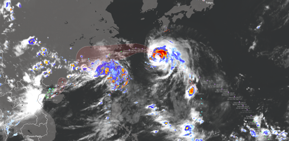
Figure 1: Typhoon Saudel moving in a westerly direction the coming days.
Saudel is expected to pass near Okinawa around Wednesday before moving west into the East China Sea. Winds gradually decrease, but storm-force conditions and very high seas remain a major routing constraint through Wednesday and Thursday.
By Friday and during the weekend, Saudel weakens further while moving towards the Taiwan Strait and southern China. Conditions improve progressively, although schedule disruption may remain significant along the track and swell may continue to affect operations outside the strongest wind field.
Conclusion
North Sea operations retain workable periods, but thunderstorm development from late Thursday makes offshore windows less predictable and increases the risk of short-notice downtime. Around Typhoon Saudel, severe winds and seas continue to demand wide operational and routing margins before conditions gradually improve later in the week.
Existing Infoplaza customers should use their dashboard and monitoring to follow changing work windows and weather risks. If you are not yet working with Infoplaza, contact us to explore how marine weather decision support can help you plan offshore operations with greater confidence.