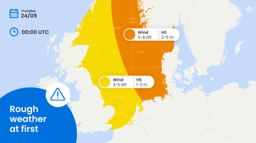
High pressure shifts eastwards away from the North Sea while an Atlantic low moves across the Norwegian Sea. Associated frontal troughs affect the North Sea later this week and during the weekend, but winds remain mostly moderate to fresh and sea states low. Overall, workable windows remain favourable. Workable conditions are less favourable over the northern Pacific where various tropical storms are present.
Weather impact on North Sea workability
• Timing: Workable conditions prevail through much of the period, although passing
frontal troughs may temporarily reduce operational windows later this week and
during the weekend.
• Operations: Moderate to fresh winds and low sea states support crew transfer, subsea
work, offshore construction, towage and marine logistics. Shorter interruptions remain
possible during trough passages.
• Regions: The southern and central North Sea offer the most favourable conditions,
while the northern sectors are slightly more exposed.
In short: Broad workable windows remain available across the North Sea, with only temporary
reductions expected as frontal troughs pass later in the week.
Operational risk
Operational risk remains limited this week. The northern North Sea is somewhat more
exposed to higher sea states, while conditions across southern and central sectors remain
favourable for most offshore activities. Passing troughs may temporarily bring stronger winds,
but prolonged downtime is not expected.
Weather situation
North Sea
A high-pressure system initially influences the North Sea before gradually shifting eastwards.
At the same time, an Atlantic low-pressure system moves across the Norwegian Sea, allowing
associated frontal troughs to affect the North Sea later this week and during the weekend.
Winds initially remain southerly before turning to more northerly directions as the pressure
pattern changes. Despite the passage of frontal troughs, winds remain mostly moderate to
fresh, limiting the overall weather impact on offshore operations. Sea states also remain
favourable. Significant wave heights are around 0.5–1 metre across the southern and central
North Sea, supporting broad workable windows. Across northern sectors, wave heights are
somewhat higher at around 1-1.5 metres, but conditions remain manageable for many
operations.
Towards the weekend, associated troughs bring a more variable pattern with periods of cloud,
rain and temporary increases in wind. Workability may therefore fluctuate around individual
trough passages, particularly in northern sectors. However, with relatively low sea states
across much of the basin, broader operational windows remain available throughout the
period.
Tropical cyclone activity
The western North Pacific remains the main area to watch. Several tropical systems have been
active across the basin recently. Typhoon Dolphin has already produced major impacts across
eastern China before, while Chan-hom is affecting Japan. Farther east, Peilou is weakening
over the open western North Pacific. Additional tropical development remains possible across
the basin and should be closely monitored for potential impacts on shipping routes and
marine operations.
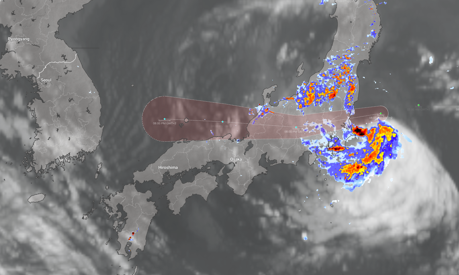 Tropical storm Chan-hom moves westwards over Japan (source imweather.com)
The tropical Atlantic is also becoming more interesting, as several disturbances are being
monitored, including a system south of the Cabo Verde Islands with a relatively high chance
of developing into a tropical depression later this week as it moves west to west-northwest.
For now, the main operational relevance is for Atlantic routing rather than immediate coastal
disruption.
Meltemi
August is the core season for the Meltemi, a well-known local wind effect over the Aegean
Sea. A sustained northerly flow can become operationally important around the Cyclades and
the southeastern Aegean, where funnelling between the islands and local terrain can further increase wind speeds. This can reduce flexibility for ferry traffic, crew transfer, towage and
nearshore operations, even when conditions across the wider Mediterranean remain calm.
Existing customers can monitor the latest operational windows and regional developments in
the Infoplaza dashboard. Planning a marine operation without access to our forecasts?
Contact Infoplaza to explore how tailored weather intelligence can support safer and more
efficient decision-making.