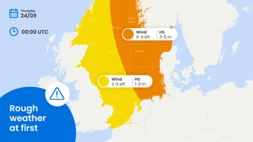
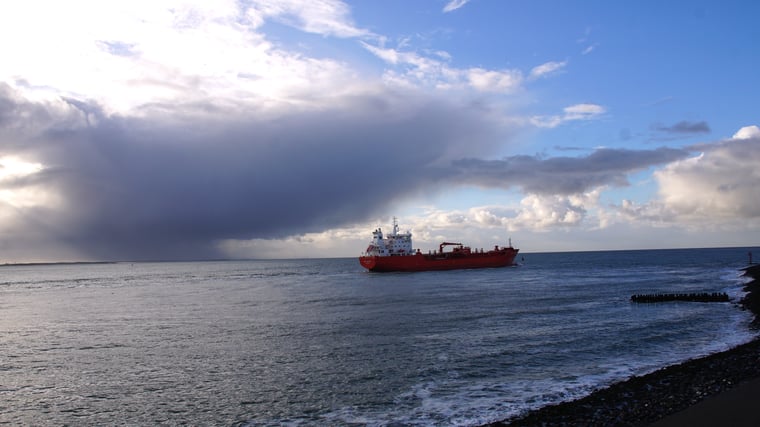
This week’s North Sea weather is largely determined by low pressure, causing changeable conditions as associated frontal troughs occasionally sweep across the area. Despite this pronounced autumn-like pattern several workable windows are expected.
Weather impact on North Sea workability
• Timing: generally speaking, conditions are rather favorable this week with moderate to strong (south)westerlies (4-6 Bft) prevailing over the North Sea. As the main trough-axis of the dominant low passes the North Sea on Thursday, winds tend weaken in its vicinity, before veering to the NW whilst increasing in its wake on Friday and Saturday.
• Operational impacts: dependent on your specific operational limits weather-sensitive operations will face (brief) interruptions. But overall, rather favorable weather is expected with highest windspeeds ahead and in the wake of the main trough. Also, keep in mind that over the warm waters of the North Sea showers occasionally bare a local thunder risk as well, especially over the southern half of the basin.
• Regionalization: moderate to strong (south)westerlies (4-6 Bft) prevail over the central and southern parts of the North Sea ahead of the main trough on Wednesday. As the system sweeps across the area winds weaken temporarily; at first over the northern North Sea on Wednesday, on Thursday also elsewhere. Afterwards winds eventually veer to the NW on Friday. Possibly increasing significantly along and downstream of the Norwegian coast.
Synoptic situation
North Sea
As discussed, low pressure and associated (frontal) troughs will remain predominant over the North Sea this week. Ahead of the main trough-axis (south)westerly winds are expected up to 20-25kt, with exception of the far north accompanied by waves generally between 1.0-2.0m on Wednesday. As the main trough passes the area on Thursday wind and waves temporarily decrease. In its wake moderate to strong northwesterlies (4-6 Bft) come in on Friday, with over the northern half of the North Sea waves between 2.0-3.0m. Along and downstream of the Norwegian coast winds might shortly increase to roughly 30kt due to funneling effects later in the day and on Saturday. A ridge of high pressure from the west causes calmer weather on Sunday.
Pacific
As the Typhoon season is ramping up in this time of year, several tropical disturbances along the northern flank of the ITCZ are present over the western Pacific this week. Not all of them will make it into fully developed Typhoons though. The system with most potential is currently named 92W and will experience quick upscale growth over the coming days, with max. sustained winds reaching a whopping 90kt in the course of the weekend according to the ECMWF model. Besides the Mariana Islands the system will remain over open ocean for a long time, possibly ending up near S Japan next week, but strongly weakened by then.
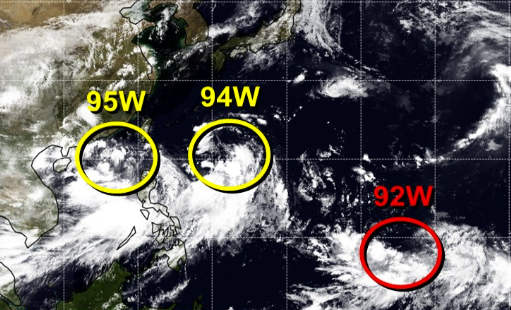 (Several tropical disturbances over the western Pacific. 92W will become a strong Typhoon.
Source: JTWC)
Existing customers can monitor the latest operational windows and regional developments in the Infoplaza dashboard. Planning a marine operation without access to our forecasts? Contact Infoplaza to explore how tailored weather intelligence can support safer and more efficient decision-making.