



A high-pressure area lingers over eastern Europe, dissipating over the weekend. Meanwhile, low-pressure systems affect the northern Atlantic, with associated frontal troughs passing over the North Sea at times. Another high approaches the North Sea from the west at the end of the week.
A high-pressure area lingers over eastern Europe, dissipating over the weekend. Meanwhile, low-pressure systems affect the northern Atlantic, with associated frontal troughs passing over the North Sea at times. Another high approaches the North Sea from the west at the end of the week.
On Tuesday, August 12, a high-pressure system will be positioned over eastern Europe. It will remain in place until the weekend, gradually shifting southeast on Saturday before dissipating over Ukraine later that day. A ridge associated with this system will extend over the North Sea on Tuesday and Wednesday, bringing calm and stable weather across the entire region.
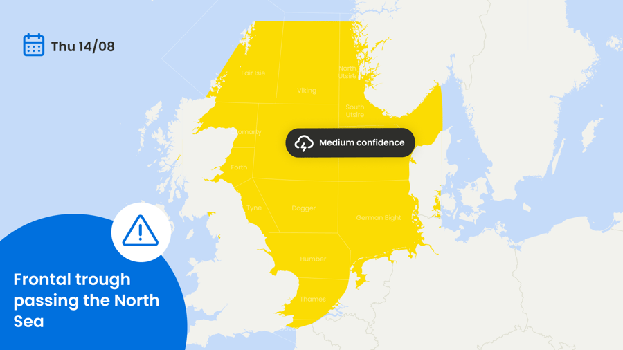
On Thursday, August 14, a low-pressure system over Iceland will move northeast. Its associated frontal trough will pass over the North Sea that day, bringing a risk of thunderstorms across much of the region. The trough is not expected to cause a significant increase in wind or wave heights. However, due to its sharp nature, there is medium confidence in this forecast from Wednesday afternoon through Thursday (Figure 1).
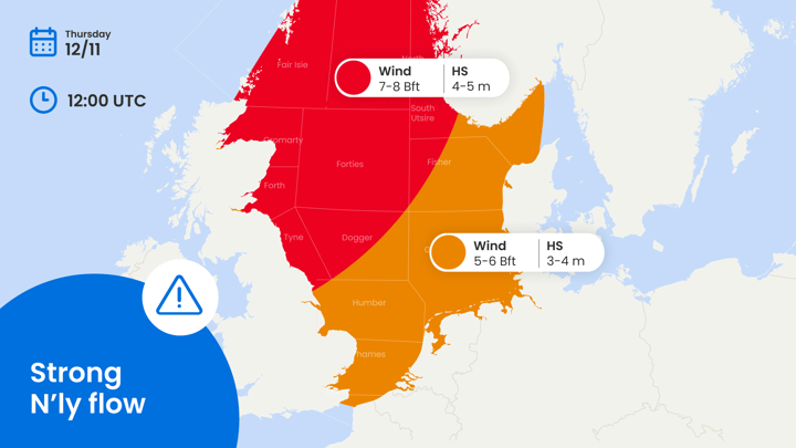
At the same time on Thursday, a new high-pressure system will build over the Bay of Biscay, moving north to northeast and approaching the United Kingdom by Friday. Another high will approach the UK from the west on the same day, and the two systems will merge later on Friday. Meanwhile, the previously mentioned low near Iceland will move into the Norwegian Sea and deepen. This will create a strong pressure gradient over the eastern North Sea between the two systems. As a result, northwesterly winds along the southern and southwestern Norwegian coast will increase to 25–30 knots, generating waves of 2.5–3 meters during the weekend (Figure 2). The rest of the North Sea will remain relatively calm.

Figure 2. Increase in wind and wave activity over the eastern North Sea during the weekend.
As the high pressure moves across the North Sea, weather conditions are expected to improve after the weekend.
Stay updated on LinkedIn
We plan to post this weather briefing on our Infoplaza for Marine Weather Operations LinkedIn page as well. This is also the place where we will share other insightful marine weather articles, so be sure to follow us to never miss an update.

 Bram van Kester
 Sofia Rudenko

