This article will help you discover the basics of our extensive weather data viewing application.
Menu
I'm Weather has three components in the top menu:

The component in bold is the one you are currently viewing.
Forecast
The forecast section offers a wide range of atmospheric and wave models, including our own in-house models. In the free (test)version of I'm Weather you only have access to GFS and GFS-WAVE. The one in green is the model you are currently viewing. When you have selected a model, you will find:
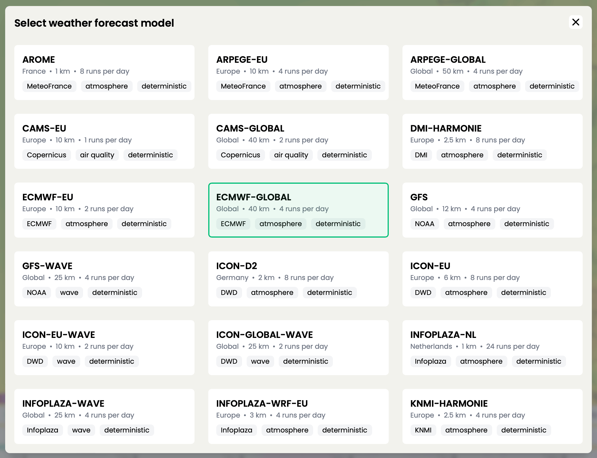
The one in green is the model you are currently viewing. When you have selected a model, you will find in the left top corner:
- The selected model
- The selected model parameter
- The issue time (start time) of the model run
- The date timestep you are viewing
Also on the left side:
- Location search
- Quick tools to make a:
- Print screen
- Animated gif
- Share/embed option (iframe)
- Create a spit screen of 2 or 4 tiles
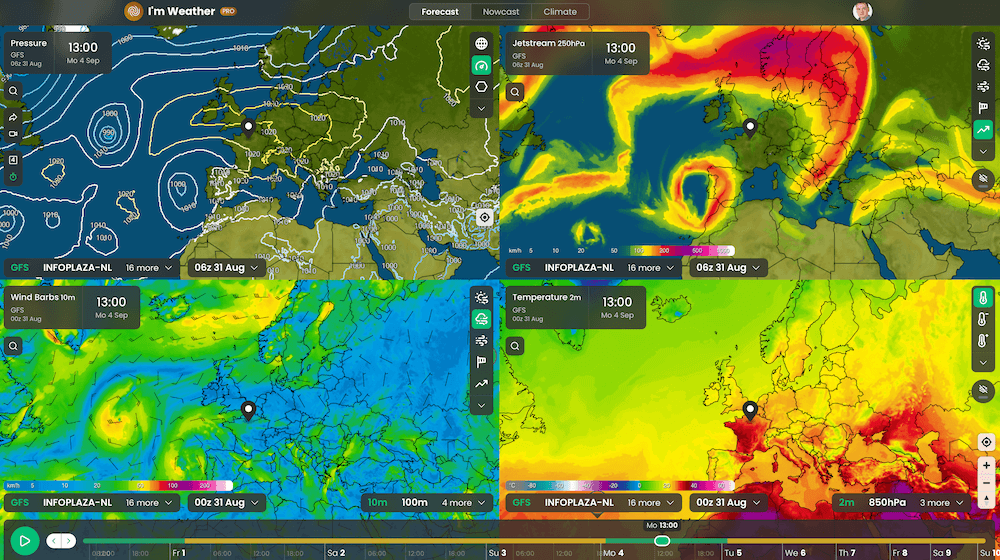
On the right side you can set the model parameter. To view all available parameters for this model, click on the "more ∨" button.
At the bottom you can change the weather model and the model run. In general you will find the latest four model runs per model. Also, there is the timestep selection bar. Click on it to go to a certain forecast timestep. There is also a 'play' functionality to see the forecast develop in time.
If you click on the map or search for a location a horizontal bar below the timestep selection bar appears. Click on this bar and the timeseries feature will open. This gives a forecast overview for multiple parameters in time for that location.
Note: a more in detail article about what you can do with these timeseries will be written later.
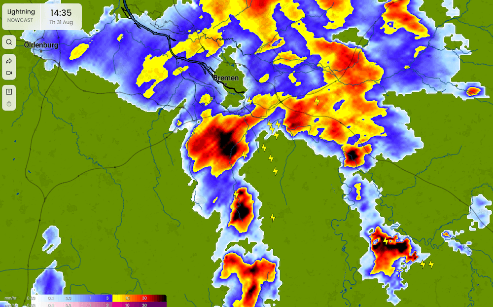
Nowcast
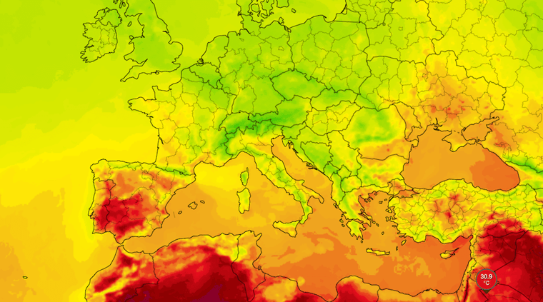
The nowcast section is about current weather. The main features are precipitation, clouds, and lightning.
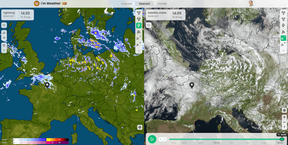
For precipitation we offer the most up-to-date radar images, and if radar does not cover an area, we use satellite techniques to detect precipitation intensity and type.
For clouds we use a variety of satellite images for the entire world in various channels: visible light, infrared, combined day/night image, and special night-microphysics images for detecting fog and low clouds.
Lightning is presented near real-time and based on data from a worldwide network of lightning sensors.
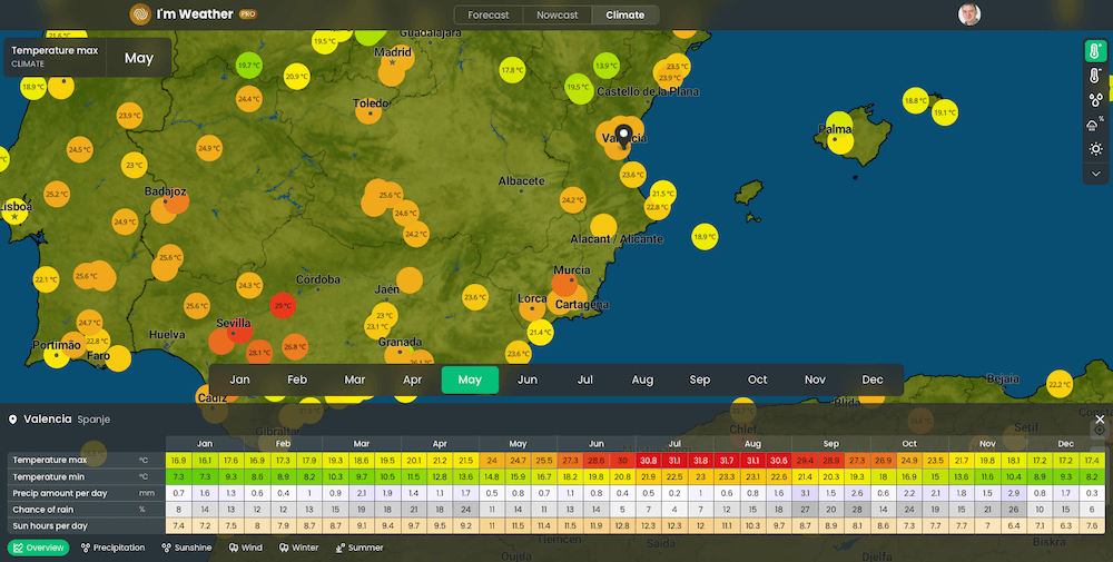
Climate
Do you want the know the average weather for a particular part of the world in a certain period of the year. Then use our climate data!
We use the ECMWF ERA climate data set, which offers a comprehensive climate overview for all major locations in the world. The data is presented in 10-day intervals.
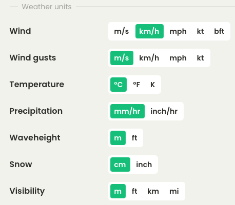
Customize I'm Weather
Do you want temperatures in Celsius, Fahrenheit or Kelvin? The wind gusts in m/s, km/h, mph or knots? All these weather unit preferences can be set in your personal setting. Also, all other setting, like dark mode, language etcetera, you will find here.
Try I'm Weather for free
I'm Weather is the weather tool for the true weather enthusiast! You can try it yourself through the link below.