The wind is the driving force behind wave growth, but did you know that with the same amount of wind, you can get a different wave height? The clouds you see can be a good indicator of what kind of waves you can expect.
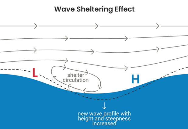
As wind blows over the water surface, a small wind circulation develops in the wave’s trough. This results in wave growth just in front of the wave crest, while the back of the wave is forced down. If the wind is strong enough, it forces the wave to grow.
The wind is not a constant flow, it is by nature gusty. Whenever you’re outside you notice that sometimes the wind picks up, and a couple of seconds later it declines again. Waves grow faster on higher wind speeds than they decline on a moment shy of wind. In general, we use the 10-minute averaged wind speed which gives a good indication on what your waves may look like, but it’s not the complete picture.
The gustiness of the wind is determined by what meteorologists call the atmospheric stability. This is a measure of wind exchange between the wind at the surface and the wind higher up in the atmosphere. If this exchange is very large, we see a higher amount of gustiness than if there’s hardly any.
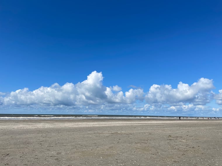
Stratiform and cumulative clouds
This atmospheric stability not only determines the exchange of wind between different air layers, but also the clouds you can expect. If there is very little exchange between the surface and the higher atmosphere, you see that clouds become more evenly spread out: we get stratiform clouds. If on the other hand the exchange is very high you would expect clouds to be spread over the atmosphere like shown in the header image: cumulative clouds.In that manner, the clouds, either cumulative or stratiform, can give an indication of the gustiness of the wind. With that in mind you can then see whether you get higher or lower wave heights compared to the waves you would expect with that 10-minute averaged wind speed.
Of course, in our forecasts we already account for the differences between a stable and unstable atmosphere. If you would like more information on how Infoplaza can assist in your offshore operations, do not hesitate to contact us.