A strong typhoon has developed over the Pacific Ocean and is located E of Taiwan. In this blog we will elaborate on the forecasted track and intensity of this severe system, discuss the influence of such a strong typhoon on your marine operations and give a bit of background about the formation of typhoons or hurricanes.
Formation of tropical systems
Tropical systems generally need warm waters to form. From previously studied tropical systems, it becomes clear that they start to form when large water bodies are warmer than 27 degrees Celsius. Those temperatures are needed to provide enough warmth and moisture to the system to form. Furthermore, a low wind shear regime is preferred for the formation of tropical systems. This means that the wind speed and direction do barely change when going high up into the atmosphere. As a result, the Coriolis force is able to interact with the forming tropical system. As a result, the system is starting to rotate, and a typhoon or hurricane has been formed. The naming of the system depends on the place where the tropical system is located. For instance, systems which forms over the Atlantic and travel towards the US are hurricanes and systems over the Pacific Ocean are typhoons.
Hinnamnor
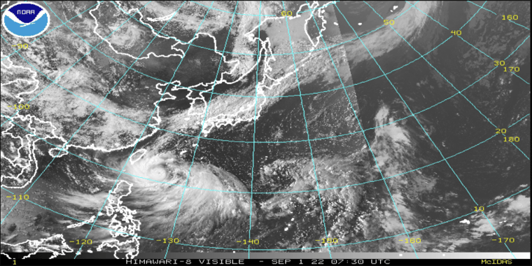
Typhoon Hinnamnor is the first strong typhoon of the new typhoon season. The typhoon is currently located well E of Taiwan and wind speeds have been recorded above 250 km/h near the eye of the system. Picture 1 shows the location of Hinnamnor on Thursday 00UTC. The system is strong, but still relatively small.
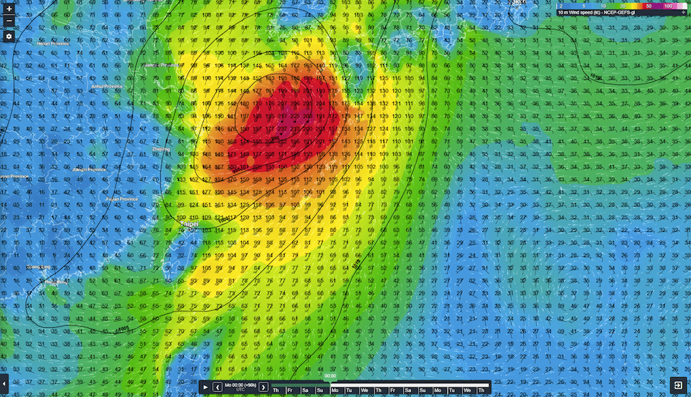
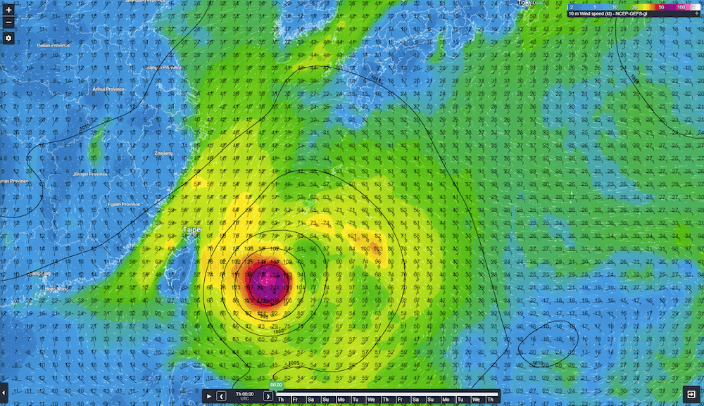 Picture 2: Wind gusts and wind direction around typhoon Hinnamnar on Sunday 4-Sept 00UTC.
Hinnamnor is likely to track N towards to Korean peninsula and Japan during the coming days. It is likely to pass right over the Ryukya Islands and will may cause a lot of damage over these islands. The system is forecasted to maintain its intensity more or less and leaves the Ryukya Islands later on Sunday or in the night to Monday (Picture 2). Hinnamnor will likely be a bit less severe when it leaves the Ryukya Islands, but the strong winds will extend significantly outward of the eye as can be seen on picture 2.
 Picture 2: Wind gusts and wind direction around typhoon Hinnamnar on Sunday 4-Sept 00UTC.
When Hinnamnor left the Ryukya Islands it is forecasted to track N over the East China Sea. The development of the system is still relatively uncertain from this point onward. The surface temperature of a large part of the East China Sea is around 28-30 degrees Celsius, which is well above the needed 27 degrees Celsius to provide enough energy, so that the system can maintain its intensity. However, the amount of vertical wind shear increases when the system moves N. Therefore, it is uncertain whether Hinnamnor is able to maintain its intensity or that it will lose some strength when closing in on Korea and Japan.
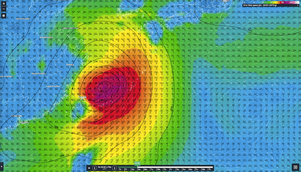
 Picture 3: Wind gusts and wind direction around typhoon Hinnamnar on Monday 5-Sept 00UTC.
Influence of a typhoon on your marine operations.
Typhoons or hurricanes have, of course, a major influence on your marine operations. Relatively light typhoons or hurricanes can already give large damages to platforms or vessels. Strong systems, such as typhoon Hinnamnor, can cause large damages to structure and are able to generate extreme high waves (often higher than 10m around the eye). There is a large threat of being out on the open sea during such extreme conditions. We as Infoplaza know the hazards of such severe tropical systems well and warn our clients well in advance of upcoming dangerous weather.