After a cold spell last week, the atmosphere quickly returns to normal in the coming days, with rather mild and unsettled weather over the larger part of the North Sea. Atlantic lows are predominant with several frontal troughs occasionally sweeping across the area, alternated by mobile ridges of high pressure which cause short breaks in the overall very active weather patterns of this week.
Synoptic overview
Storm Isha has left the North Sea and quickly fills over Scandinavia today (Tuesday). In its wake a mobile ridge crosses the area, from the W followed by a frontal system associated with a next Atlantic low. The system is expected N of Scotland in the night to Wednesday before filling over S Scandinavia later in the day. This low is now called storm Jocelyn. A new mobile ridge makes its way eastwards across the North Sea on Thursday, temporarily breaking up the strong westerly airflow. Early on Friday however, a new frontal system eagerly moves in from the Atlantic. Throughout this week high pressure lingers over S Europe.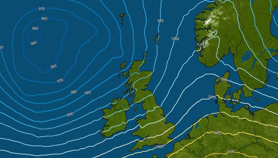 Fig. 1. Ridge of high pressure leaving to the E on Tuesday 15z. Storm Jocelyn approaches from the Atlantic.
During the coming weekend the synoptics don’t change that much. However, high pressure over S Europe seems to gain influence over the southern half of the North Sea at least. Further north the influence of the Atlantic will remain predominant.
Wind and waves
As a result of the described synoptic constellation, a moderate to fresh westerly airflow (4-5 Bft) unfolds over the North Sea on Tuesday as a mobile ridge passes. Ahead, and in its wake, winds tend to be stronger, especially from the evening well into Wednesday as the next Atlantic low (storm Jocelyn) makes her way into the Norwegian Sea and S Scandinavia. On the southern and western flank gale to strong gale force winds (8-9Bft) veering from southwest to northwest are expected. Significant wave height associated with this wind field will range from 2.0-3.0m just east of the UK (partly sheltered) to 5.0-7.0m further east. Strongest winds (and highest waves) will most likely be located over the northeastern half of the North Sea in the wake of the low near a secondary trough (see Figure 2).
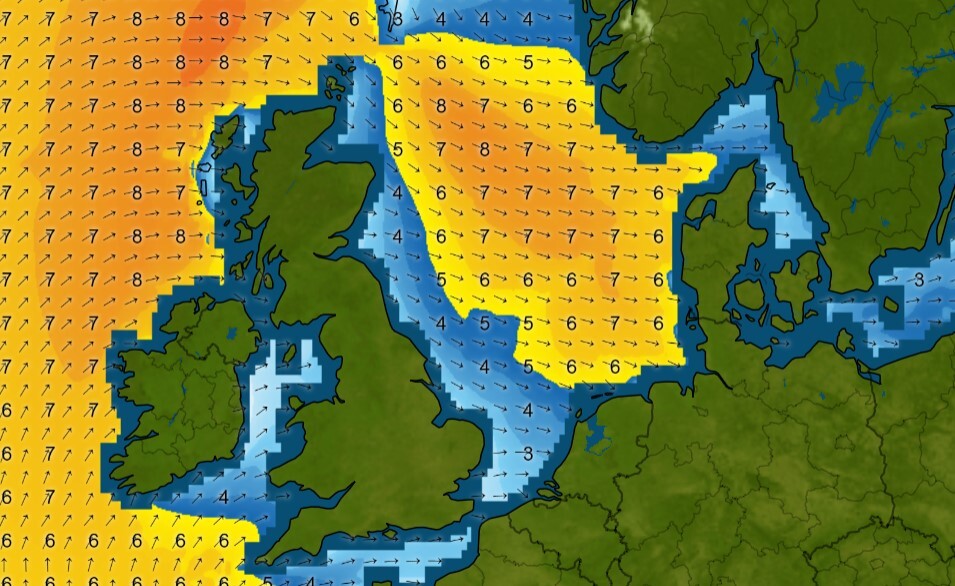 Fig. 2: Wave peak Wednesday 17z
Later on Wednesday winds gradually decrease from the W as a mobile ridge enters the area, leading to relatively calm conditions over the North Sea well into Thursday with a moderate breeze backing from northwest to southwest (see Figure 3).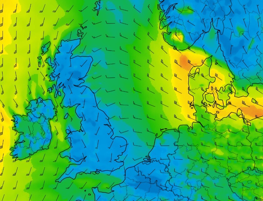 Fig. 3: Incoming ridge with decreasing winds Thursday night
Later on Thursday and early on Friday a new frontal trough increases the pressure gradient over the North Sea. The resulting wind/wave peak is most pronounced just behind the trough over the northern half of the North Sea. There, wind speed reaches near gale to gale force (7-8 Bft) coming from the W. Further S winds tend to be a bit weaker. Associated Hs peaks at 3.0-5.0m, with highest values over the north(east)ern half of the North Sea.
During the weekend the pattern doesn’t change that much with highest waves in the N, most likely between 4.0-6.0m, and lowered Hs in the S where high pressure possibly gains influence in the course of the weekend.
Conclusion
As discussed, several unsettled phases are expected this week as Atlantic lows pass N of the North Sea; greatly decreasing workability at times. In between mobile ridges shortly calm things down a bit, enabling a few workable windows in which some of our clients can make up for the lost work.Always up-to-date
Like this weather briefing? Our monthly newsletter gives you even more insights. Think about the marine weather phenomena, updates about our ever-evolving forecasting products and the latest and most relevant marine weather briefing. Subscribe to receive our Infoplaza marine newsletter once a month.