Some offshore operations cannot be performed, or can only be partially carried out, when visibility at sea is poor. Poor visibility is usually caused by fog. This fog is most common in the spring when the seawater is still cold, and the air just above the water can warm up quite a bit. However, your work activities can also come to a halt during the winter due to moderate or poor visibility. In this blog, we will discuss the weather phenomena that can cause this and which areas in the North Sea are most vulnerable to it.
We'll discuss visibility in ports and on open sea.
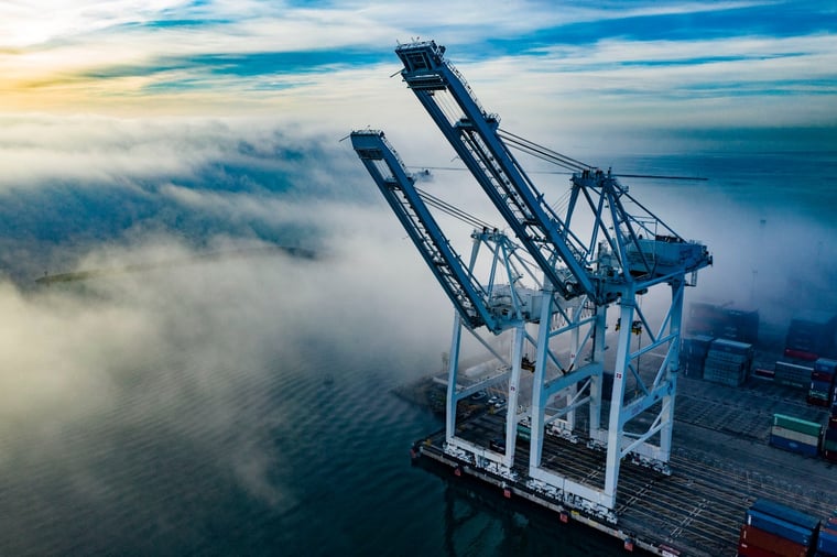
Fog in ports
In the ports around the UK and the Netherlands, mist occurs most frequently during the winter. This type of mist is also known as advection fog. This is because the fog doesn't form above the harbor waters but is instead transported in from the inland areas by the wind. During the long winter nights, temperatures over land can drop significantly. If the temperature drops low enough, the moisture in the air condenses into fog. With an offshore wind, this fog can drift towards the sea. This can significantly hinder operations in ports or just off the coast due to dense fog. As the fog patches track further out to sea, it often dissipates. The relatively warm seawater warms a thin layer of air above it as well. Warm air can hold more moisture than cold air, so the mist droplets eventually turn back into water vapor further out at sea. Resulting in improved visibility.

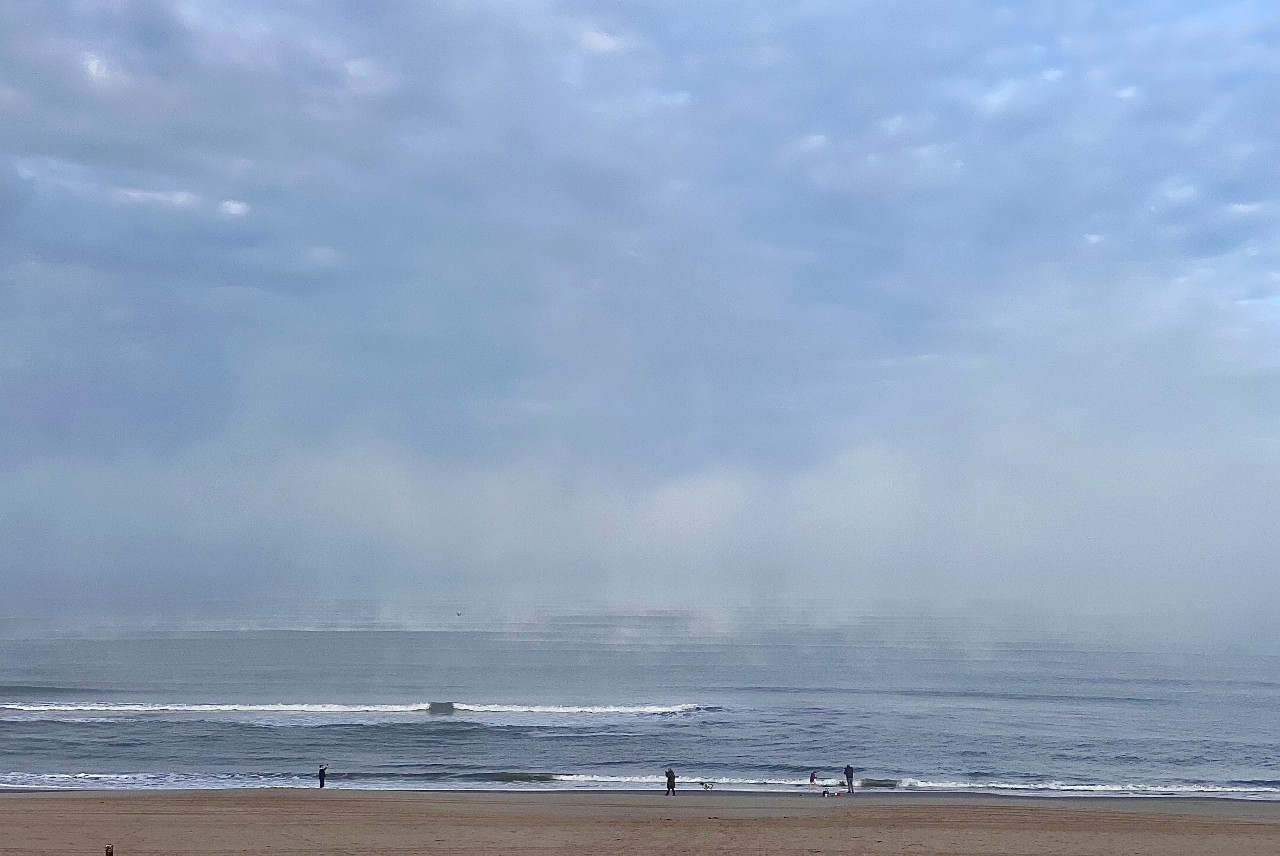 Fog formation over warm sea waters in cold upper air this autumn along the Dutch coast near Kijkduin (Foto: Arjan Willemse)
Poor visibility on open sea
This doesn't mean that visibility is always good further out at sea during the winter half-year, quite the opposite! Despite fog being most common in the spring, the winter season also experiences long periods of moderate to poor visibility at sea. Low-lying clouds are particularly prevalent during the winter half-year. For platform operations, this often poses no obstacle because the platform is usually beneath the cloud base. However, for wind turbine installations or projects where helicopter flights are crucial, it can be a different story. Helicopter landings on a platform must be done visually. This means that in case of poor visibility along the approach route, the helicopter cannot take off. During the winter season, the cloud base of low-lying clouds can sometimes be as close as 200-300 feet above the sea surface. Additionally, due to a lack of sunlight, it can take days for the low-lying clouds to finally dissipate.
The top of the clouds is white, which causes sunlight to be reflected off the clouds. As a result, very little sunlight reaches the sea below the clouds. However, it is necessary for sunlight to reach the sea below the clouds to dissipate the low-lying cloud cover. Sunlight provides warmth and, in turn, turbulence. It is only through these warm pockets of air that rise that the low-lying clouds can dissipate from below. Due to a lack of sunlight (and thus warmth) during the winter half-year, this process fails, and low-lying cloud cover can persist stubbornly for days on end. Furthermore, drizzle and water spray from strong winds can also contribute to poor visibility as well.
Even though wind, rain, and sometimes rough seas dominate the weather in the winter over the North Sea, fog can also occur regularly. Therefore, it is necessary to always carefully check our weather forecast during visibility-sensitive operations. Additionally, you can always reach out to us for all your weather-related questions. 


