The marine industry is vital for global trade and economic growth. However, this industry faces several challenges, including unpredictable weather conditions that can affect the safety and efficiency of marine operations. Weather observations provide essential data that helps in predicting offshore weather conditions, improving safety, and reducing costs.
Marine observations are generated via a vast network of global sensors and monitoring instruments such as moored buoys, offshore installations, voluntary observing vessels, drifting buoys and geostationary satellites. Marine observations at sea show what weather have occurred and is particularly important for:
• forecasts and warnings to help ships and other offshore operators to avoid severe weather conditions at sea.
• input to computer models that predict the future state of the atmosphere.
• provision of meteorological information over the long term that aids our understanding of the global climate.
Marine observation systems generate large amounts of data from the atmosphere, the ocean, and the land, which are then processed and analysed to create detailed models of weather patterns. These models can be used to predict the future behaviour of weather systems, offering us valuable insights into the potential impact of weather events.
Generating accurate forecasts
One of the most important benefits of marine observations is the ability to improve the accuracy of offshore weather forecasts. This is essential for individuals, businesses, and governments alike, as it enables them to plan day-to-day operations offshore as well as prepare for extreme weather events, such as hurricanes, tornadoes, and floods. This can help save lives, optimise costs, reduce damage to property, and mitigate the economic impact of extreme events.
 Image: AS
Many projects offshore are weather critical, so Infoplaza’s goal is to provide the best weather forecast possible for clients to reduce downtime in their marine operations and to make sure that crews are safe out on the open sea. But what is the process of constructing this forecast and how do we make sure it is reliable?
How to make a marine forecast
The starting point for any marine forecasts is collecting data from numerical weather and wave models, more commonly known global and local models. Global weather models consist out of a large domain and a relatively low resolution, whereas local models simulate over a small domain with a relatively high resolution. Both global and local models are important when preparing the weather forecast.
Examples of global weather models include Europe’s ECMWF model and the USA’s GFS model and Wave Watch III wave calculation model. Forecasters often start with looking at the big picture. What are the general winds doing? Is a certain location situated in warm or cold air? Is there any chance that large scale bad weather that may affect the location?
Besides the domain and the resolution, the skill of a model is also important. The skill tells forecasters more about how good a weather model is in simulating the right weather and wave conditions in certain locations around the world.
Local, or high resolution, weather models are used when a forecaster prepares a detailed forecast for a specific location. Due to the high resolution, small-scale processes around the location are well captured by these models, while those local effects are mostly overlooked by global models due to their relatively low resolution. There are a lot of high-resolution numerical weather prediction models.
 Using different weather models. Image: Infoplaza
A few examples of high-resolution weather and wave models are Harmonie, ICON-D2, Arome, WRF, nested WW-3 grids and SWAN. Due to the high resolution implemented in the models, their spatial resolution is relatively low. Therefore, those models are only used for relatively small domains that serves the client location in the best way possible.
When all model data has been collected, it’s then combined and computed internally in order for it to be quality checked by meteorologists. The meteorologist then makes an accurate and understandable weather and wave forecast out of an enormous amount of (valuable) data and deep knowledge about weather and wave systems. The aim is to share all relevant weather and wave information with our clients to make sure that the risk of downtime will be as small as possible. The forecast provided is intended to support safe operations and optimal financial results for our clients.
Infoplaza strongly believes that even with high-end model output the forecast is only as good as the model’s performance. Eventually it is the postprocessing, data analyses and clear client specific tailoring by our experienced forecasters that makes a marine forecast really stand out.
The importance and benefits of marine observations
A forecast generated using commonly available models and datasets will give you a relatively reliable forecast. However, sometimes the accuracy of offshore marine weather forecasts requires further calibration. If user’s requirement is for a more accurate offshore weather forecast, collecting observational data is the best way to be able to plan your operation more efficiently.
Marine observations are needed for many purposes: for acquiring a better scientific understanding of the marine environment, but also, increasingly, as marine knowledge for decision making as well as developing products and services to support companies and individuals working offshore.
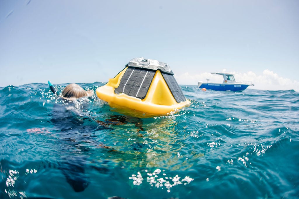 Collecting data through a Sofar Spotter Buoy. Image: Sofar
Forecasters will always compare the almost infinite amount of model data to observations in the vicinity of the worksite and upstream. This process helps boost model performance in specific locations as well as allowing the forecaster to tweak models in such a way that the output suits the observations near perfectly. On top of that, the forecaster will establish which models perform best for certain locations and this constant verification contributes to an optimized maritime forecast which eventually ends up on a client’s desk. Benefits include:
Accuracy of forecasts
Weather observations provide accurate and up-to-date data on ocean and atmospheric conditions that can help in predicting offshore weather conditions with high accuracy. Accurate weather forecasts reduce the risk of accidents, enhance safety, and increase the efficiency of marine operations.