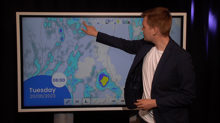
North Sea marine weather briefing for week 25 - June 20 - June 25.
Video forecast at the end of the article.
The high-pressure area that influenced the weather over the North Sea for such a long time has finally moved away. As a result, low-pressure systems from the Atlantic Ocean are now able to reach the UK. Associated frontal troughs will track over the North Sea during the upcoming week. Despite the passing troughs, both wind and waves will remain relatively calm due to the small pressure gradient, making conditions favorable for work most of the time during this week.
Synoptic overview
A minor low-pressure area is located just southwest of the UK and will track northward towards Scotland. An associated frontal trough tracks northeastward over the North Sea. Warm air is being advected in front of the trough, resulting in atmospheric instability. Showers, possibly accompanied with thunder, may occur during the passage of the frontal trough. The next frontal trough will pass over the North Sea on Wednesday, moving in a northeasterly direction.High-pressure builds again over the North Sea on Thursday, resulting again in calm conditions. Meanwhile, a minor low-pressure area forms W of Ireland and tracks N towards Iceland. Another associated frontal trough is expected over the UK on Friday and Saturday, possibly affecting the far east of the North Sea as well. The rest of the North Sea remains under the influence of previously mentioned high. The core of the high-pressure area is expected to be over the Netherlands on Saturday and Sunday.
Wind and waves - week 25
Figure 1A shows the trough tracking in a northeastward direction during the night to Wednesday. There is a possibility of thunderstorms along this trough. Associated wind gusts might reach 14 m/s, especially for the locations close to the Dutch and English shores. The severity of the thunderstorms is expected to decrease further offshore..png?width=1027&height=727&name=WindWed00UTC%20(1).png) Figure 1A: Sea level pressure (black lines), wind direction (barbs) and wind speed (colors) on Wednesday 00UTC.
Figure 1A: Sea level pressure (black lines), wind direction (barbs) and wind speed (colors) on Wednesday 00UTC. .png?width=988&height=733&name=WaveWed00UTC%20(1).png) 1B: Significant wave height on Wednesday 00UTC.
1B: Significant wave height on Wednesday 00UTC.
Figure 1B shows the significant wave height at 00UTC on Wednesday. The significant wave height mostly ranges between 0.5-1.5m. Locally, waves reach values up to 1.5-2.0m meters when a thunderstorm passes through. Additionally, visibility might be poor on Tuesday and Wednesday ahead of the trough, as warm air is advected over still relatively cold seawater. The highest chance of fog is therefore over the northern half of the North Sea and along the Norwegian coastline.
According to figure 2A, a strong ridge builds over the North Sea on Friday, Saturday, and possibly Sunday as well. This results in calm weather conditions, with relatively low wind speeds and a low significant wave height (Figure 2B). Due to the increased pressure, the risk of thunderstorms will have decreased, and therefore, workable conditions will be very good over a large part of the North Sea later during the week, possibly lasting into the weekend. The most active weather remains over the Atlantic Ocean. 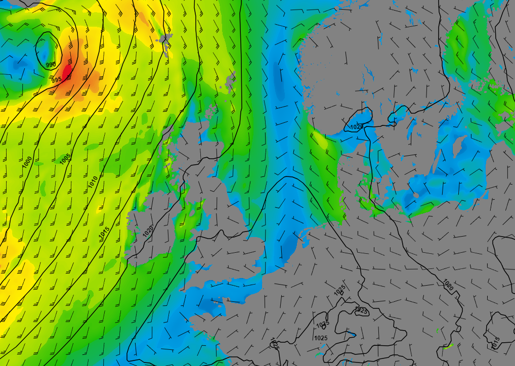 Figure 2A: Sea level pressure (black lines), wind direction (barbs) and wind speed (colors) on Saturday 00UTC
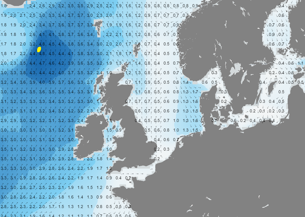 Figure 2B: Significant wave height on Saturday 00UTC.
Conclusion
There will be plenty of workable conditions during large parts of the week. Wind and waves will generally remain calm enough to perform most offshore operations. However, a few thunderstorms might reduce the workable time slightly on Tuesday and Wednesday, especially near the shore. Furthermore, fog over the northern half of the North Sea and along the Norwegian coastline might also become an issue. The risk of thunderstorms and fog decreases later during the week as high pressure builds over the North Sea. Both wind and waves remain calm as well, resulting in favorable workable conditions.
Weekly weather briefing
Every week we will post an updated weather briefing on the Infoplaza website and the Infoplaza Marine Weather Operations LinkedIn page. We will also share weather related articles and topics on offshore weather on these pages. We hope all our clients stay safe this week. Please feel free to contact us at any time if you have any questions or remarks.


