The week starts relatively calm with decreasing winds and waves due to a building ridge over the UK. A low develops near Iceland midway through the week and brings some more unsettled weather. A strong high-pressure system builds over the UK and the North Sea during the weekend, resulting in calm conditions again.
Synoptic situation
A low-pressure area is situated over the southern half of Scandinavia and tracks rapidly east while at the same time a ridge builds over the UK. Associated high pressure is located over southern Europe. The ridge tracks E over the North Sea during Wednesday night, while low pressure develops S of Iceland. The low tracks NE on Wednesday and associated frontal trough crosses the North Sea on Wednesday too. A secondary low-pressure area develops in its wake over the Faroe Islands and tracks SE along the coastline of Norway and reaches Denmark on Friday. High pressure builds over the Atlantic in the meantime and tracks E over the UK and the North Sea during the weekend, resulting in calm weather.
Read on for the video summary
Wind and waves
Wind and waves will be relatively calm due to the passing ridge on Tuesday over a large part of the North Sea (see Figure 1 and Figure 2). Significant wave height is expected to be mostly below 2 meters over the southern and middle half of the North Sea and up to 3 meters over the northern half of the North Sea, due to passing low-pressure areas.
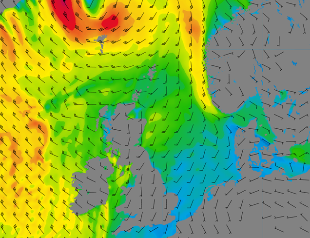 Figure 1: Wind speed and direction on Wednesday 22 February at 00UTC according to GFS.
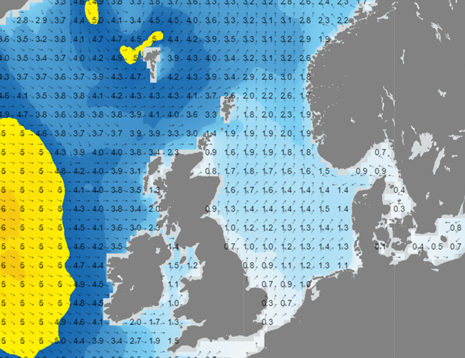 Figure 2: Significant wave height and direction on Wednesday 22 February at 00UTC according to GFS.
The low-pressure area that forms near the Faroe Islands on Wednesday tracks NE and the associated frontal trough tracks E over the North Sea. The temperature gradient within the trough is relatively small but this temperature gradient will drive the winds near the surface. Due to this small gradient, the wind speed will be relatively low within the trough. Behind the trough, the wind shifts to the NW allowing some swell to enter the North Sea from the N. Due to the sheltering effect from the UK over the far S of the North Sea, the waves will increase in height to 1.5-2.0 meters along the Dutch coastline to 2-3,5 meters over the rest of the North Sea.
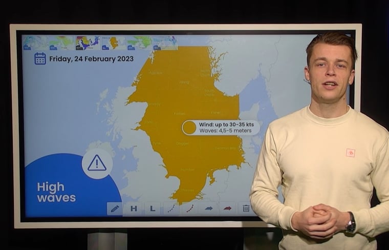
A strong northerly wind of around 20-30 kts, locally up to 35 kts, picks up over the North Sea as high pressure builds over the UK. Due to the strong wind and long fetch waves have all the time to gradually build in height. As a result, waves up 4,5-5 meters will be present on Friday and Saturday over a large part of the North Sea. The UK provides again some shelter of the far S of the North Sea and the English Channel. 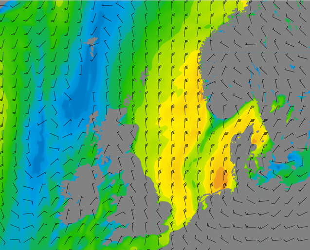 Figure 3: Wind speed and direction on Friday 24 February at 00UTC according to GFS
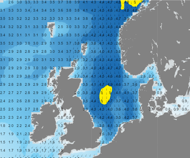 Figure 4: Significant wave height and direction on Friday 24 February at 00UTC according to GFS
Conclusion
Although the weather stays relatively calm during a large part of this week, waves can build quite high due to incoming swell from the N. This will happen mainly from Thursday onward as the wind turns N after the passing trough on Wednesday and will last until at least Saturday. High pressure builds over the North Sea on Sunday, resulting in decreasing waves again.
Weekly weather briefing
Every week we will post an updated weather briefing on the Infoplaza website and the Infoplaza Marine Weather Operations LinkedIn page. Furthermore, we will share weather related articles and topics on offshore weather on these pages. We hope all our clients stay safe at sea this week. Please feel free to contact us at any time if you have any questions or remarks.


