
This week has started with strong winds blowing from the west and northwest. High pressure extending north over the North Sea later this week will result in calmer conditions, especially in the central and southern North Sea.
Synoptic situation
An active low-pressure area near Iceland tracks southeast and will cross the Shetlands on Wednesday morning. It will move further southeast and is expected to pass over Denmark on Thursday night. Meanwhile, high pressure is expected to build south of the UK and a ridge will extend north over England and the North Sea. This will prevent a new Atlantic low moving into the North Sea, and instead will force it to northeast into the Norwegian Sea. An associated trough may affect the northern North Sea before the previously mentioned ridge moves east on Saturday, rapidly followed by a new ridge of high pressure on Sunday. In between, a frontal trough is expected to cross the northern North Sea late Saturday.
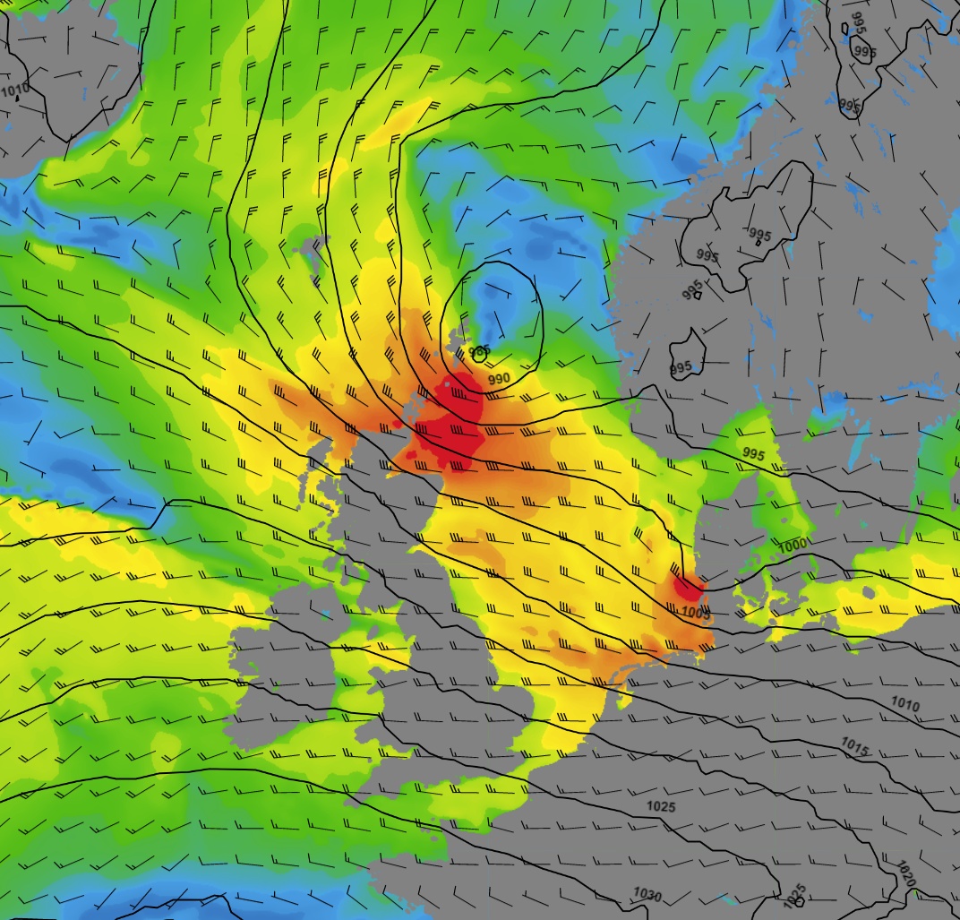 Figure 1: Situation on Wednesday 12 UTC (GFS), low pressure tracking SE via the Shetlands.
Wind and waves in the North Sea this week
The strongest winds and highest waves this week are expected to be behind the low crossing the northern North Sea on Wednesday. Northwesterly winds may well reach strong gale force (9 Bft) to the east of Scotland and significant wave height may reach between 6.0 to 8.0 meters. To the south, winds might also reach gale force, and waves are expected to increase from 4.0 to 6.0 meters.
The forecast is uncertain along the expected path of the low-pressure area, around the Shetlands, Viking and just offshore South Norway. Slightly different positioning of the low may have large impact on forecasted winds and waves, but in this instance however, global models are largely in agreement with each other.
Both winds and waves are expected to calm down from Thursday on. It is only in the most northern part of the North Sea, in the east Shetland Basin, that wind and waves will increase again on the approach of the new low that is moving east into the Norwegian Sea and on the passage of a frontal trough late Saturday.
Figure 2: Animation: showing the wind barbs and precipitation (GFS) this week and coming weekend.
Conclusion for this week 's marine weather
This week has started with unsettled weather, resulting in gale force winds and high waves. High pressure extending north over the North Sea results in calmer conditions from Thursday. However, the northern North Sea remains sensitive to unsettled weather as new disturbances pass close or just north.
Weekly weather briefing
Every week we will post an updated weather briefing on the Infoplaza website and the Infoplaza Marine Weather Operations LinkedIn page. We will also share weather related articles and topics on offshore weather on these pages. We hope all our clients stay safe at sea this week. Please feel free to contact us at any time if you have any questions or remarks.