Low pressure is situated over the northern half of the North Sea, resulting in unsettled weather during the start of this week. The low fills and tracks towards the southwest, before stalling west of Ireland and intensifying once again. Meanwhile, high pressure builds over the North Sea, resulting in good workable conditions from Thursday onward.
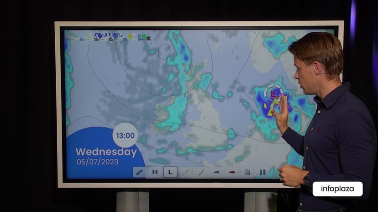
Video briefing at the end of the article
Low pressure is positioned over the northern North Sea and Scandinavia, with associated frontal troughs frequently affecting the North Sea today and tomorrow. Wind speeds remain well above 25kts, and significant wave height around 3 meters for most of the North Sea. However, just east of the UK and over the southern half of the North Sea, the weather is calmer due to the sheltered location. From Thursday onward the weather stabilizes as high pressure starts to build, resulting in more workable windows.
Synoptic overview
A low-pressure core is situated over Norway with associated frontal trough tracking east over the North Sea today. The trough may develop into a secondary low-pressure area over the German Bight during the night to Wednesday. The parent low over Scandinavia tracks east towards Ireland while filling, but intensifies once again on Thursday. Meanwhile, high pressure builds over the North Sea, resulting in calm weather conditions on Thursday, Friday, and Saturday. The previously mentioned low west of Ireland starts to track in an easterly direction on Sunday, and the associated frontal trough reaches the North Sea over the course of Sunday.Wind and waves
Figure 1A depicts the frontal trough tracking east on Tuesday, with an associated wind field. The strongest winds occur just ahead of the trough, with wind gusts reaching up to 65 kph. The most active wind speeds occur in the German Bight on the possible development of a secondary low- pressure area over Wednesday night. In Figure 1B the associated significant wave height (Hs)is illustrated. Hs reaches values up to 3-3.5 meters over the German Bight and 1.5-2.5 meters over the rest of the North Sea. The lowest wind speed and wave heights are forecasted along the east coast of the UK and the far south of the North Sea due to their sheltered location during westerly winds.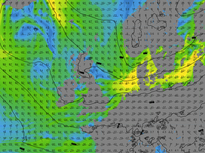 Figure 1A: Sea level pressure (black lines), wind direction (barbs) and wind speed (colors) on Tuesday 12UTC.
 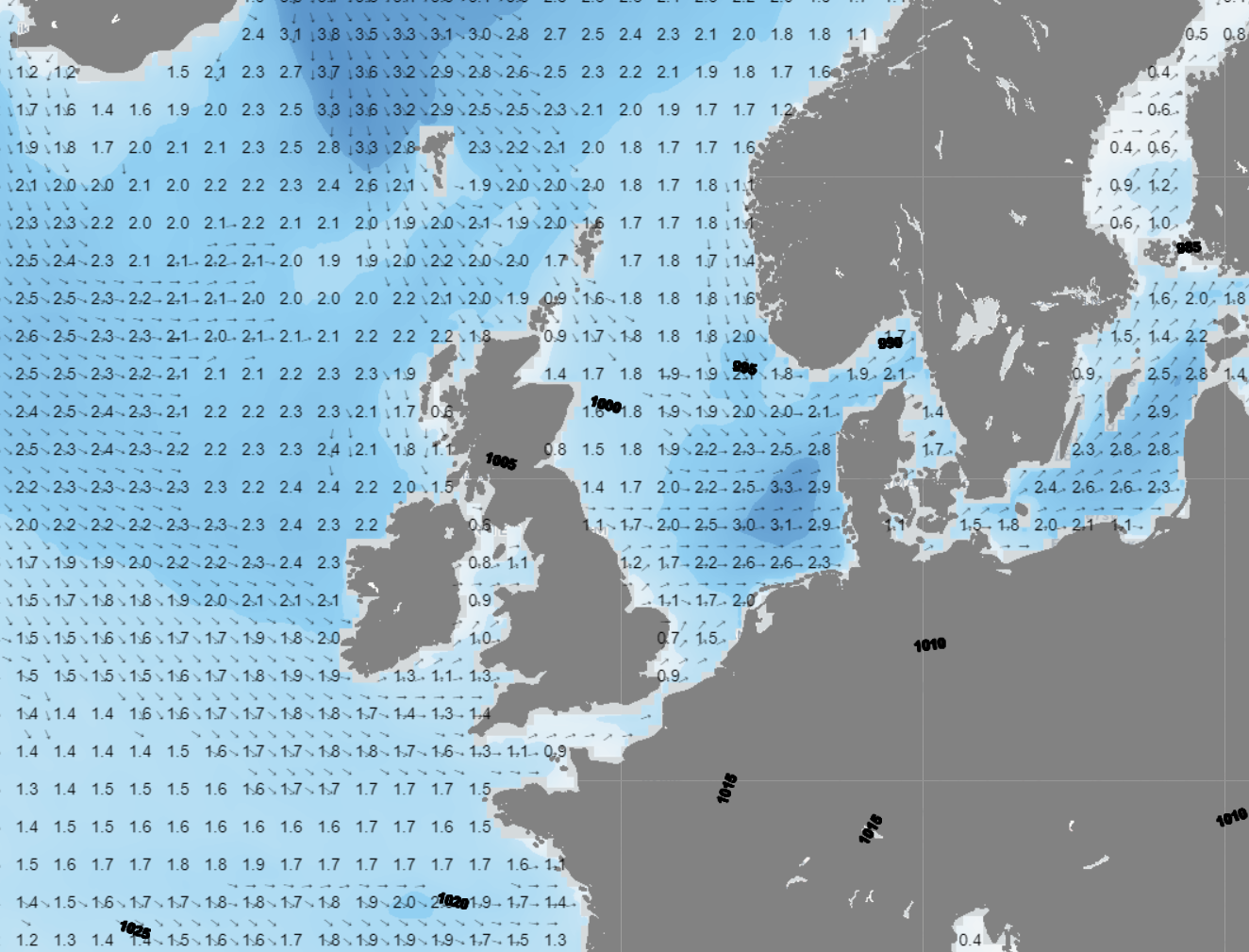 Figure 1B: Significant wave height and direction on Tuesday 00UTC.
High pressure will build later during the week over a large part of the North Sea, leading to calm weather conditions and providing good workable windows. The wind shifts to a southerly direction, and wind speed will generally remain low. Significant wave height is expected to stay around 1 meter on Friday and Saturday. The lowest values will be forecasted over the southern half of the North Sea and along the Dutch coastline. This calm weather will result in good workable conditions for most operations on Friday and Saturday. However, on Sunday, the deep low west of Ireland will approach the UK and its associated frontal trough may reach the southern North Sea with an increasing risk of thunderstorms.
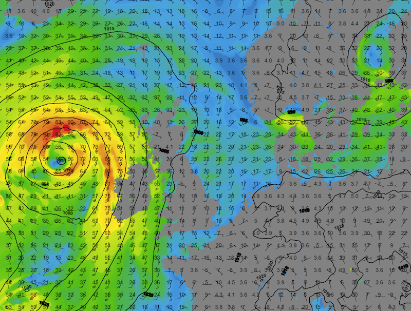 Figure 2A: Sea level pressure (black lines), wind direction (barbs) and wind speed (colors) on Friday 12UTC.
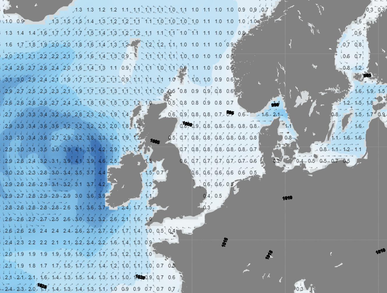 Figure 2B: Significant wave height and direction on Friday 12UTC.
Conclusion
Weather conditions will remain unsettled until Wednesday afternoon due to the passage of various frontal troughs. Wind speed will be up to 25-30 kts and Hs will occasionally reach 3 meters over the northern North Sea and the German Bight. However, conditions will be much calmer on Thursday, Friday, and Saturday due to the formation of a strong ridge over the North Sea. This will likely result into good workable conditions for most offshore operations during these days. On Sunday, a new frontal trough approaches the North Sea, increasing the risk of thunderstorms and potential downtime once again.
Weekly weather briefing
Every week we will post an updated weather briefing on the Infoplaza website and the Infoplaza Marine Weather Operations LinkedIn page. We will also share weather related articles and topics on offshore weather on these pages. We hope all our clients stay safe this week. Please feel free to contact us at any time if you have any questions or remarks.


