High pressure over Scandinavia and the Norwegian Sea will result in relatively calm weather conditions with good workability options for most areas in the North Sea over the coming week. A complex low-pressure area is expected to move NE across the North Sea during the weekend, after which the winds turn to a N’ly direction and rapidly increase, thereby reducing the weather windows.
Synoptic overview
A strong high-pressure area (1040hPa) over Scandinavia, with an associated ridge over the northern North Sea, slowly shifts W across the southern part of the Norwegian Sea over the coming days and is expected to decline on Friday. A minor low-pressure area moves W across the Benelux during the course of Thursday and is situated over England on Friday. What will happen during the weekend is uncertain at this stage. However, the most likely scenario is that the minor low will merge with a secondary low approaching from the Bay of Biscay, moving together as a complex low-pressure area NE across the North Sea over the weekend. At the same time, a new strong high-pressure area builds near Iceland. In between, a N’ly flow will transport cold air well south into the North Sea with an increasing risk of wintry showers.Skip to the video briefing at the end of this article
Wind and waves
The northern parts of the North Sea will predominantly face calm weather conditions with gentle to moderate winds (5-15kts) and a significant wave height around 1m for most areas over the next days. E/NE’ly winds will dominate over the southern and central parts of the North Sea, which will gradually strengthen to fresh or strong (15-25kts) during the second half of this week. As a result of the increasing winds, the significant wave height is expected to increase to values around 2m. During the weekend, uncertainty quickly increases due to a lack of confidence in the exact development and track of the complex low-pressure area that is expected to move NE across the North Sea. After passage of the low, a firm N’ly flow is expected to settle from the Norwegian Sea all the way down into the North Sea with rapidly increasing winds (gale force or higher) and waves (exceeding 5m) as result.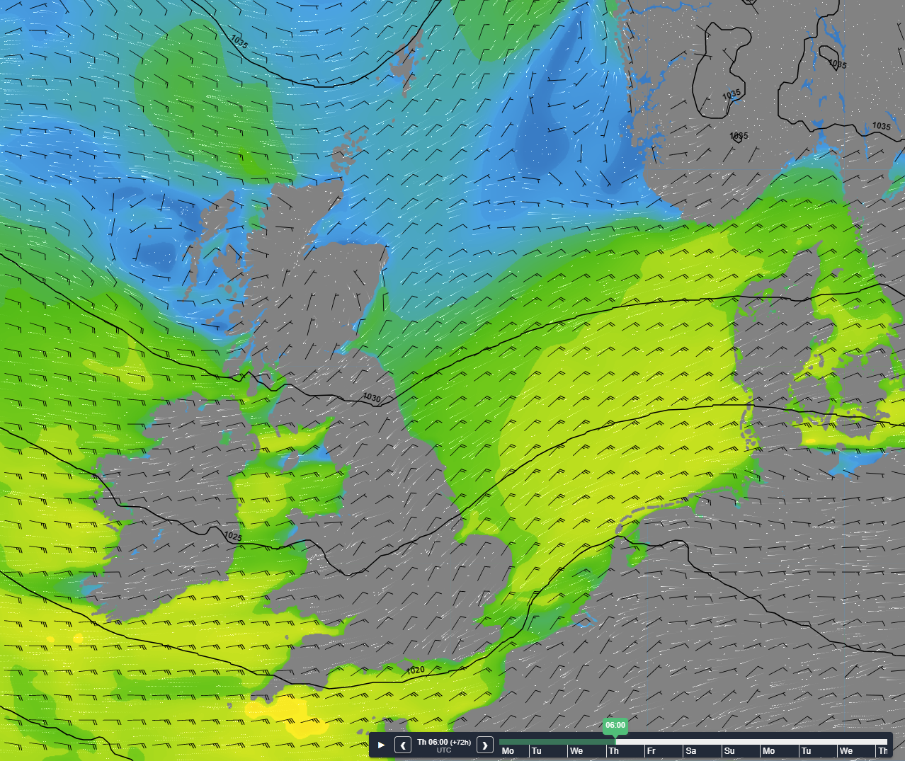 Figure 1: Isobars (black lines 5hPa) and wind speed/direction (kts) valid Thursday April 20th 6 UTC.
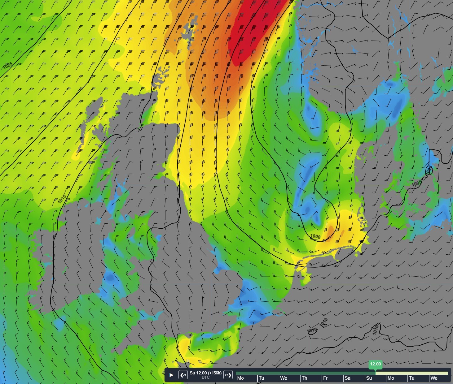 Figure 2: Isobars (black lines 5hPa) and wind speed/direction (kts) valid Sunday April 23rd 12UTC.
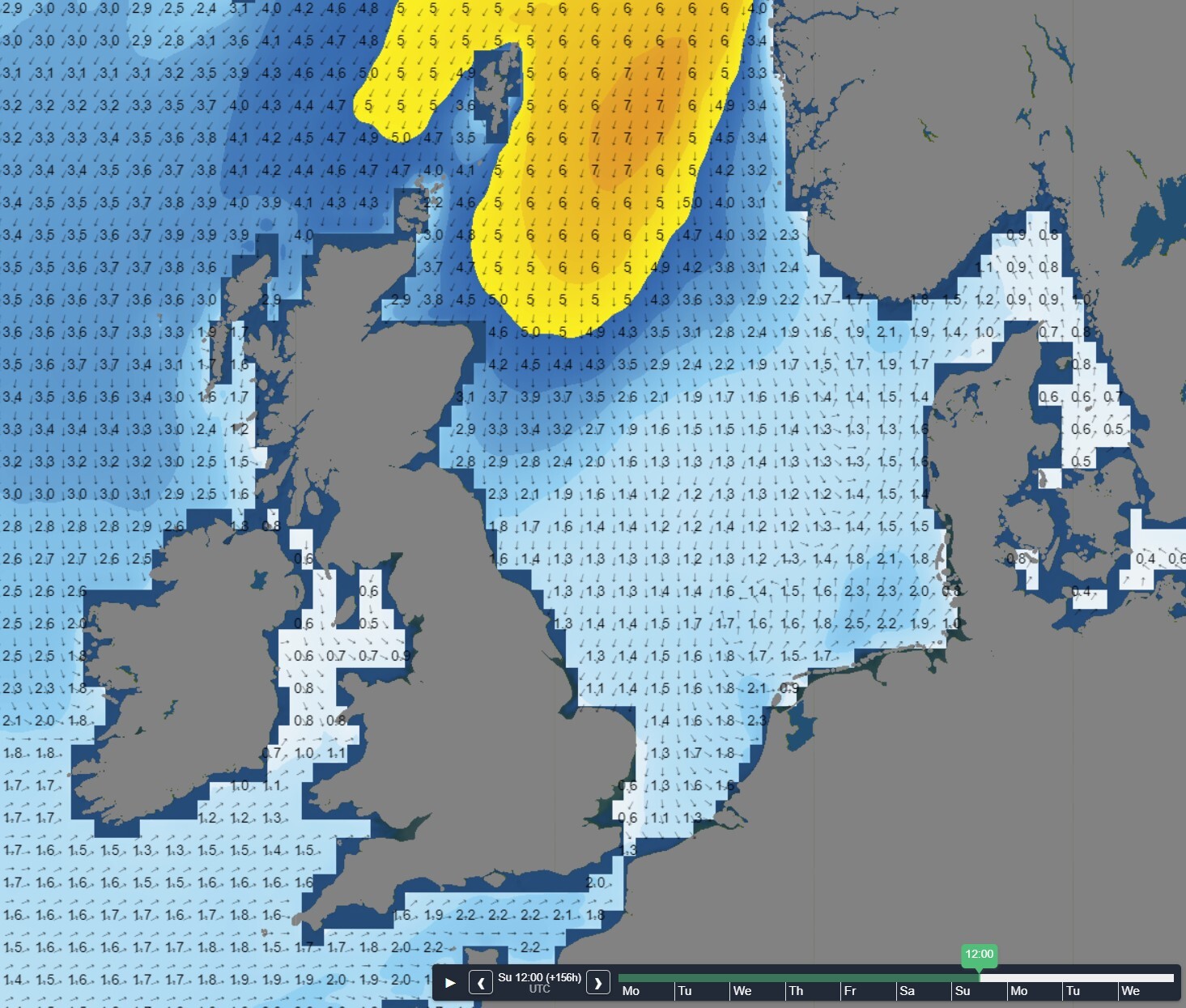 Figure 3: Significant wave height/direction (m) valid Sunday April 23rd 12UTC.
Conclusion for week 16
High-pressure dominates just north of the North Sea this week, while a minor low moves W across the southern North Sea over the course of Thursday. During the weekend, a complex low-pressure area is expected to move NE across the North Sea. Good workability windows will dominate for most areas in the North Sea till the weekend, thereafter most likely rapidly diminishing from the north as a firm N’ly flow is expected to settle from the Norwegian Sea all the way down into the North Sea.
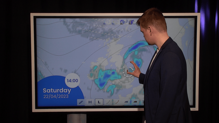
Weekly weather briefing
Every week we will post an updated weather briefing on the Infoplaza website and the Infoplaza Marine Weather Operations LinkedIn page. We will also share weather related articles and topics on offshore weather on these pages. We hope all our clients stay safe at sea this week. Please feel free to contact us at any time if you have any questions or remarks.