Just like last week, large parts of the North Sea will be influenced by Atlantic high pressure this week, especially the eastern North Sea which will have to wait somewhat longer before wind and waves will come down, as low pressure lingers over Denmark at first. High pressure is not able to fully extend over the North Sea before the end of the week. Will these calm weather conditions continue during and after the weekend? Find out the details in this week’s weather briefing below.
Video briefing at the end of this article.
Synoptic overview
Strong high pressure (1035 hPa) lingers over the Atlantic on Tuesday with a ridge extending over the UK and western part of the North Sea. Low pressure is present over Denmark and Skagerrak, keeping the pressure gradient tight over the eastern part of the North Sea. This declining low pressure gradually moves south into Germany on Wednesday, while high pressure remains stationary. This results in a slowly loosening pressure gradient from Wednesday onwards, though high pressure is unable to extend fully over the North Sea at first. This is expected to happen by Friday, with calmer conditions extending eastwards.
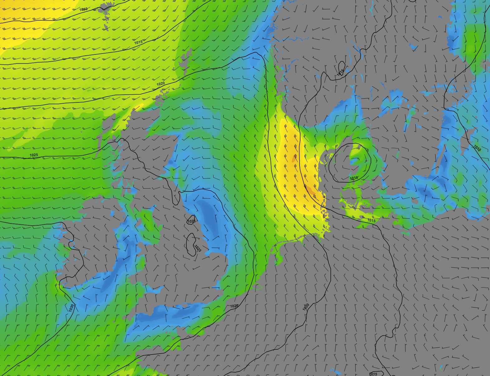 Figure 1. Atlantic high pressure extends a ridge over the UK and the western North Sea this week. The German Bight remains under low pressure influence at first.
During the weekend, high pressure is expected to remain dominant over much of the North Sea with generally calm conditions expected to continue. However, the confidence decreases by then as models start to differ as to what extent low pressure will result. Some weakened fronts may cross the North Sea from north to south during the weekend. Strong, deep low pressure is not expected.
Colder air is being transported on the northern flank of previously mentioned high pressure, so the risk of bad visibility due to fog or low clouds is in most places insignificant. Along the UK east coast a few fog patches or some low clouds may develop later this week.
Wind and waves
Large differences in wind speed can be observed over the North Sea on Tuesday. Along the UK east coast, the wind remains calm with 1-3 Bft. Waves generally fluctuate between 0.5-1.5m over the western half of the North Sea. Over South Utsire, Fisher and the German Bight, winds blow with 6-7 Bft as low- pressure lingers over Denmark. Due to funneling, the wind speed may locally reach up to 8 Bft just south of Norway Tuesday afternoon. Waves reach up to 3.5-4.0m on Tuesday. The wind field will slowly weaken while moving south on Wednesday, as low pressure moves south into northern Germany. Waves will follow and are expected to drop below 2.0m Wednesday afternoon.
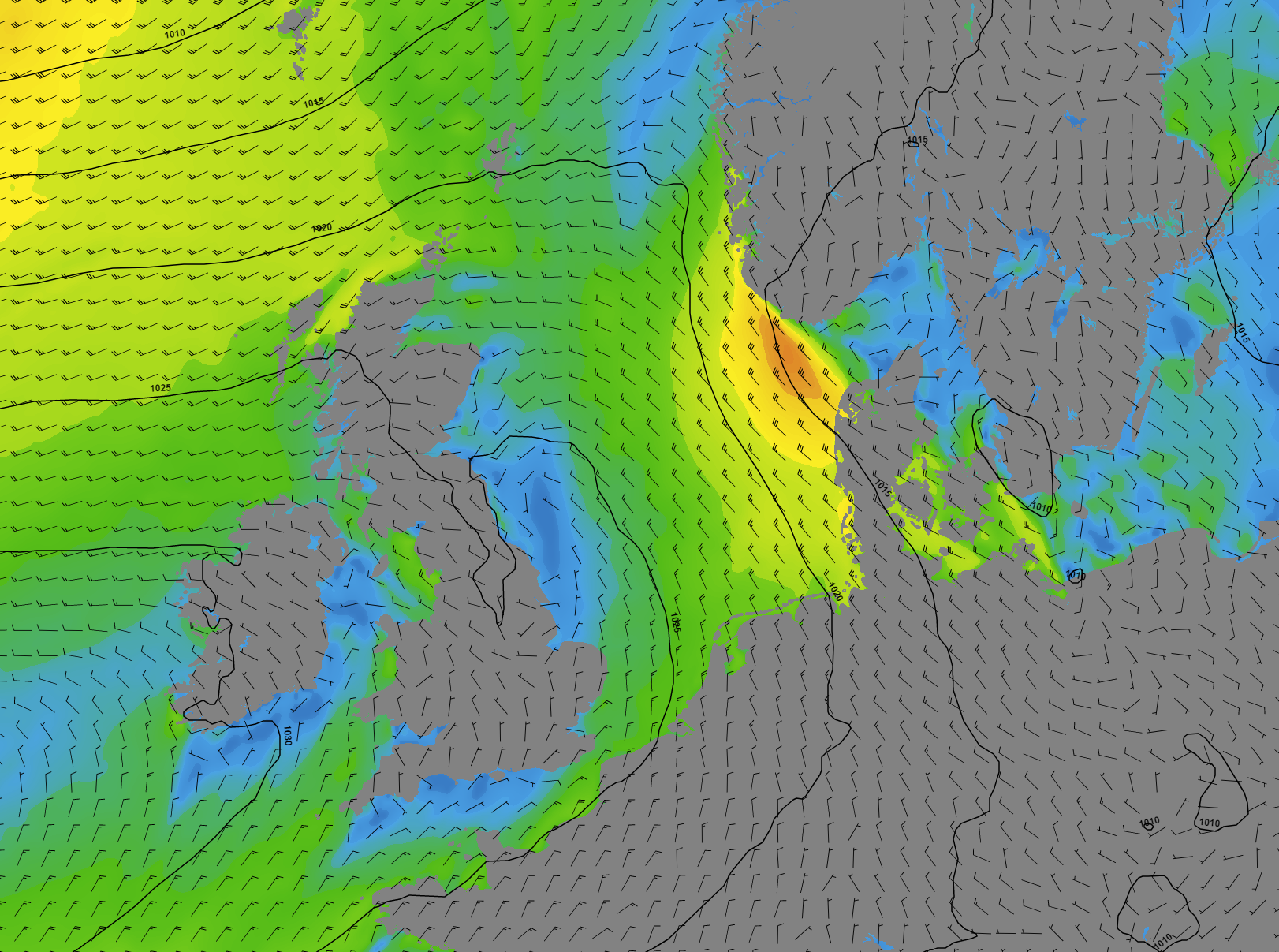 Figure 2. A strong wind field with up to (near) gale winds just south of Norway on Tuesday, weakening on Wednesday.
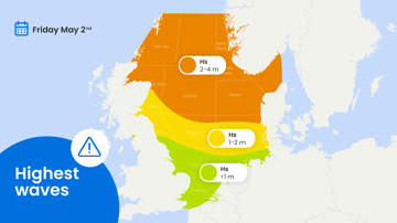
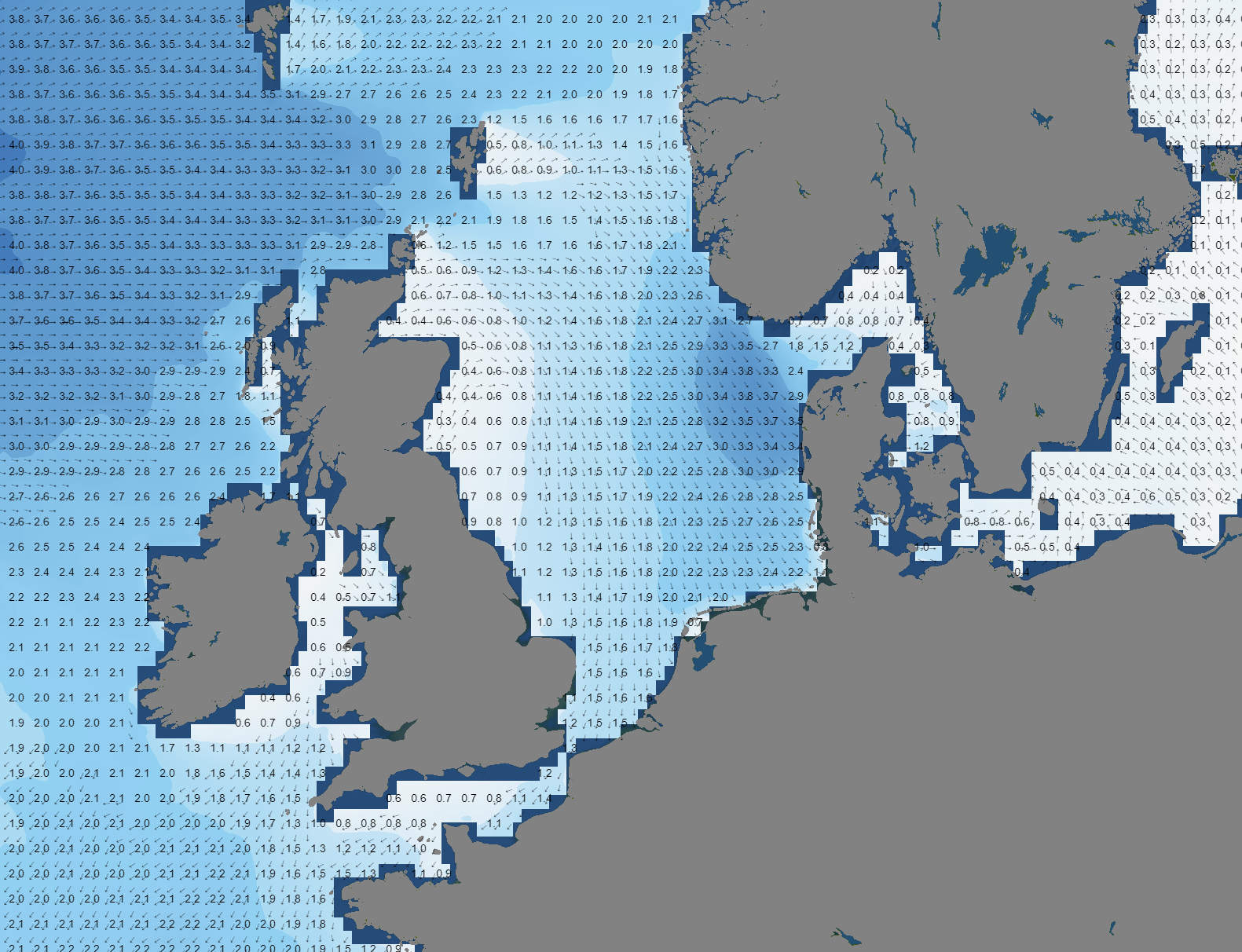 Figure 3. High waves are expected on Tuesday over Fisher and the German Bight. Waves will drop below 2.0m again on Wednesday. Waves of just over 3.0m are produced along the Norwegian coast later this week.
On Wednesday and Thursday, 4-5 Bft winds are maintained over the northern and eastern North Sea. The western North Sea continues to be calm with 1-3 Bft winds. The funneling effect just south of Norway is maintained during the rest of the week, generally with strong to sometimes near-gale winds. The southern North Sea, just west of the Benelux, may also see 4-5 Bft winds at times this week, depending on the exact positioning of the high-pressure ridge. Waves will gradually increase from 1.5m to 2.5m over the northern and eastern North Sea these days, only exceeding 3.0m in a narrow band along the Norwegian coastline.
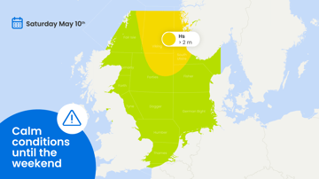
From Friday, calmer conditions are expected to extend over the entire North Sea. Calm to moderate winds (mostly 2-4 Bft from various directions) are expected and waves will generally fluctuate between 1.0-2.5m, with highest values over the northern North Sea.
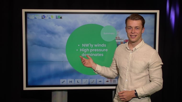
Conclusion
As discussed, especially in the western part of the North Sea there are good workability possibilities expected this week. The weather remains calm and chances for fog are low. The eastern North Sea has some difficulties at first with strong to near gale northerlies until early Wednesday (German Bight) but conditions will improve in this area as well later this week.
Weekly weather briefing
Every week we will post an updated weather briefing on the Infoplaza website and the Infoplaza Marine Weather Operations LinkedIn page. We will also share weather related articles and topics on offshore weather on these pages. We hope all our clients stay safe at sea this week. Please feel free to contact us at any time if you have any questions or remarks.