A deep low-pressure area over Scandinavia generates a significant pressure gradient, resulting in near-gale to gale force northwesterly winds on Tuesday and Wednesday. Subsequently, high-pressure influence increases, leading to more stable weather conditions and favourable working windows.
Synoptic overview
On Tuesday, a deep low-pressure area is situated over Central Scandinavia (980 hPa). This system lingers over Southern Scandinavia in the following days, spawning a secondary low over the Norwegian Sea on Wednesday. Several associated (frontal) troughs primarily affect the Northern North Sea this week. Simultaneously, a weakening low-pressure area traverses the southern part of England on Tuesday, subsequently affecting the southernmost part of the North Sea later that day.
Following its passage, high pressure over the Bay of Biscay advances northeastward, accompanied by an associated ridge moving east across the North Sea on Thursday and Friday. By this time, a new Atlantic Low approaches Ireland (990 hPa), and an associated weak cold front crosses the North Sea on Friday. The system lingers northwest of Scotland over the weekend. Associated (frontal) troughs predominantly influence the Northern North Sea.
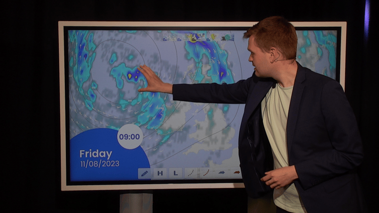
Video briefing at the end of the article
Wind and waves
The deep low-pressure area over Central Scandinavia triggers a substantial pressure gradient, resulting in near-gale to gale force northwesterly winds across the Northern North Sea and along the south- and west coast of Norway. In the Skagerrak region, winds may intensify even further, potentially reaching strong gale force (>40 kts). These winds will elevate the significant wave height to 4.0 – 5.0 meters in the aforementioned areas. Moving westward and southward, both winds and waves become calmer (15 – 25 kts, 1.5 – 3.0 meters significant wave height). The east coast of the United Kingdom and the Southern North Sea experience a shielding effect due to the northwesterly wind direction.
Wind and wave conditions remain relatively unchanged on Wednesday before subsiding from the southwest starting on Thursday. During this period, a high-pressure ridge gains influence over the North Sea, coinciding with the gradual dissipation of the low-pressure over Scandinavia. Waves are projected to reach up to 2.0 meters on Friday, accompanied by a moderate to fresh breeze (10 – 20 kts). Throughout the weekend, minimal influences from low-pressure systems are anticipated, leading to insignificant changes in conditions.
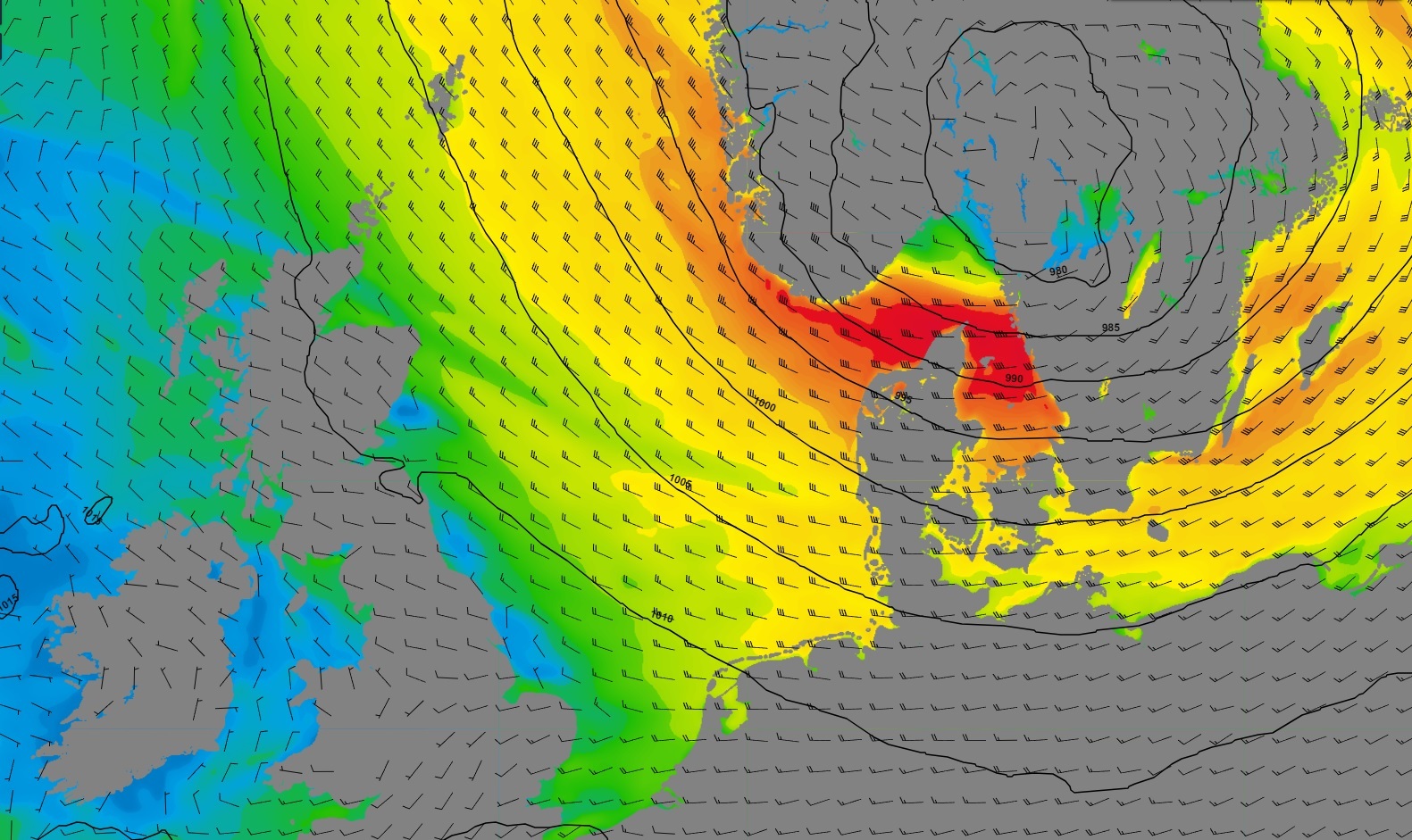 Figure 1: Isobars (black lines 5hPa) and wind speed/direction (kts) valid Tuesday, August 8th, 12 UTC.
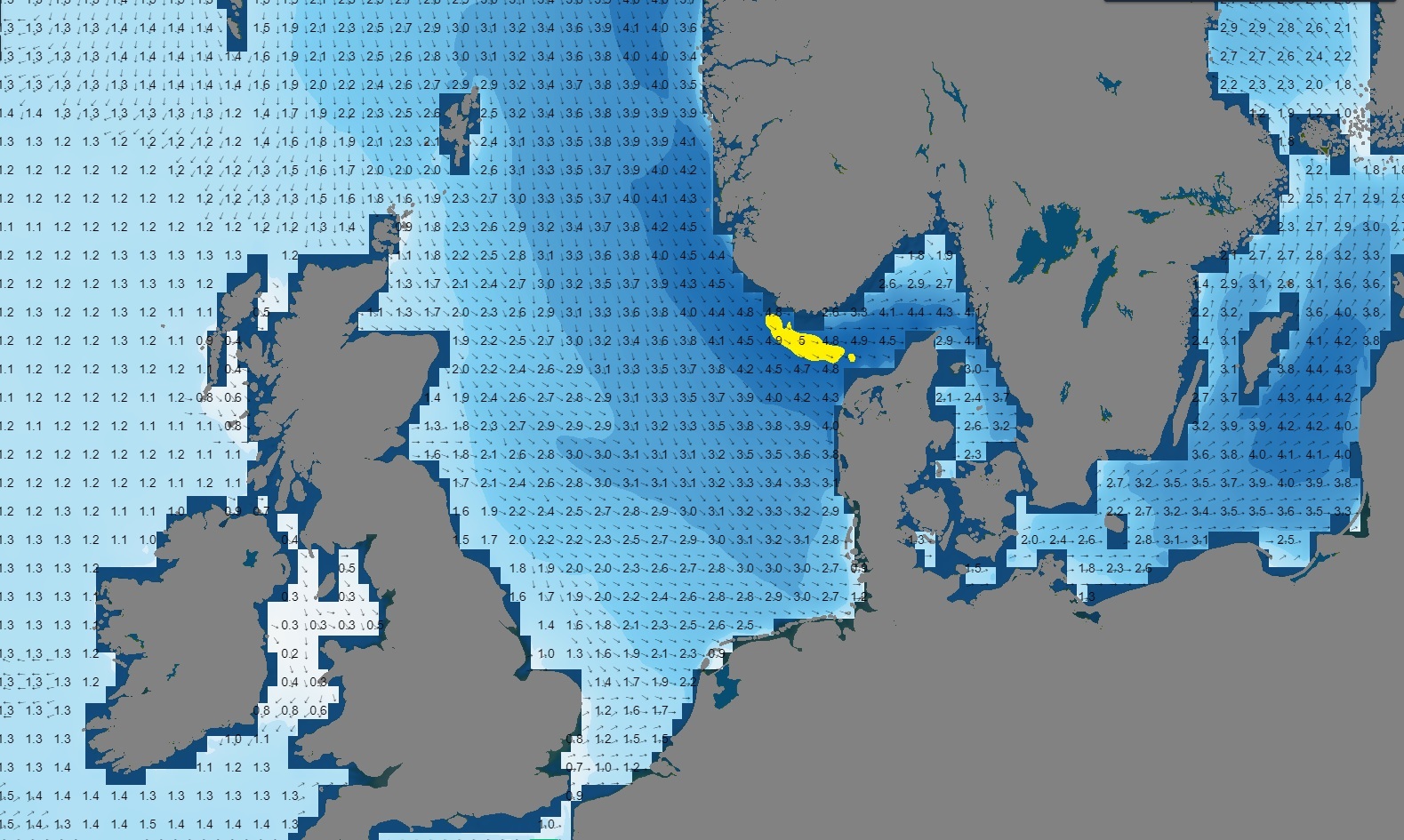 Figure 2: Significant wave height/direction (m) valid Tuesday, August 8th, 12 UTC.
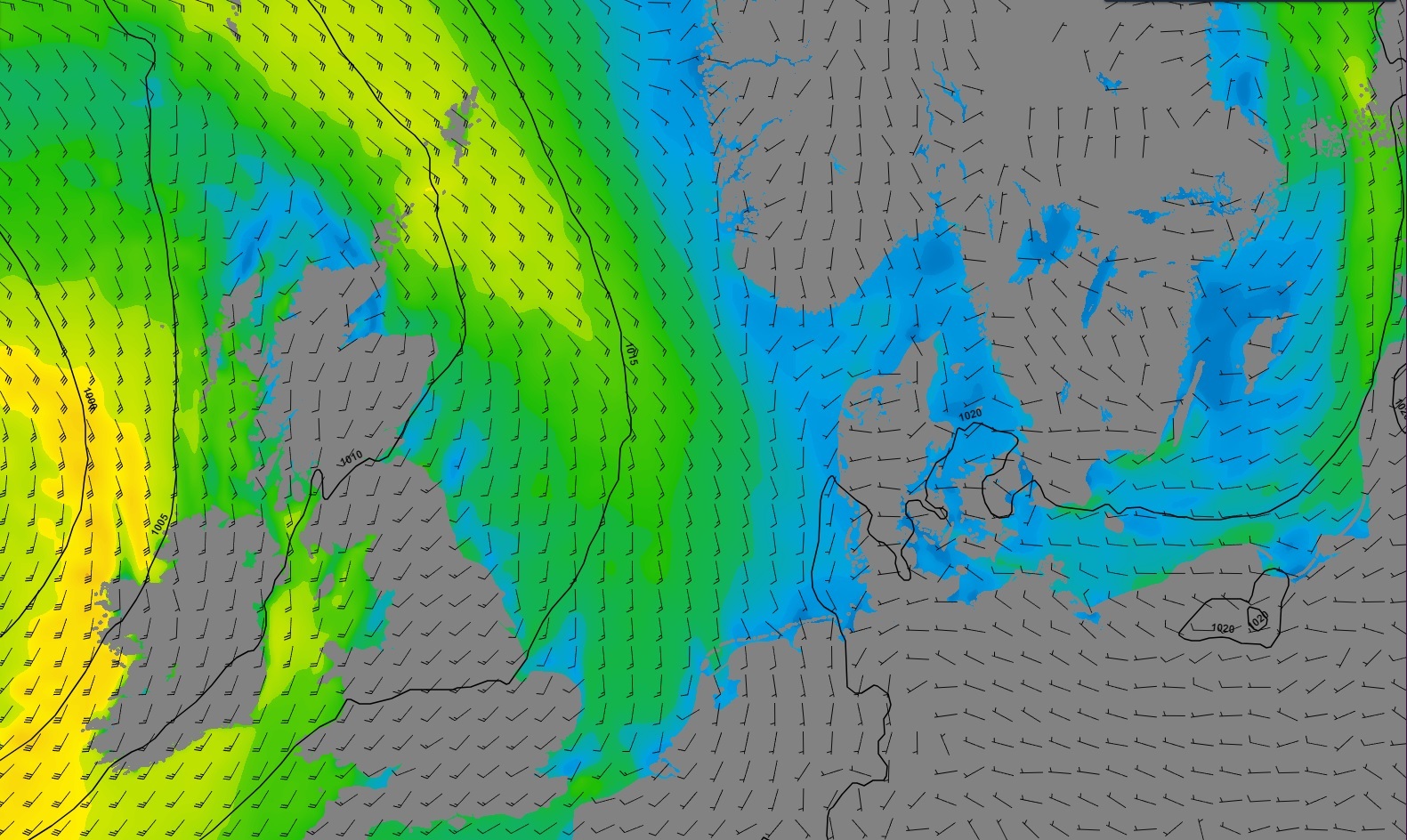 Figure 3: Isobars (black lines 5hPa) and wind speed/direction (kts) valid Friday, August 11th, 12 UTC.
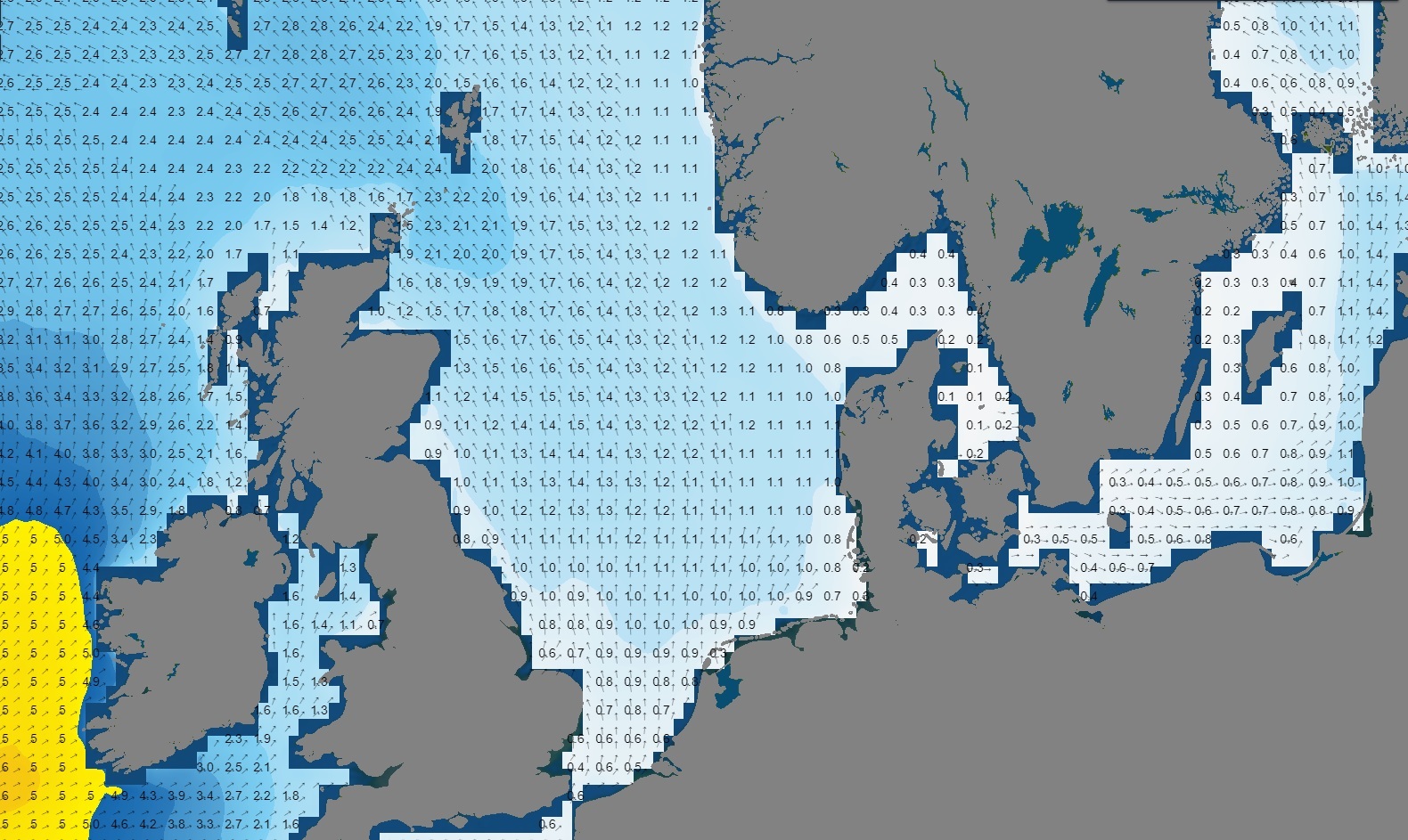 Figure 4: Significant wave height/direction (m) valid Friday, August 11th, 12 UTC.
Conclusion
The presence of a deep low-pressure area over Scandinavia results in a notable pressure gradient on Tuesday and Wednesday, causing near-gale to gale force NW’ly winds. Locally, wave heights could reach up to 5.0 meters. As of Thursday, the low-pressure system is gradually dissipating, and high-pressure conditions are becoming dominant over the North Sea. Consequently, winds and waves are expected to decrease. The weak cold front on Friday is unlikely to bring significant weather disturbances. This week offers favourable working windows, particularly from Thursday onward. Infoplaza will continue to monitor the latest weather developments. For the most up-to-date information, please refer to our daily updated forecast reports to stay informed about the latest developments.
Learn more about the weather
We just launched our new resources page. Here you will find special content like videos, webinars and whitepapers that will guide you to a decision point. Use these expert insights to improve your business or simply to get your knowledge about marine weather up-to-date.