High pressure is situated over central Europe, while low pressure intensifies over Iceland. Between those pressure systems, a strong southwesterly flow brings mild air over the North Sea. Meanwhile, a sharp cold front develops north of Scotland and tracks south over the UK and the North Sea on Wednesday. This front lingers over the North Sea until the weekend. High pressure builds over the Atlantic by then, resulting in a strong northerly flow over the North Sea, bringing cool air.
Synoptic overview
High pressure is present over a large part of the European mainland, while low pressure develops near Iceland. An associated cold front tracks gradually southeast over the UK and the North Sea on Wednesday and reaching the Netherlands by the end of the day. High pressure builds over the southern North Sea afterward, and the cold front tracks northeast again as a warm front, bringing warm air over the southern half of the North Sea.A new low pressure area develops north of Scotland early on Friday and tracks east towards Norway. An associated cold front tracks southeast over the North Sea again. High pressure builds over the Atlantic Ocean in the meantime. Between these two pressure systems, a northerly flow develops, bringing polar air to the North Sea on Sunday.
Wind and waves
A sharp cold front extends from the south of the UK, over the southern North Sea, towards Denmark on Wednesday 12UTC. Later that day, the cold front tracks slowly in a southeasterly direction. The wind significantly increases behind the cold front, especially in between Scotland and southern Norway, with sustained wind speeds up to 35-40kts, possibly gusting up to 50 kts (see Figure 1). Over the southern half of the North Sea wind speeds are ranging from 20-25 kts, possibly gusting up to 30-35 kts (see Figure 1).
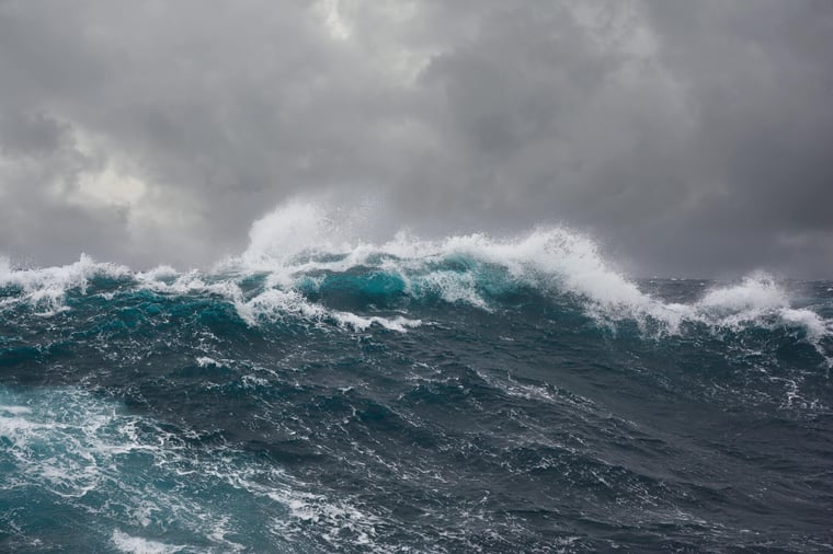
As a result of the unstable and windy weather conditions, waves are in particularly high over the middle and northern half of the North Sea. Significant wave height will increase to 5m later Wednesday over there. Meanwhile, Hs will mainly vary between 2-3m over the rest of the North Sea. Due to the westerly winds, the east coast of the UK experiences less heigh waves since the UK provides some shelter.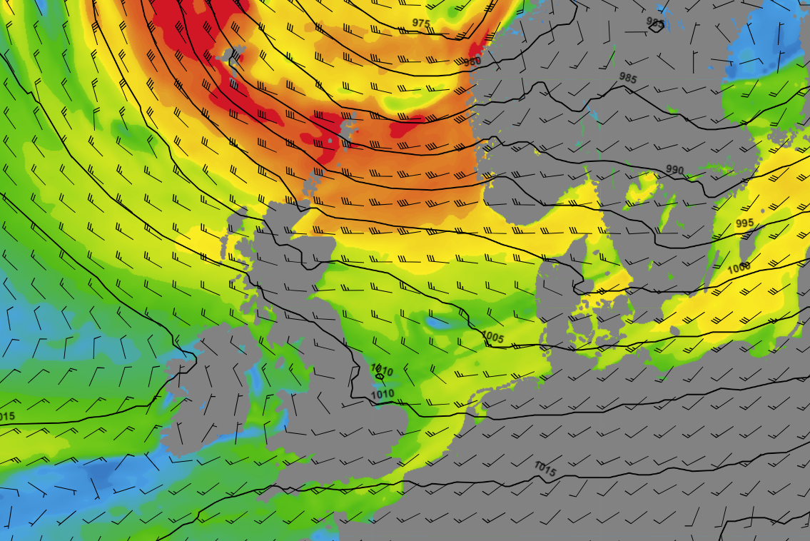 Figure 1: Wind speed and direction on Wednesday 11 October at 12UTC according to GFS
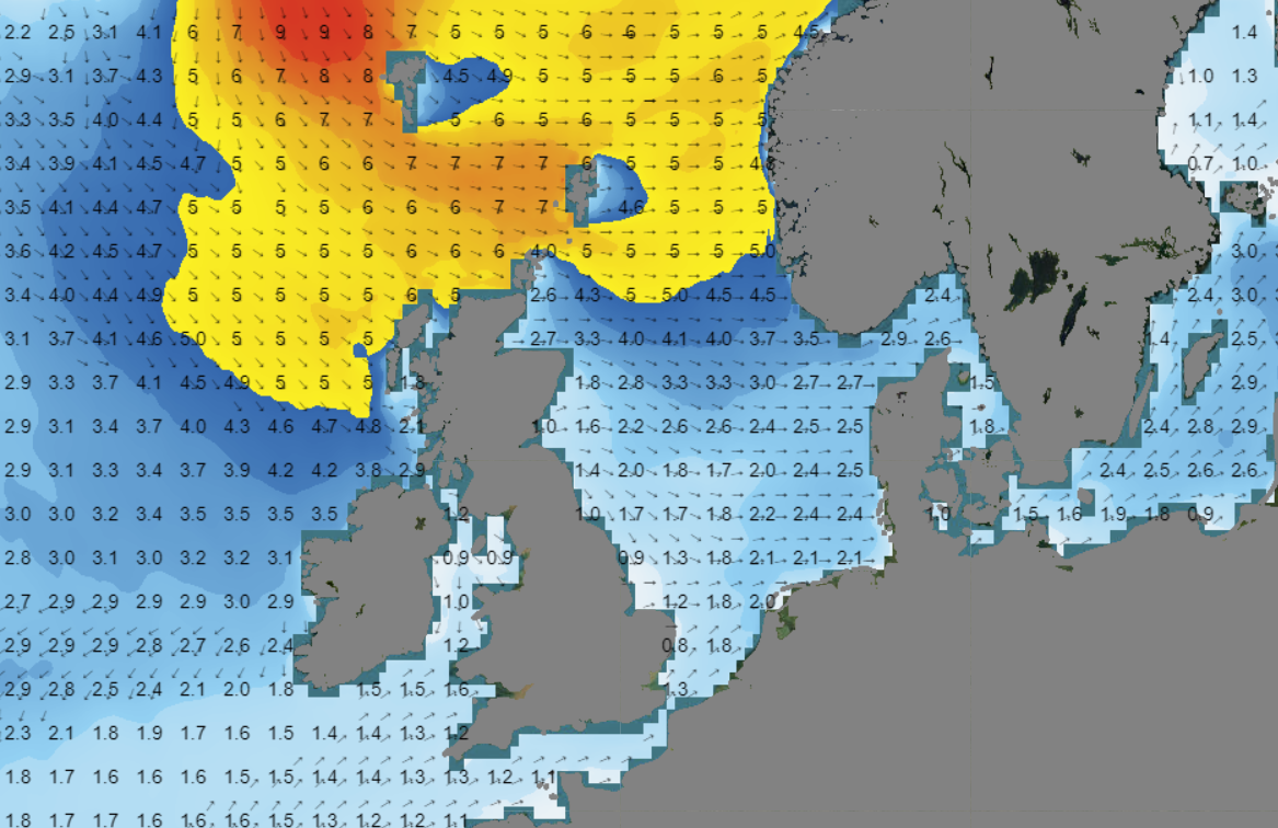 Figure 2: Significant wave height and wave direction on Wednesday 11 October at 12UTC according to GFS
The weather will stabilize shortly on Thursday, as a mobile ridge passes over the North Sea. But a new cold front tracks southeast on Friday, resulting in strong winds and high waves again.
Due to the cold upper air and still relatively warm sea water, the air is unstable. As a result, waves are often able to grow more in height compared to model output. Therefore, the calculated significant wave heights of 2.5-6m might be even a bit on the low side (Figure 4).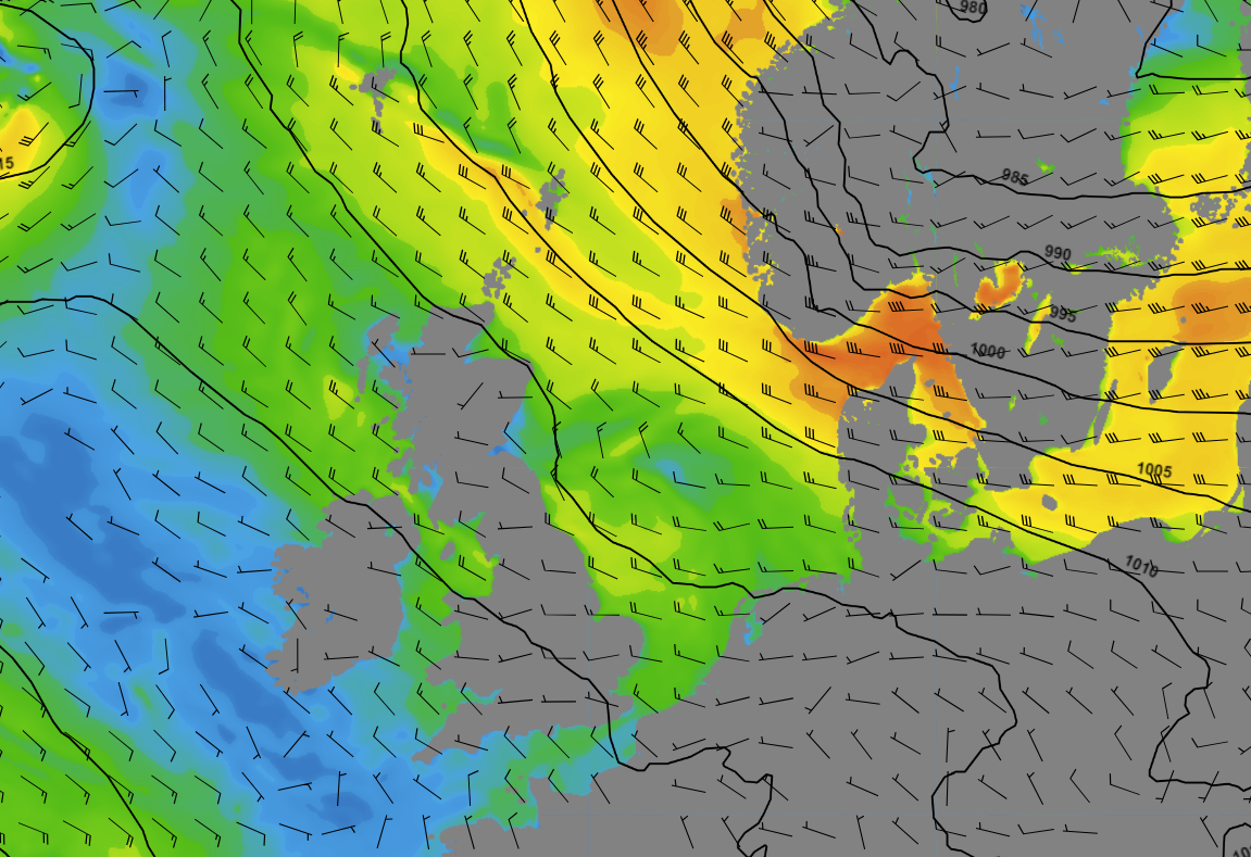 Figure 3: Wind speed and direction on Sunday 15 October at 00UTC according to GFS
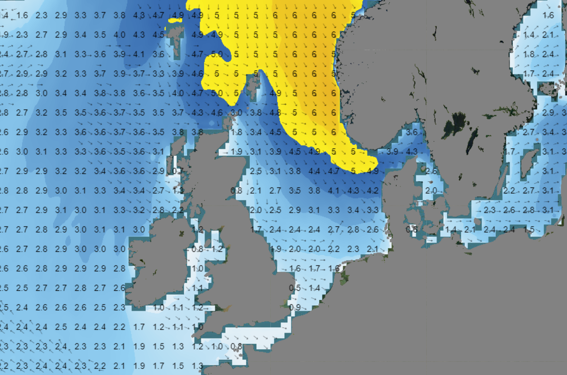 Figure 4: Significant wave height and wave direction on Sunday 15 October at 00UTC according to GFS
Conclusion
Low pressure areas will bring unsettled weather for a large part of this week. Various sharp cold fronts will track over the North Sea. Those fronts are accompanied by strong winds and high waves. Polar air reaches the North Sea on Saturday and Sunday. Due to temperature differences between the upper air and the sea water, numerical weather models might even underestimate the significant wave height during the weekend.
Learn more about the weather
We just launched our new resources page. Here you will find special content like videos, webinar and whitepapers that will guide you to a decision point. Use these experts insights to improve your business or simply to get your knowledge about marine weather up-to-date.