A weak low-pressure area over the central North Sea moves away to the northeast and is followed by a high-pressure area from Wednesday. A frontal trough is expected to move north via the North Sea on Saturday, bringing gale force winds over the central and northern parts of the North Sea.
Synoptic overview
A low-pressure area over the central North Sea will move northeast into Scandinavia on Wednesday. The cloudbase will be low in the vicinity of the low-pressure area, and there is a risk of lightning in the northern North Sea initially. High pressure will build over the UK on Wednesday, shifting eastward over the North Sea on Thursday. This will result in calm conditions over the North Sea. Most of the wind is expected over the southern North Sea as a thermal low-pressure area develops over France and the Iberian Peninsula. This may result in fresh east to northeasterly winds over the southern North Sea later on Thursday and on Friday.
The most activity over the North Sea is expected later on Friday and on Saturday. An Atlantic low-pressure area is anticipated west of Ireland. The associated frontal trough is expected to move northward via the North Sea on Saturday, resulting in unsettled weather, including low clouds and a risk of lightning. Wind and waves will increase simultaneously.
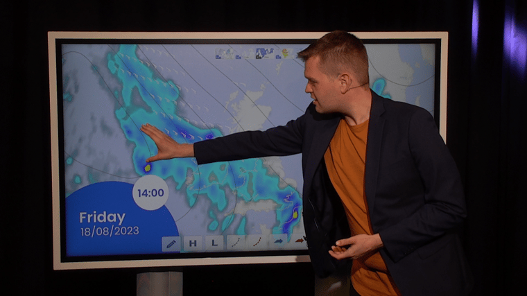
Video briefing at the end of this article
Wind and waves
The low-pressure area over the central North Sea on Tuesday is rather weak, with winds around 20 kts at maximum. On Wednesday, Thursday, and for the majority of Friday, conditions will be calm. Fresh northeasterlies are expected over the southern North Sea on Thursday, on the southern side of the high-pressure area.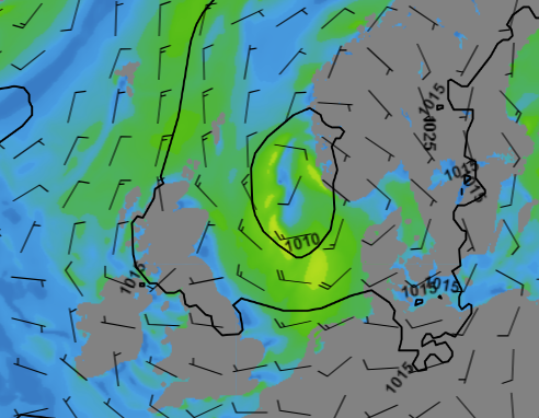 Figure 1: Isobars and wind barbs on Tuesday 15-08 12 UTC (GFS model)
Both wind and waves will increase later on Friday and especially on Saturday as the frontal trough moves north via the North Sea. Ahead of the trough, winds might increase to 30-35 kts from a southeasterly direction over the central and northern North Sea. Meanwhile, the significant wave height will increase to 3.0-4.0 meters over the central North Sea and 4.0-5.0 meters over the northern North Sea. Wind and waves will calm down again on Sunday.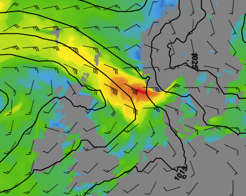 Figure 2: Isobars and wind barbs on Saturday 19-08 12 UTC (GFS model)
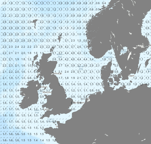 Figure 3: Wave direction and Significant wave height on Saturday 19-08 12 UTC
Conclusion
The majority of this week will bring calm weather with winds below 20 kts and waves below 2.0 meters. However, on Saturday, a frontal trough might bring gale-force southeasterlies and waves up to 5.0 meters in the northern part of the North Sea. For the most up-to-date information, please refer to our daily updated forecast reports to stay informed about the latest developments.
Learn more about the weather
We just launched our new resources page. Here you will find special content like videos, webinars and whitepapers that will guide you to a decision point. Use these expert insights to improve your business or simply to get your knowledge about marine weather up-to-date.