In the upcoming days, a low-pressure system will move over the central North Sea, leading to unsettled conditions. However, we do not anticipate strong winds or gales; instead, the wind speed is expected to remain mostly moderate to fresh. On Thursday and Friday, another low-pressure system is forecasted for the southern North Sea, bringing a short period of increased wind speeds. Over the weekend, a ridge of high pressure will build over the area, resulting in relatively calm conditions.
Synoptic overview
A low-pressure system, located just northeast of Scotland (1002 hPa), will slowly move east-southeast over the central North Sea on Wednesday, lingering over southern Scandinavia on Thursday and Friday. This low, along with associated shallow troughs, will bring unsettled conditions, including occasional showers and thunderstorms. The pressure gradient over the North Sea will remain relatively weak, resulting in mostly moderate to fresh winds.Another low-pressure system is expected over the southern North Sea on Thursday and Friday. Associated troughs will cross the southern part of the North Sea and the English Channel, bringing showers and thunderstorms to these regions. Wind speeds may briefly increase to strong levels during this time.
Over the weekend, a ridge of high pressure is set to build over the UK and the North Sea, resulting in calm and dry conditions. The risk of fog will be limited, and the ridge will establish a relatively cool and dry northerly flow over the area.
Wind and waves
Initially, conditions are relatively calm. Today and Wednesday, wind speeds will remain moderate to fresh over most parts of the North Sea as the low-pressure system tracks over the central North Sea. During this time, the significant wave height will hover around 1 meter.On Thursday and Friday, the low-pressure system over the southern North Sea will bring strong winds for a short duration. Wind speeds in these regions are expected to increase to around 25 knots, while the rest of the North Sea will experience wind speeds around 15 knots. The significant wave height in the southern North Sea and German Bight will briefly reach up to 2 meters.
Over the weekend, the ridge of high pressure will lead to calm conditions. Wind speeds will decrease to mostly moderate, ranging between 10-15 knots. Only near the coast of southern Norway, fresh winds with speeds up to 20 knots are expected. In this region, the significant wave height will linger around 1.5 meters, while the rest of the North Sea will experience waves around 1 meter.
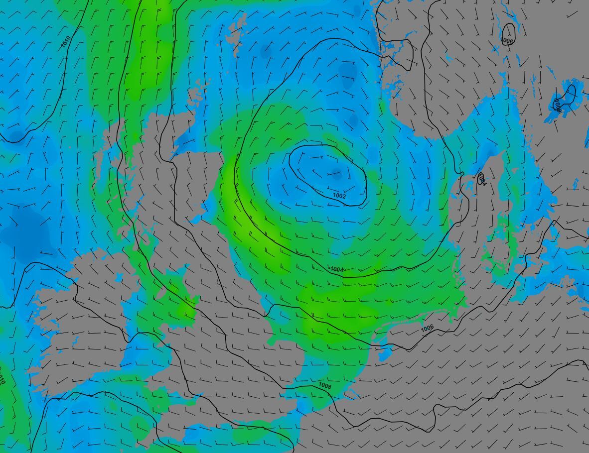 Figure 1: Wind speed and direction, and pressure (hPa) valid Wednesday, August 30th, 12 UTC. Shallow low is present over the North Sea. Wind speed remains mostly moderate to fresh.
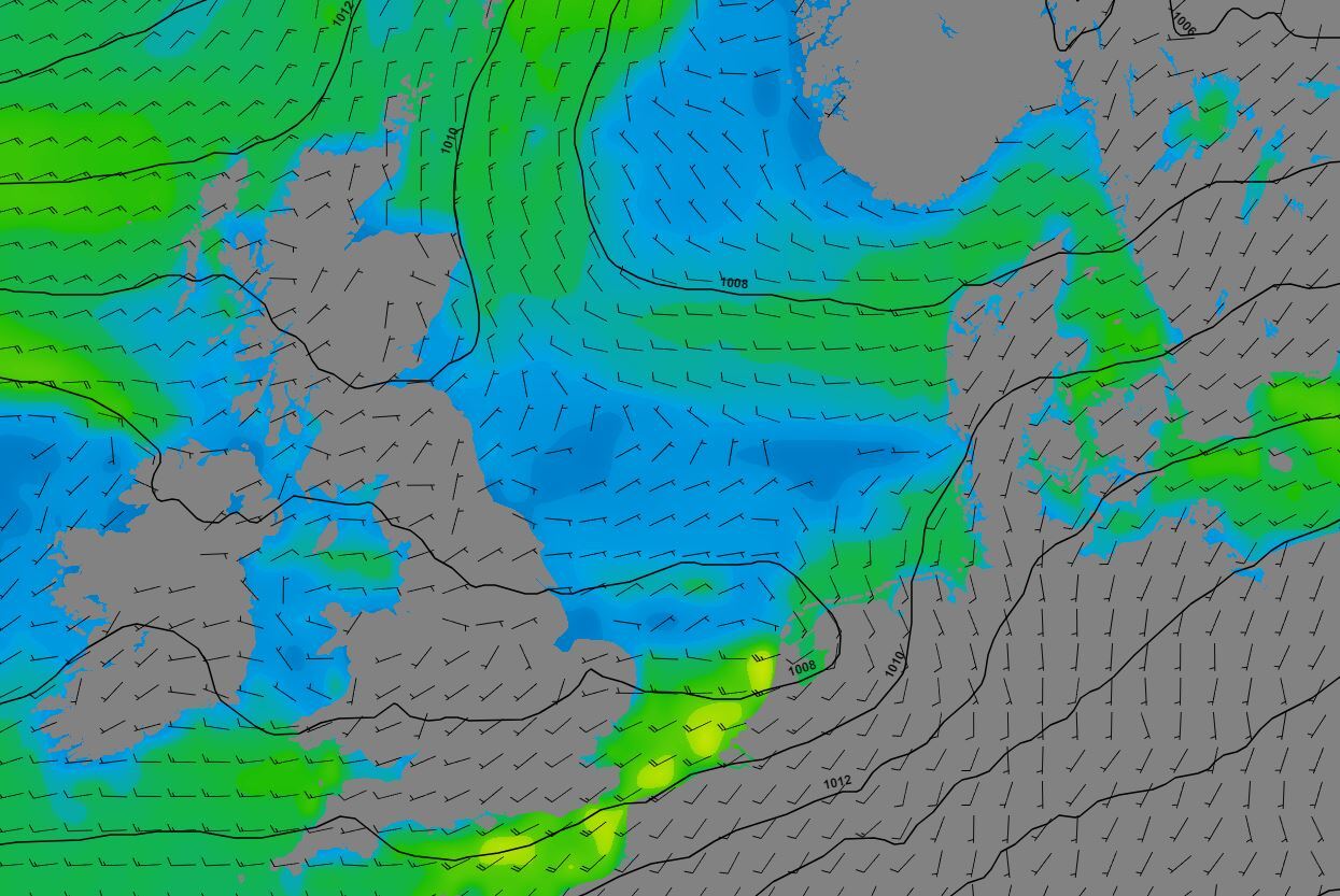 Figure 2: Wind speed and direction, and pressure (hPa) valid Friday September 1st, 00 UTC. Low over the southern North Sea. Strong wind in the southern parts.
Conclusion
This week's generally calm weather offers numerous working opportunities across much of the North Sea. Adverse conditions, such as occasional thunderstorms or temporarily increased wind speeds and waves near low-pressure areas, may pose temporary operational challenges. However, in most cases, wind speed and wave height are unlikely to significantly impede activities throughout this week.Learn more about the weather
We just launched our new resources page. Here you will find special content like videos, webinars and whitepapers that will guide you to a decision point. Use these expert insights to improve your business or simply to get your knowledge about marine weather up-to-date.