A low-pressure area over Scotland slowly moves NE across the East Shetland Basin on Wednesday. A mobile ridge, associated with a high-pressure area over central Europe, shifts ENE across the North Sea on Friday. The next deep Atlantic low-pressure area is expected to move NE across Scotland and the northern North Sea during this weekend. Although relatively unsettled weather this upcoming week, no extreme winds and waves are expected (at this stage), so workable weather windows will be present from time to time.
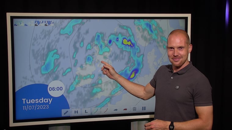
Video briefing at the end of the article
Synoptic overview week 28
A low-pressure area (998hPa) over Scotland moves NE across the East Shetland Basin on Wednesday and along the Norwegian coastline thereafter, and associated troughs will affect the North Sea from time to time over the coming days. A high-pressure area (1020hPa) shifts ENE across central Europe later this week, and an associated mobile ridge shifts E across the North Sea on Friday. The next deep Atlantic low-pressure area (980hPa) is expected to move NE across Scotland and the northern North Sea during the following weekend.
Wind and waves in the North Sea this week
A W/SW’ly flow will dominate the weather over the North Sea this week. The highest winds are expected ahead of the lows on Tuesday and Wednesday, as well as during next weekend. However, winds are not expected to exceed fresh or strong (20-25kts) most of the time, while the significant waves are expected to increase from 1-1.5m today to a maximum of 2-2.5m over the northern North Sea in the night to Thursday. The passage of the ridge of high-pressure on Friday will calm down the weather again, and the waves are expected to decrease to around 1m for most areas.
During the weekend, the reliability of the weather forecast decreases due to uncertainty in the exact track and development of the approaching low-pressure area and its associated troughs. The SW’ly winds will most likely pick up to strong or possibly near gale force (25-30kts) during the weekend. As a result of these enhanced SW’ly winds, the waves are expected to increase to 2.5-3.5m over the course of the weekend.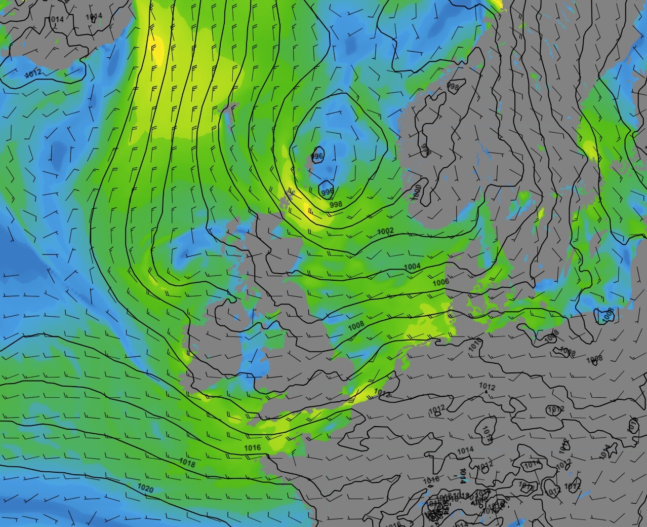 Figure 1: Isobars (black lines 5hPa) and wind speed/direction (kts) valid Wednesday July 12
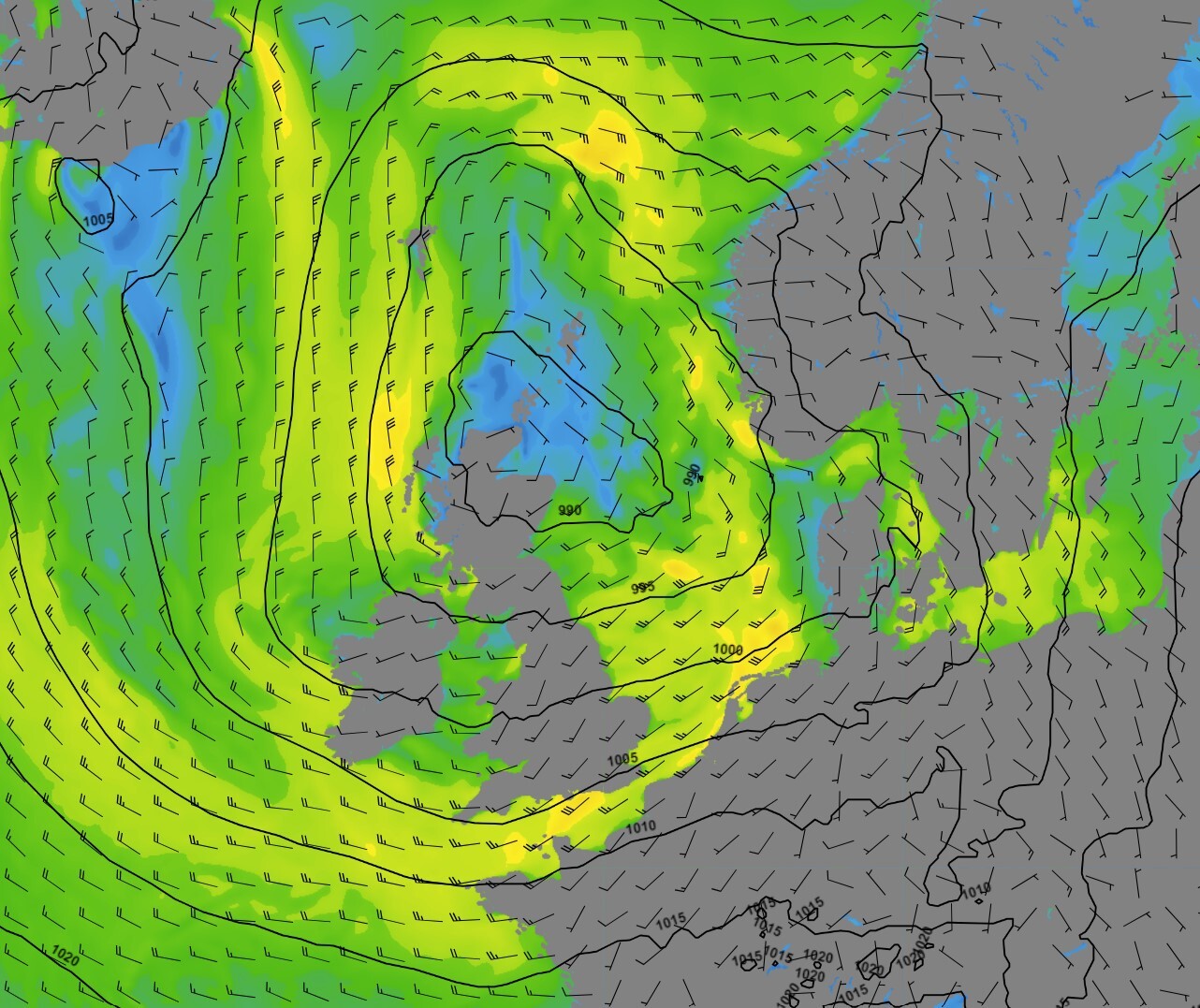
Figure 2: Isobars (black lines 5hPa) and wind speed/direction (kts) valid Sunday July 16
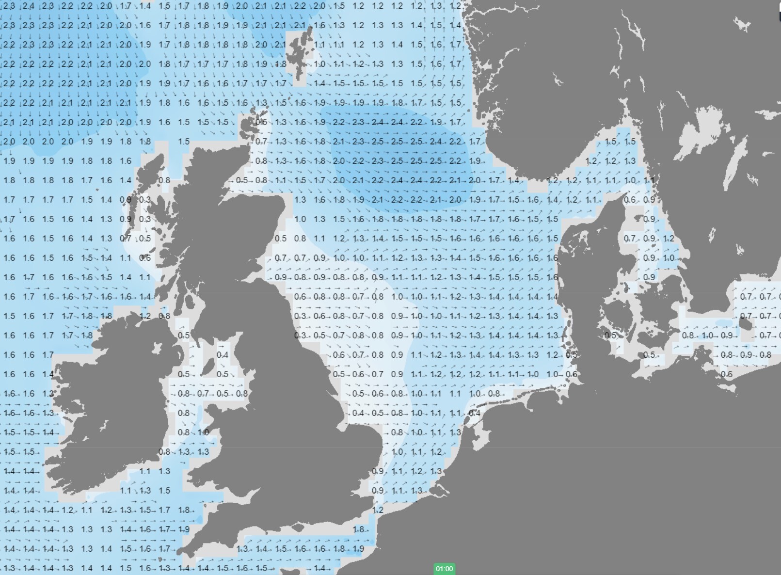 Figure 3: Significant wave height/direction (m) valid Thursday July 13
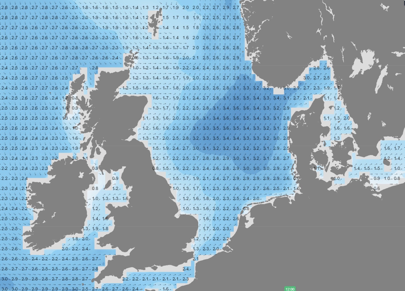 Figure 4: Significant wave height/direction (m) valid Sunday July 16
Conclusion
Despite the relatively unsettled weather condtions, no real severe weather is expected this upcoming week. Workable weather windows will be frequently present for most areas over the coming days, while during the weekend increasing winds and waves are expected to gradually reduce the chance of good operational conditions.
However, Infoplaza will continue to monitor the latest weather developments, so please make sure to check, and follow-up our daily updated forecast reports to check the latest developments. The risk of low clouds and/or fog will remain low for the greatest part of the North Sea this week. Only the northern parts of the North Sea might occasionally be affected by some poor conditions due to the relatively low water temperatures in combination with relative warm air.
Weekly weather briefing
Every week we will post an updated weather briefing on the Infoplaza website and the Infoplaza Marine Weather Operations LinkedIn page. We will also share weather related articles and topics on offshore weather on these pages. We hope all our clients stay safe at sea this week. Please feel free to contact us at any time if you have any questions or remarks.