Our goal is to provide the best weather forecast possible to reduce downtime during your marine operations and to make sure that the crew is safe out on the open sea. But how do we create such a weather and wave forecast? This blog explains the process of making a weather forecast from the moment that the weather data arrives in our system until you are able to see our end product: an accurate weather and wave forecast.
Numerical weather prediction models and their skill nowadays
Before we dive into more detail about how a weather forecast is created, it is important to have a basic knowledge of numerical weather models and their skill. In a nutshell, there are two different kinds of numerical weather and wave models, namely global and local models. Global weather models consist out of a large domain and a relatively low resolution, whereas local models simulate over a small domain with a relatively high resolution. Both global and local models are important when preparing the weather forecast. The different models will be discussed further in the following sections.
Besides the domain and the resolution, the skill of a certain model is important as well. The skill tells us more about how good a weather model is in simulating the right weather and wave conditions. All models have different strong and weak points. For instance, a specific model has a high skill in predicting wind speeds and a low skill in predicting the temperature. Those strong and less strong points of certain models vary between different numerical weather models. Nonetheless, the skill of numerical weather prediction models in general increased significantly during the recent years. A few decades ago, it was impossible to provide customers with an accurate forecast for the coming days. Even the skill of a forecast for just the coming hours was relatively low.
Nowadays, weather models are much better in predicting upcoming weather events compared to a few decades ago. As a result, the weather forecast is much more reliable. However, all the numerical weather predictions out there are still describing nature in a mathematical way. It is impossible to ‘capture’ all the processes in the atmosphere and sea correctly without making assumptions. Therefore, a forecaster, who can judge whether a model is producing reliable output, is from great value. During the rest of this blog, the workflow of a marine forecaster is explained in which he/she tends to produce the most accurate forecast as possible.
Global weather models
Examples of global weather models are for instance ECMWF and GFS and WW-3 specifically regarding wave calculations. Forecasters often start with looking at the big picture. What are the general winds doing? Is a certain location situated in warm or cold air? Is there any chance that large scale bad weather may affect the location? Those questions are just a few examples of what a marine forecaster evaluates when examining data from global weather models. These models are able to provide a general overview of the weather and sea conditions around a certain location. The forecaster is able to judge, based on his knowledge about models, whether the data produced by the model is reliable. If the data is not reliable, the forecaster tries to use other models to investigate whether their accuracy is better. Furthermore, a forecaster can create a forecast based on knowledge about shortcomings of numerical weather models and experience at a certain location.
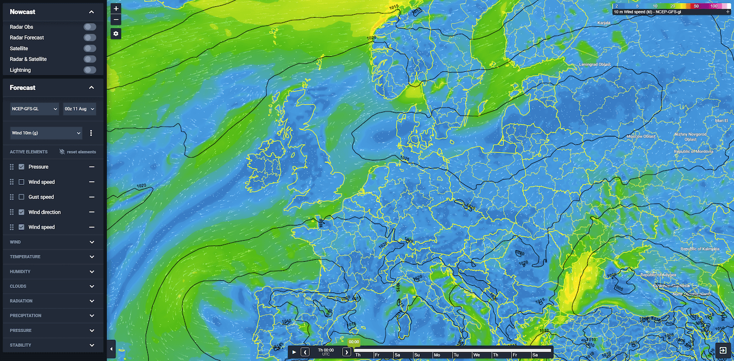 Picture 1: GFS surface wind an pressure values depicted in our online portal.
Local weather models
Local, or high resolution, weather models are used when a forecaster prepares a detailed forecast for a specific location. Due to the high resolution, small-scale processes around the location are well captured by these models, while those local effects are mostly overlooked by global models due to their relatively low resolution. There are a lot of high-resolution numerical weather prediction models. A few examples of high-resolution weather and wave models are Harmonie, ICON-D2, Arome, WRF, nested WW-3 grids and SWAN. Due to the high resolution implemented in the models, their spatial resolution is relatively low. Therefore, those models are only used for relatively small domains that serves the client location in the best way possible.
Observations to validate model output and sensitivity of operations
To validate whether produced model output is sufficient, the forecaster checks the current observations near the forecast location and upstream. Therefore, the forecaster is able to judge which models perform the best and will be used when making the forecast. Besides that, the meteorologist takes the sensitivity of the operations in consideration as well. Those limits will get a special attention in the communication of the weather forecast.
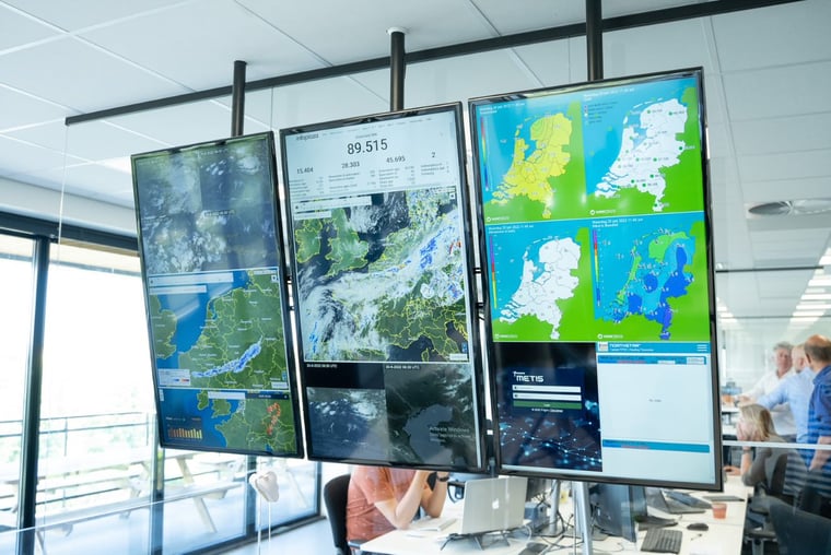 Picture 2: The Infoplaza weather room. The place where your marine forecast has been made and where the weather is closely monitored and discussed around the world.
The actual forecast
A forecaster combines all the data gathered from the global weather models and the local weather models. He or she makes an accurate and understandable weather and wave forecast out of an enormous amount of (valuable) data and deep knowledge about weather and wave systems. Our aim is to share all relevant weather and wave information with our clients to make sure that the risk of downtime will be as small as possible. The provided forecast supports safe operations and optimal financial results for our clients.
Always up-to-date
Our monthly newsletter is made to give maximum insight. Think about marine weather phenomena, updates about our ever-evolving forecasting products and the latest and most relevant marine weather briefing. Subscribe to receive our Infoplaza marine newsletter once a month.