In part 2 of this Caspian Sea series, we give insight in Infoplaza’s way of working. How are the weather conditions and ice development monitored during winter in the Caspian Sea?
In short, there are three main ways: through field teams, autonomous metocean monitoring stations and using high resolution satellite imagery of the whole region.
Field teams
Field teams will be stationed on an icebreaker ship and will assess the thickness of the ice by measuring the broken edges of the ice as the ship moves through the ice sheet. Additionally, the team will access the ice from the ship on foot and collect data by drilling holes and taking ice cores. These ice cores are necessary to measure the temperature and salinity of the ice. Temperature is measured directly using a thermometer probe, and salinity is measured by melting the ice and then using a calibrated probe to check its salinity. These measurements are crucial because they directly relate to the strength of the ice sheet: colder and less saline ice is stronger and is harder for vessels to operate in.
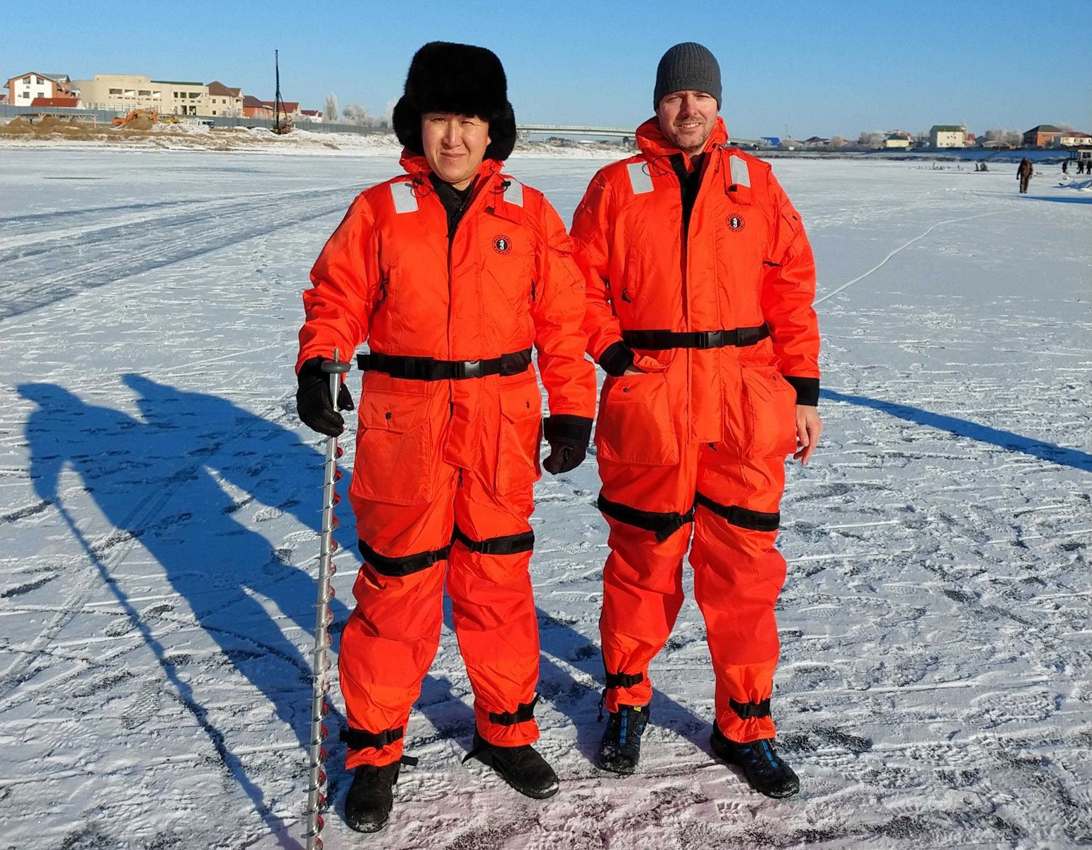
The field teams also keep track of major ice features in the ship's operational area. They update ice charts on a daily basis to provide an accurate representation of the current ice conditions in the entire area.
Metocean monitoring
Over the years we have maintained many metocean monitoring stations for clients which report key parameters such as winds, air temperature, air pressure, RH, water temperature, water levels etc. Data from these are incorporated into the ice reporting systems in real time and are essential to allowing the best information to be available for client operations. These data are especially important for estimating Freeze Up of the NE Caspian waters, the key point after which only ice strengthened vessels can access the NE Caspian area. They also help with estimation of Break Up, where non ice strengthened vessels can again operate freely in the NE Caspian.
Also read part 1 in this series: Inside the unique maritime and meteorological conditions of the Caspian Sea
Satellite imagery
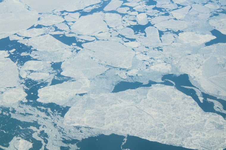
We also have a team based on the shore who are responsible for creating ice charts using satellite imagery. These charts show the extent of the ice and its features across the entire ice-covered area. The team gathers information from various sources, including daily reports from field teams and vessels. They also utilize automated vessel traffic monitoring systems (AIS) to track the speed of vessels, which can indicate if they are encountering difficulties navigating through the ice.
The team analyses both visual and radar imagery to update the charts on a daily basis. This allows them to track the formation of ice, its movement due to wind, and create a comprehensive record of the ice conditions throughout the season. The ice-covered areas are divided into regions based on similar ice types and ages, providing a detailed understanding of different ice conditions.
 Sentinel-1 satellite. Image: ESA
Since ice thickness is crucial for operations in the area, the team keeps a running record of daily mean temperatures, known as Freezing Degree Days (FDDs). This information helps calculate the theoretical thickness of the ice across different areas of the ice sheet.
The satellite-derived ice charts are sent to vessels every day via email, providing them with the most up-to-date information for their operations. Vessels can use these charts to avoid heavily rubble-filled and ridged areas, identify open water leads that can facilitate passage, and minimize their time spent navigating through the ice.
Vessel reports for seal sightings
There is a fourth way of monitoring that’s important, but it’s not necessarily related to maritime weather and ice development. It is, however, affecting offshore operations. We are talking about vessel reports of an endangered species in this area: the Caspian seal. Through vessel reports we have access to information about Caspian seal sightings.
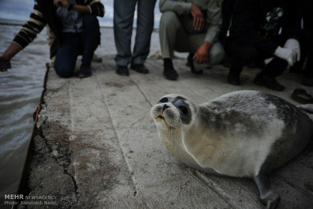 Image: Mehr News Agency, CC BY 4.0, via Wikimedia Commons
The Caspian Seal is officially an endangered species since 2008. It has faced (and still faces) significant threats, like being hunted in the Russian regions of the Caspian Sea. Although hunting has been prohibited in Kazakh national waters since the Soviet Union's dissolution, it has continued in Russia. To minimize the impact on the seal population and avoid further endangering them, vessel operations incorporate procedures aimed at preventing disturbances.
During the months of January and February, seal pups are born and often gather in sizable groups on the ice. These young seals are unable to swim for several weeks after birth, so it is crucial that vessels do not disturb or force them into the water. To assist with this, the ice charting team records daily sightings of adult and juvenile seals. These sightings are included in the charts and can cover the past few days or even weeks. Vessels can then consult these charts to steer clear of areas where seal groups have been spotted.
This proactive approach helps vessels navigate while avoiding close proximity to these seal groups, reducing potential disruptions to their natural behavior and ensuring their well-being.
Ice charting in the Caspian Sea
The Caspian Sea is truly an exciting place thanks to its diverse conditions. Like to know how we handle ice charting here? Learn more about our work via the button below.


