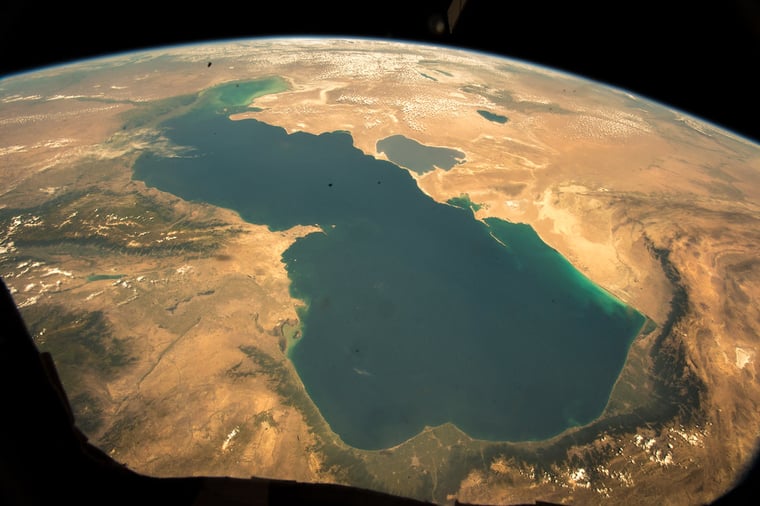
The Caspian Sea, situated between Europe and Asia, is the largest lake on Earth. It is surrounded by five countries: Kazakhstan, Russia, Turkmenistan, Iran and Azerbaijan. In surface, it’s even larger than the UK. Therefore this enormous enclosed body of water holds great economic importance for the region as a transport route – not to mention the substantial oil and gas reserves. Next to that, the region is known for its diverse meteorological conditions and is even home to an endangered species, the Caspian seal. It is also an area that becomes ice infested over the winter months in the Northern part. This causes significant challenges to marine operations in the area. So for weather companies it’s of utmost importance to inform clients here thoroughly to maximize workability.
In this article series, we’ll take a deep dive into the characteristics of the Caspian Sea. We will shed light on the meteorological conditions and the types of ice of this large area, explain how we, as a marine forecasting provider operate in this truly unique region, and the economic and logistical importance of such work for operating companies. Also we will discuss how the changing climate affects the region, and you’ll get to know the Infoplaza team based in Atyrau, Kazakhstan.
 Image: Copernicus Sentinel-2 image
Meteorological conditions in the Caspian Sea
We start off this series by looking at the most common meteorological and maritime conditions in this enormous region.Seasonal variations
The weather in the northeastern Caspian region, including Atyrau, doesn't change dramatically from day to day during the winter and summer seasons. It has an arid or semi-arid climate, which means it experiences hot summers and cold winters with very little precipitation.
In winter, there can be quite a large variation in the area. A ‘warm’ season will result in large areas of open water while ‘harsh’ seasons can result in the whole northeastern Caspian Sea being frozen over, with ice extending down the central Caspian shoreline from as far as Makhachkala (Russia) on the west coast - to Kuryk (Kazakhstan) on the east coast.
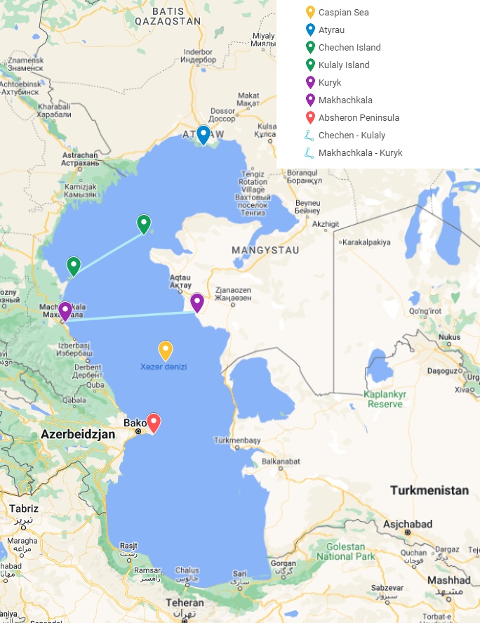 Map with points of interest concerning the formation of fast ice - made with Google Maps
The severity of winters in the NE Caspian varies significantly from year to year. The ice period usually lasts from November to March where complete freezing and formation of fast ice will usually reach the line from Chechen Island to Kulaly Island. In very sever winters, with northern winds, floating ice is known to reach areas just north of the Absheron Peninsula (Azerbaijan).
Also read: How we monitor ice development in the Caspian Sea
During the summer, the temperatures in this area usually reach around 35 degrees Celsius (but it can exceed 40 degrees Celsius). During the winter the average temperature drops to around -10°C, and in extreme cases the temperature can reach -35°C.
Different types of ice
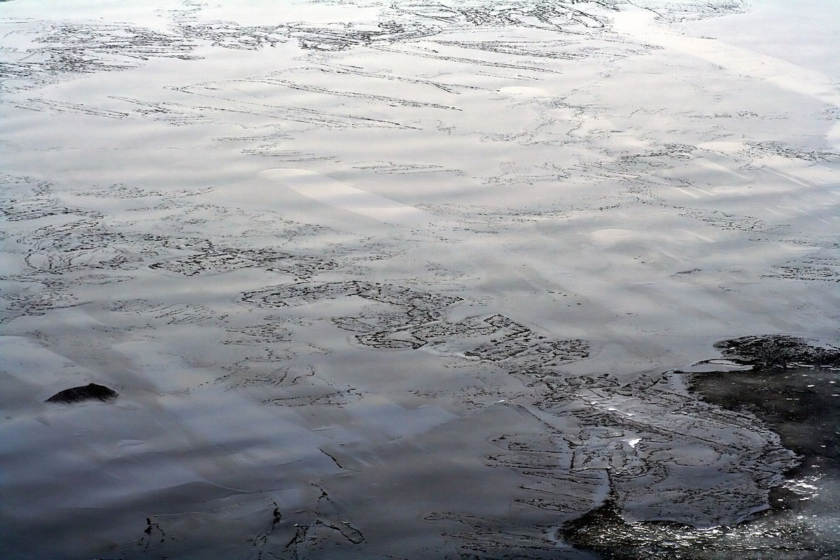 Grease ice (source: Wikimedia Commons)
The ice regime in the Caspian Sea is very dynamic. Because the ice season is relatively short, the flat ice on the surface grows to a thickness ranging from 30 to 60+ centimeters. However, the wind puts pressure on the ice, causing it to break, deform and become mobile. As a result, the ice layers can pile up on top of each other, forming stacks that are over 1 meter thick. This movement of the ice can also create grounded rubble features called stamukhi, which can grow to be taller than 10 meters.
Moving ice sheets
Because of the moving ice sheets, many different features form during the winter. Open water channels called "leads" open up and close, multiple ridges of ice appear, and there are often large areas with broken and uneven ice.The ice near the shore is more stable, with a layer of ice that remains throughout the season, called “landfast ice”. The more mobile ice is found a few kilometers away from the coastline. Stamukhi are areas with deformed ice where the ice is “grounded”, so stuck on the seabed. When the ice sheet moves past them, it creates a gap of open water on the side where the ice has moved away. This is called a "wake."
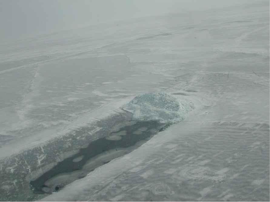 A stamukha in the Caspian Sea
The ice sheet, as it moves, has the potential to displace ice features that are grounded on the seabed. This displacement can cause the soil on the seabed to be significantly scoured or eroded. This poses a problem for pipelines that need to be buried deep enough to avoid being affected by this soil deformation. Consequently, it is not feasible to lay cables across the seabed as they would be at risk of being broken during these scouring events.
The Caspian Sea is truly an exciting place thanks to its diverse conditions. Like to know how we handle ice charting here? Learn more about our work via the button below.