Troughs and an active low will dominate the weather in the North Sea area this week. In between these systems the weather conditions will improve for short periods of time, with moderate to fresh winds and waves in the region of 1.5 to 2 meters. This may result in relatively good workability options at times.
Synoptic overview
A deep and complex Atlantic low moves slowly NE towards Iceland by Thursday. An associated frontal trough crosses the North Sea today, followed by a further trough in the night to Thursday, both moving eastwards. A small but active low is expected over England on Friday, tracking E over the southern North Sea to the Netherlands and Germany late Friday and Saturday. At the same time high pressure is expected to build over the Norwegian Sea. An associated ridge extends over the northern and central North Sea over the weekend.
You will find the video briefing at the end of this article.
Wind and waves
Near the trough that crosses the North Sea today, unsettled conditions are expected to prevail over the area.
On Wednesday the area of interest is in between the trough moving away over Scandinavia, and the next trough approaching from the west over the UK. The conditions will improve temporarily, resulting in workability opportunities offshore. The wind decreases to mostly moderate, and the waves will not exceed 1,5 -2,0 meters in most locations over the North Sea. Especially near the coast of eastern England and near the Netherlands, Hs will barely reach 1 meter, potentially resulting in good workability for most operations.
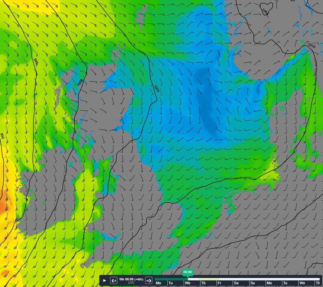 Figure 1: Isobars (black lines) and wind speed and direction Wednesday March 29th 06 UTC. Calm conditions in between the troughs.
Near the trough that crosses the North Sea during Thursday night, gale force winds and waves height over 4 meters are possible.
Early Friday, in between the frontal trough and the next low, conditions will improve temporarily again, resulting in workability opportunities offshore.
During the course of Friday and Saturday, near the active low over the southern North Sea, conditions may be rough to very rough, with gale force winds and waves over 4 meters. The development and track of this low is unsure at this moment, so confidence of the forecast for Friday and Saturday is low. Please consult the latest forecasts in the course of the week, as development will become clearer with improving confidence.
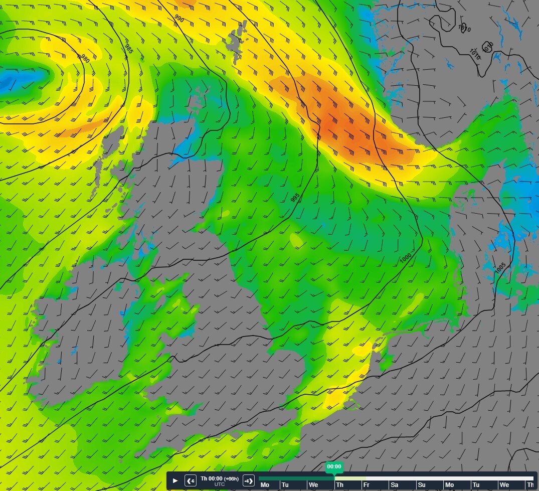 Figure 2: Isobars (black lines) and wind direction and wind speed Thursday March 30th 00 UTC.
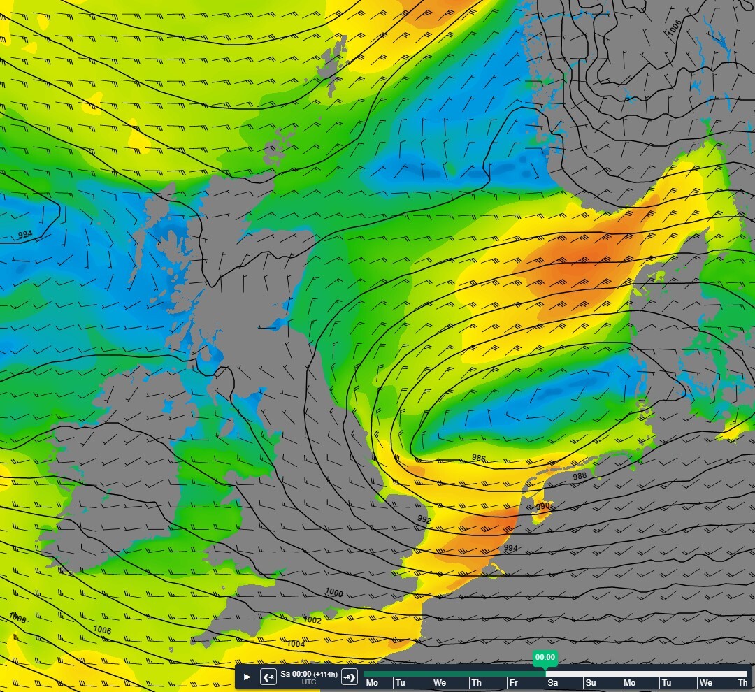 Figure 3: Isobars (black lines) and wind direction and speed Saturday April 1st 00UTC
After the passage of the low, conditions will improve again from the north as a ridge of high- pressure builds over the North Sea over the weekend.
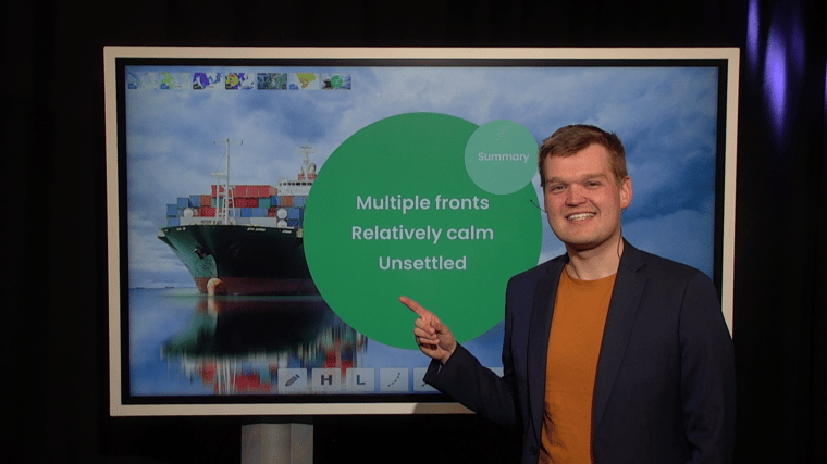
Conclusion
Various frontal troughs will sweep across the North Sea this week. Furthermore, an active low is expected to cross the southern North Sea late Friday and Saturday. In between the troughs and the low the weather remains unsettled but both wind and waves are expected to be relatively calm at times. As a result, some weather windows are anticipated, that will provide workability opportunities, although they are expected to be quite short. Weekly weather briefing
Every week we will post an updated weather briefing on the Infoplaza website and the Infoplaza Marine Weather Operations LinkedIn page. We will also share weather related articles and topics on offshore weather on these pages. We hope all our clients stay safe at sea this week. Please feel free to contact us at any time if you have any questions or remarks.


.png?width=360&name=image%20(12).png)