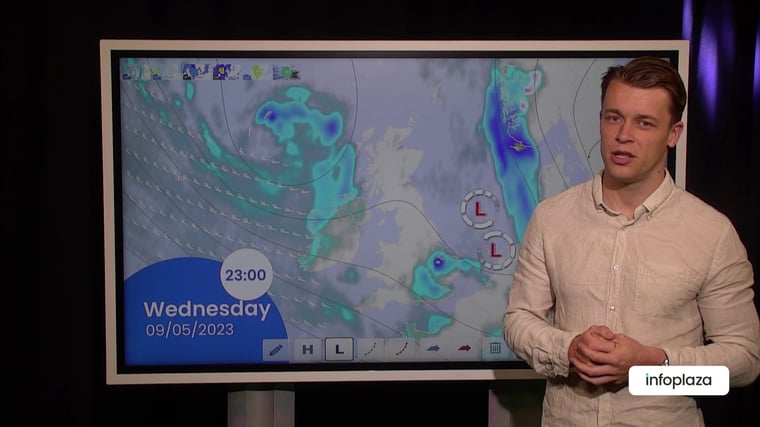
An Atlantic low moves ESE while slowly filling, expected over England on Thursday. This results in strong winds and wave heights over 3 meters near the coast of Norway at first. An associated broad trough stretches over the North Sea on Wednesday and Thursday. The wind will decrease over those days, also resulting in lower waves. A weak ridge of high pressure shifts SE over the North Sea on Friday and Saturday, with continuing calm conditions. Towards the weekend pressure drops near Iceland, resulting in higher wind and waves. The best chances of workable weather windows are expected from Wednesday to Friday and possibly Saturday.
Synoptic overview
An Atlantic low WNW of Ireland moves slowly ESE to England by Thursday. An associated broad trough stretches over the North Sea on Wednesday and Thursday. A weak ridge of high pressure builds over the northern North Sea in the course of Thursday, shifting SE to the southern North Sea by Saturday. At the same day a new low is expected near Iceland, with frontal troughs moving SE over the North Sea over the course of the weekend.
Wind and waves:
At the moment the Atlantic low results in strong winds and wave heights over 3 meters near the coast of Norway. The southerly flow, conveying mild and moist air, is also generating foggy conditions in many areas.
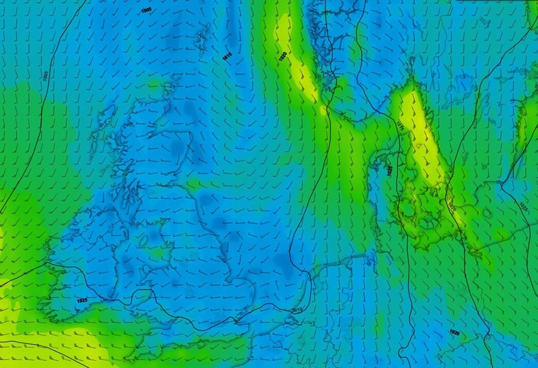 Figure 1: Isobars (black lines) and wind speed/direction valid Tuesday May 9th 12 UTC. Strong wind in the NE part of the North Sea.
From Wednesday and following days the broad trough and the ridge of high-pressure result in low pressure gradient over the North Sea. The wind will decrease over those days to a mostly moderate or even gentle breeze. This results in lower waves, with significant wave height expected tol decrease to below 1 meter, with good chances of workable weather windows. Also, the risk of fog will decrease.
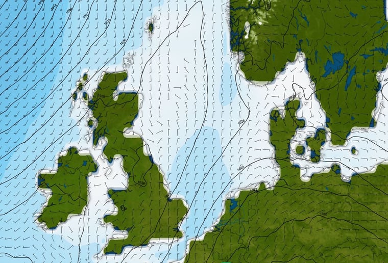 Figure 2: Significant wave height, Isobars (black lines) and wind, valid Saturday May 13th 00 UTC. Ridge of high pressure results in calm conditions over the area.
Towards the weekend the pressure gradient in the north tightens as the pressure drops near Iceland. The wind will increase to a mostly strong breeze, accompanied by rough seas with waves up to 3 meters. Further south the weather remains under influence of the ridge until Sunday. In the southern North Sea, the winds remain mostly gentle or moderate with slight seas and significant wave height around or below 1 meter. In this area there will be good chances of workable weather windows remaining until the end of the of the week.
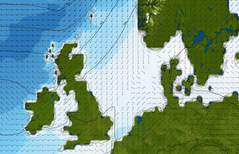 Figure 3: Significant wave height, Isobars (black lines) and wind, valid Sunday May 14th 00 UTC. Strong wind and rough seas approaching from the NW, still calm conditions further south.
Conclusion
At the moment an Atlantic low results in strong winds and wave height over 3 meters near the coast of Norway. Over the coming days a broad trough and a ridge of high pressure will bring relatively calm conditions over the North Sea with decreasing wind and lower waves. This results in good chances of workable weather windows. Towards the weekend pressure drops near Iceland, with deteriorating conditions from the north. In the southern North Sea, the chances of workable weather windows remain good until the end of the week.
Weekly weather briefing
Every week we will post an updated weather briefing on the Infoplaza website and the Infoplaza Marine Weather Operations LinkedIn page. We will also share weather related articles and topics on offshore weather on these pages. We hope all our clients stay safe at sea this week. Please feel free to contact us at any time if you have any questions or remarks.