Southwesterlies will dominate over the North Sea initially, on Tuesday during the passage of a frontal trough, and on Wednesday during the passage of a high-pressure ridge when winds and waves will decrease. Forecast uncertainty is anticipated for Thursday and Friday when developing low-pressure areas are expected to affect the North Sea. Southwesterlies are expected to return during the weekend when a new passing high-pressure ridge will lead to calmer winds and waves.
Synoptic overview
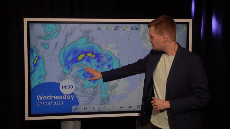
A frontal trough is tracking eastward via the North Sea today, with the associated low-pressure area positioned near Iceland. Following the trough, a weak ridge of high pressure will pass over the North Sea early on Wednesday.
The synoptic situation becomes more dynamic around midnight on Thursday as an active low-pressure area is expected over Scotland. This low will curve northward into the Norwegian Sea, followed rapidly by a secondary low-pressure area crossing the central North Sea on Friday. However, this scenario is based on calculations from the American model. According to the European ECMWF model, this secondary low will be nothing more than a trough, and its track is further to the south. Other atmospheric models have different outputs. This highlights the low confidence in our weather forecast for Thursday and Friday.
The models agree on a new high-pressure area building over the Low Countries early on Saturday, extending a ridge over the North Sea. This ridge will shift slowly eastward during the weekend.
Wind and waves
Southerly winds might reach gale force for a while in Viking, just before the passage of the frontal trough on Tuesday evening. Wave height is expected to be around 3.0 meter in the East of Shetlands Basin. Winds and waves will weaken on Wednesday as the ridge of high pressure shifts east via the North Sea.
As mentioned above, confidence of the forecast becomes low on Thursday and Friday during the passage of developing low pressure areas.
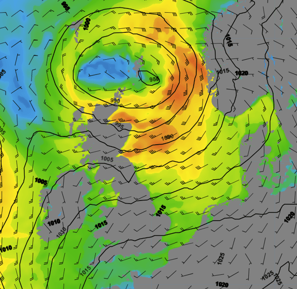
Figure 1: Isobars and wind speed and wind direction on Thursday 28 September, according to GFS.
The American GFS models shows strong gales on the south and east side of the low pressure area. Significant wave height will increase to about 5.0 meters in the central and later also northern part of the North Sea.
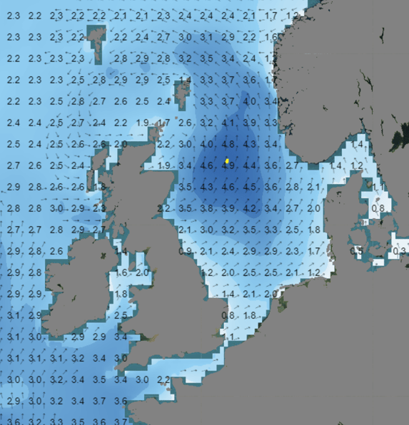
Figure 2: Wave height and direction on Thursday 28 September, according to the wave model, based on GFS.
A second low-pressure area on Friday might lead to comparable winds and waves, further highlighting the uncertainties as models once again differ in their output.
It's during the weekend that opportunities for workability are expected to increase. Wind and waves will calm down, and confidence in the forecast will grow.
Conclusion
The weather forecast for this week begins with the passage of a frontal trough on Tuesday. Winds and waves will weaken on Wednesday during the passage of a high-pressure ridge. However, the forecast becomes uncertain on Thursday and Friday due to uncertainty surrounding the passage of low-pressure areas. The situation will calm down again during the coming weekend as a new high-pressure ridge passes over the North Sea.
Learn more about the weather
We just launched our new resources page. Here you will find special content like videos, webinars and whitepapers that will guide you to a decision point. Use these expert insights to improve your business or simply to get your knowledge about marine weather up-to-date.