Despite the relatively unsettled large-scale synoptical set-up with steering low pressure over the Norwegian Sea and Scandinavia, large parts of the North Sea will have good workable weather conditions this upcoming week. Only the northern and eastern parts of the North Sea will face some enhanced NW’ly winds and waves the first days, which may limit the number of workable weather windows in these areas.
Synoptic overview
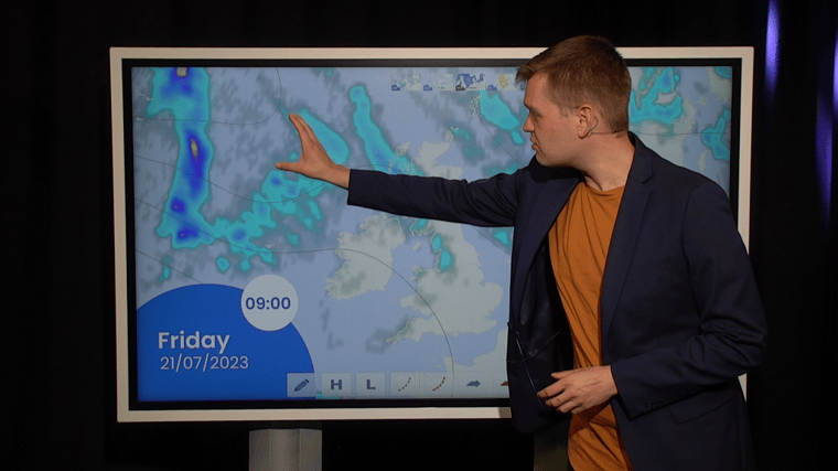
A low-pressure area (995hPa) over the southern Norwegian Sea slowly drifts SE towards Norway while gradually filling the coming days. A secondary low-pressure area (1015hPa) over Ireland slowly moves E across England tonight and across the North Sea on Wednesday while gradually filling as well. A weak mobile ridge of high pressure extends over the North Sea on Friday. Next Atlantic low-pressure area (1000hPa) is expected to approach Ireland from the WNW on Saturday, most likely curving counterclockwise across the UK and into the North Sea thereafter.You can find the video briefing on our LinkedIn page
Wind and waves
The steering low-pressure activity over the Norwegian Sea and Scandinavia will result in a dominating W/NW’ly flow over the North Sea this week. The highest winds, mostly fresh to strong (20-25kts) are expected in the northern and eastern parts of the North Sea on Tuesday and Wednesday. These winds will push the significant wave height to 2.5-3m in these areas as a result. Winds and waves will gradually calm down thereafter, as the mobile ridge of high pressure shifts across the North Sea later this week and into the weekend.The southern and western parts of the North Sea will predominantly see calm weather conditions with winds that are not expected to exceed moderate or fresh (around 15kts) throughout this outlook period. The sheltered areas in the south and west are expected to see the highest significant wave height between 1-1.5m on Thursday. The reliability of the weather forecast decreases on Sunday due to uncertainty in the exact track and development of the approaching low-pressure area. At this stage, the large-scale models do not agree with a track either across the northern or the southern North Sea.
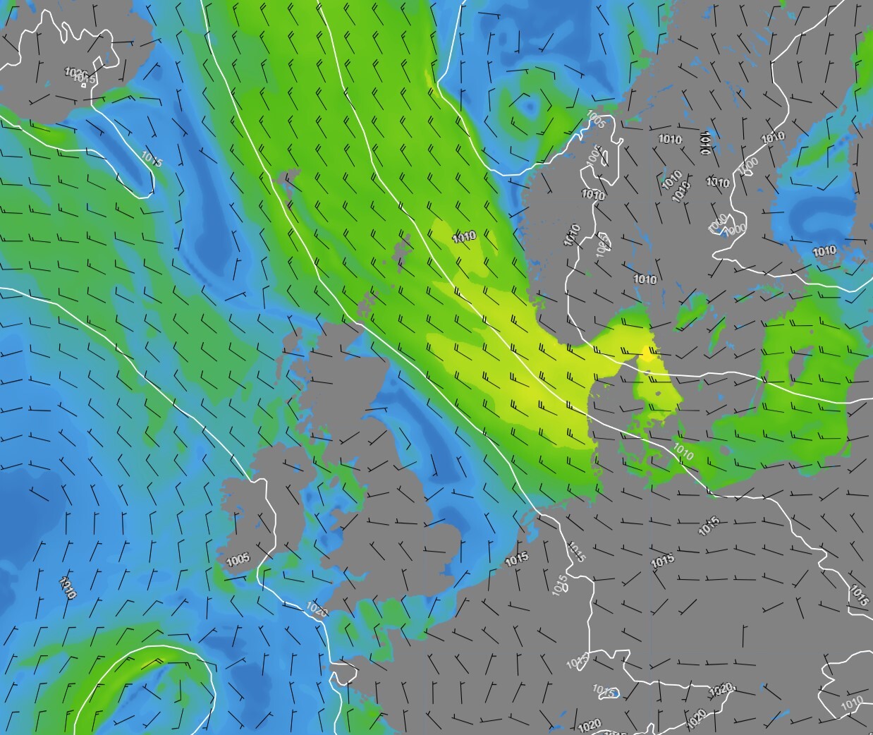 Figure 1: Isobars (black lines 5hPa) and wind speed/direction (kts) valid Thursday July 20th 00 UTC.
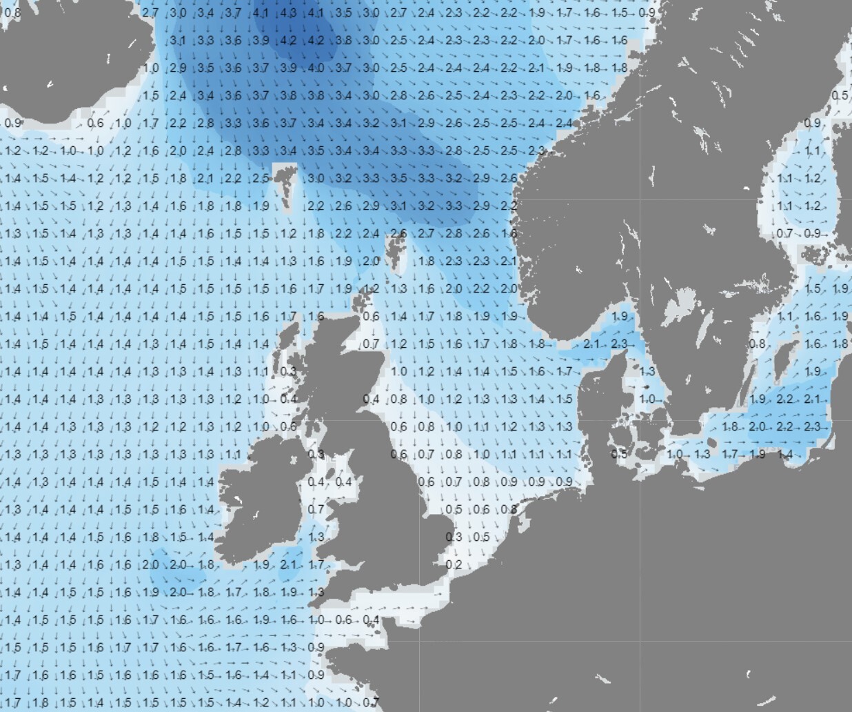 Figure 2: Significant wave height/direction (m) valid Tuesday July 18th 12 UTC
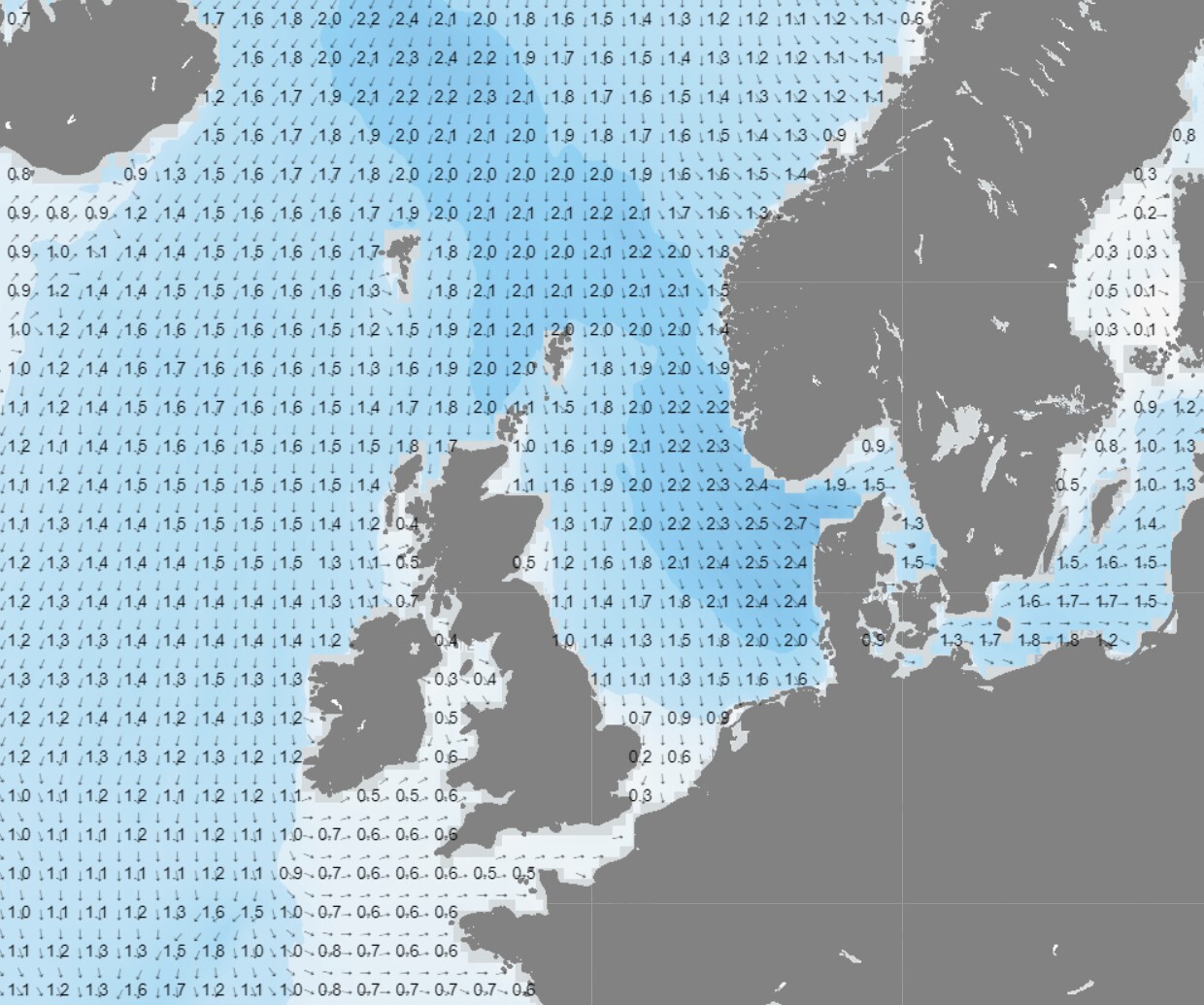 Figure 3: Significant wave height/direction (m) valid Thursday July 20th 12UTC.
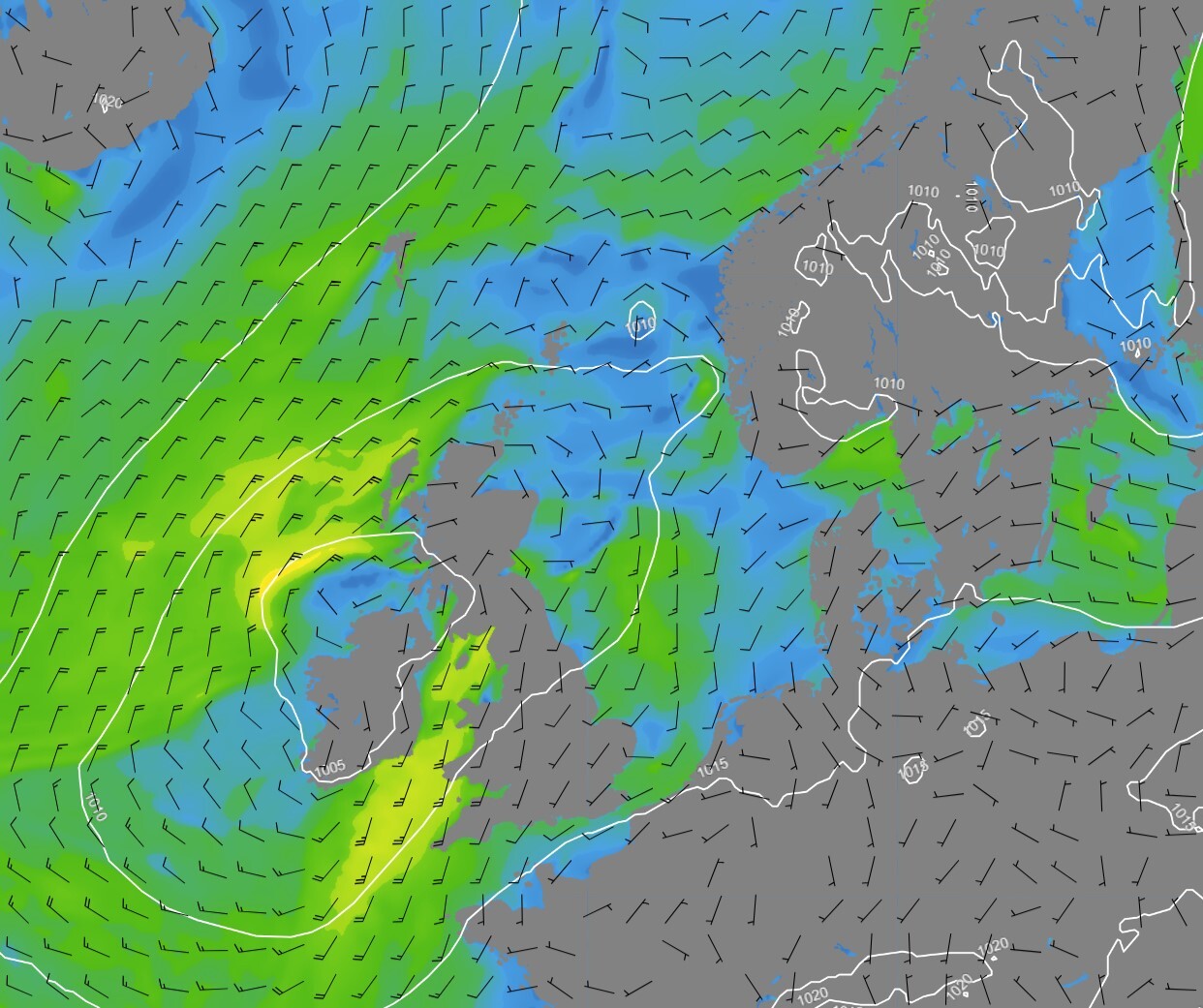 Figure 4: Isobars (black lines 5hPa) and wind speed/direction (kts) valid Sunday July 23rd 00UTC.
Conclusion
Despite the ongoing relatively unsettled weather conditions, no real severe weather is expected this week. Depending on your specific operations, the number of workable weather windows might be limited by the enhanced NW’ly winds and the associated wave field in the northern and eastern parts of the North Sea the first days. The southern and western parts of the North Sea will see calm weather with good operational conditions throughout this outlook period. The dominating NW’ly flow will bring down relatively cold air into the North Sea, so low clouds and/or fog are not expected to influence your operations negatively. The same is valid for the risk of thunderstorms and/or lightning.Infoplaza will continue to monitor the latest weather developments, so please make sure to check, and follow-up our daily updated forecast reports to check the latest developments. We hope all our clients stay safe at sea this week. Please feel free to contact us at any time if you have any questions or remarks.
Learn more about marine weather
We just launched our new resources page. Here you will find special content like videos, webinars and whitepapers that will guide you to a decision point. Use these expert insights to improve your business or simply to get your knowledge about marine weather up-to-date.