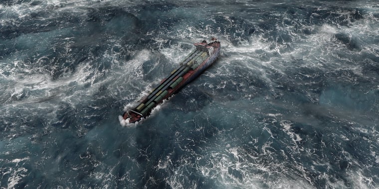
We wrote already about the possibility of a stormy period at the start of this week. This blog elaborates once more on the potentially dangerous upcoming weather situation.
Wednesday till Friday morning
An elongated low-pressure area tracks east over the North Sea today and reaches Denmark and the far south of Scandinavia in the night to Thursday as depicted in figure 1. A sharp trough is located over the middle part of the North Sea. The strongest wind gusts are located along that trough. Wind gusts up to 55-60 knots are possible in that region. Wind gusts are up to 50-55 knots further south over the North Sea and there is barely any wind north of the low-pressure area.
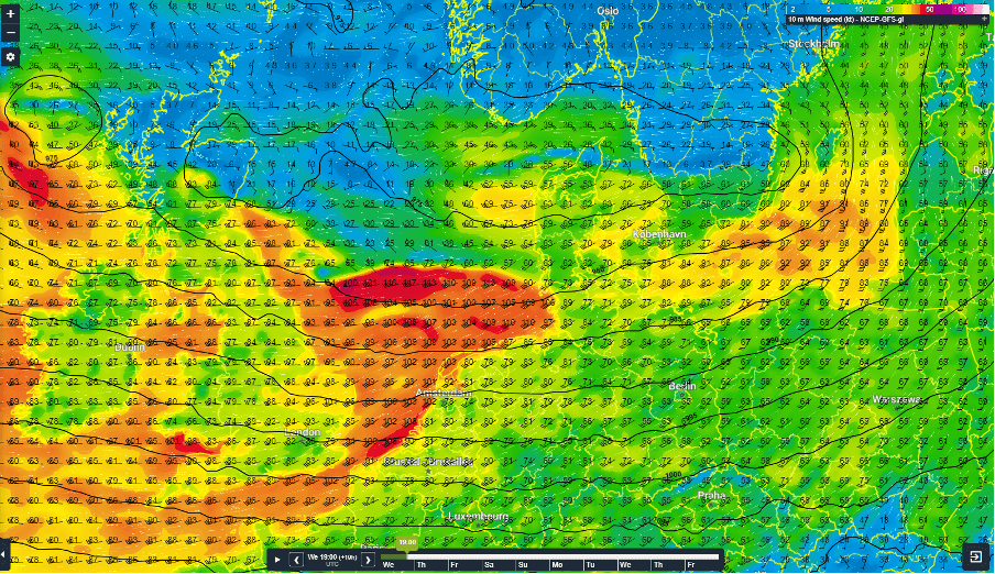 Mean Sea level pressure (black lines) and 10 m wind speeds calculated by GFS for Wednesday 19UTC.
Friday and Saturday
A new low-pressure area rapidly forms south-west of Ireland on Thursday and races towards the UK and the North Sea on Friday. The low is located between the UK and Denmark Friday afternoon. A very strong pressure gradient results in a lot of wind on the south and south-west side of the low-pressure area. Wind gusts are possibly up to 65-75 knots. Locally, wind gusts of a few knots higher are even possible. There is still some uncertainty in the exact track of the low-pressure area. Especially around the core of the low, since a small deviation from a previously calculated track can have a large impact on the forecasted wind speeds. The low tracks east over Denmark and the Baltic Sea on Saturday.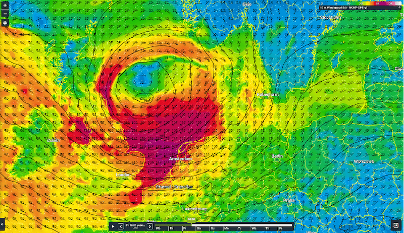 Mean Sea level pressure (black lines) and 10 m wind speeds calculated by GFS for Friday 16UTC.
Weather and wave info crucial
Having accurate weather information when extreme weather events appear is crucial for your offshore operations. Infoplaza can help you with tooling, weather data and advice of meteorologists.