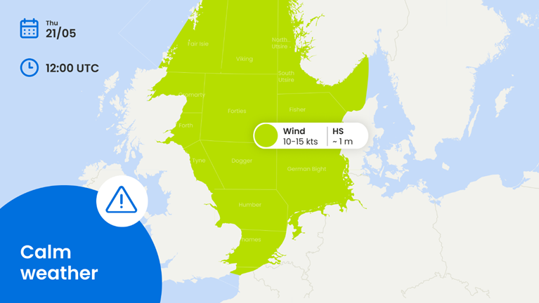
Frontal troughs, associated to an Atlantic low, move away to the north as high pressure builds over France, extending over the North Sea the coming days. The unsettled weather of the past days turns to spring weather with calm seas and low wind speed. Find out below where and when your workable windows will occur in this week’s weather update.
Weather impact
- Workability: For the North Sea, the unsettled conditions of the past period turns to quite good workable under the influence of high pressure approaching from the south. Even in the north wind is expected to ease to mostly moderate.
- Downtime risk: At first, strong winds and waves up to 3 meter, are still possible, especially over the northern North Sea. Also the passage of a weak frontal trough may result in temporarily decreasing conditions on Saturday. Even then, wind speed remains mostly fresh, with wave height around 1 meter, leading to short disruptions of sensitive maritime operations.
- Possible hazards: From Sunday on the Norwegian Sea may come influenced by lows over the northern Atlantic, with disrupting strong winds and associated moderate to rough seas. The actual development is still rather uncertain at this moment.
Weather situation
Frontal troughs, associated to an Atlantic low, move away to the north. High pressure builds over France, extending over the North Sea the coming days. For the North Sea, Bay of Biscay and Irish Sea this implies calm conditions as previously mentioned. The Norwegian Sea may become influenced by a steering large scale Atlantic low in the weekend, with strong westerly winds. Besides that Hs is expected to remain around or below 1 m for the rest of the week, meaning plenty of operational windows will occur.
Strong winds and higher waves may return in the Norwegian Sea in the weekend




 Bram van Kester
 Marsel Blok

