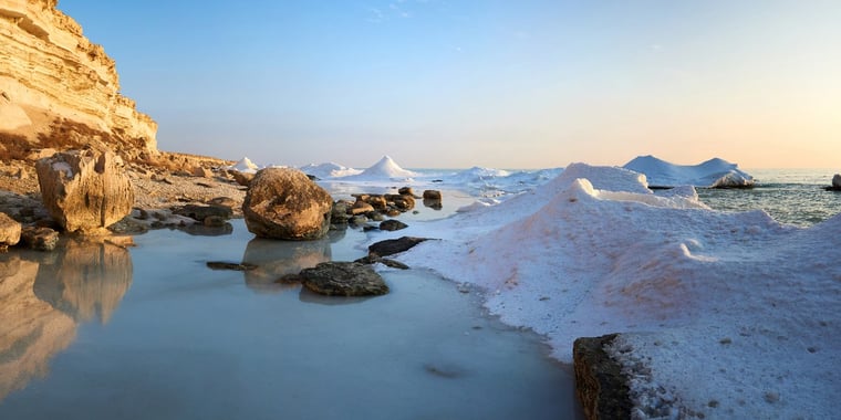
The extreme climate of the Caspian Sea, characterized by cold winters and temperatures as low as -30°C, creates challenging working conditions for our clients’ marine operations. The shallow waters of the northern Caspian Sea easily freeze and are potentially covered with ice more than half a meter thick from November to late March. Depending on the severity of the winter, the ice cover extends beyond the Saddle area and the Kulaly Archipelago. During the coldest winters, it reaches as far as Bautino Bay, which is an important base for marine activities in the northern Caspian Sea.
Infoplaza provides in-house ice charting services to ensure our clients can safely operate to mitigate the risk of potential ice related hazards throughout the winter period. A team of experienced ice charters operates from Kazakhstan and The Netherlands and have a vast experience in monitoring the specific local weather and ice conditions. The latest information from satellite imagery, in-field information from vessels and offshore teams are converted into various ice charting products that are issued on a daily basis.
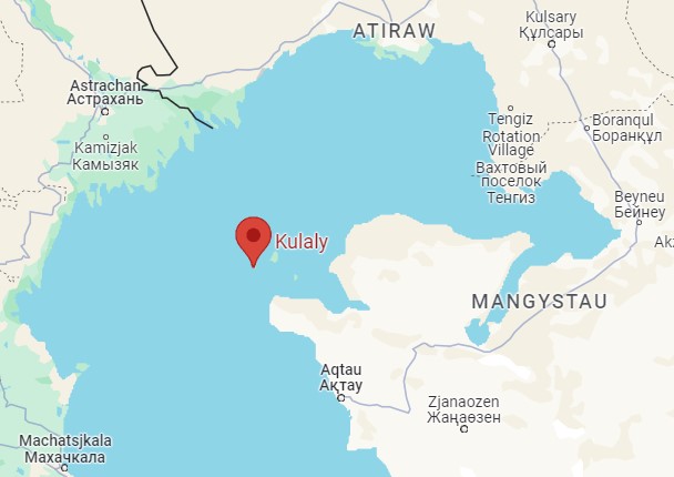 Location of the Kulaly archipelago in the Caspian Sea. Just northwest of it lies the Saddle area. Image: Google Maps.
Prior to the winter season, the team typically begins monitoring the sea surface temperatures of the northern Caspian Sea, as well as the long-term weather forecasts in October each year to estimate the risk of the development of the first ice. The appearance of the first ice is crucial because from this date only ice class vessels can operate in the northern Caspian Sea.
First ice formation
Once the sea surface temperatures cool down to approximately +5°C, a single significant cold air outbreak with temperatures well below freezing point can be enough to rapidly decrease the sea surface temperature towards freezing point. This subsequently initiates the first ice formation and eventually leads to the complete freeze-up of the NE Caspian Sea, sometimes occurring within just one week. This process is especially pronounced after the passage of a low-pressure system and a high-pressure system settling over Kazakhstan.Cold air which accumulated over Russia before, can flow out and settle over the region. Additionally, as winds typically turn to a northeasterly direction and strengthen before freeze-up, a negative surge occurs with extremely low water levels over the north-east Caspian Sea, resulting in a reduced water column (below 3m). The heat released when water freezes is removed more quickly by enhanced winds as well.
This classic freeze-up pattern occurred last winter (2022/23), as the combination of the abovementioned factors led to a rapid development of new ice in the shallowest coastal areas along the north and east coast (see Figure 1).
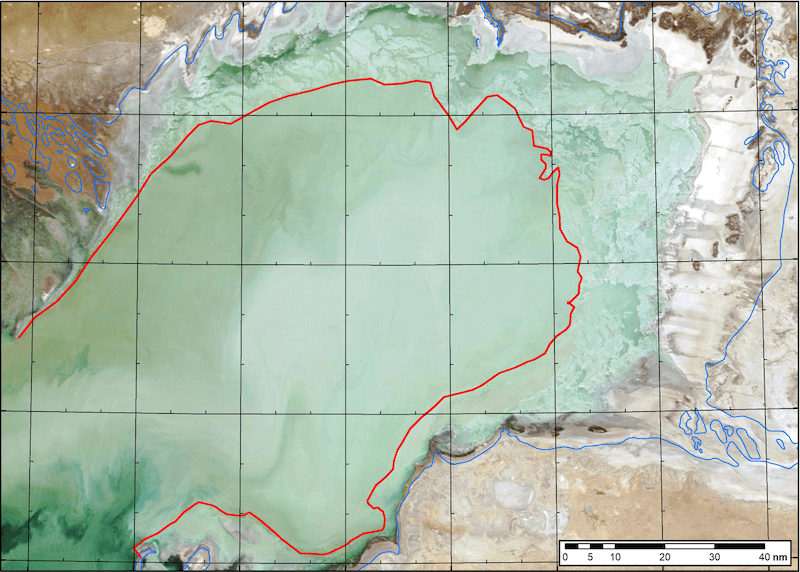 Figure 1: MODIS satellite imagery December 1st 2022 showing the ice edge (red line). New ice developed in the shallow coastal zones, and drifted in a southwesterly direction.
The new ice rapidly thickened, extended and drifted southwestward across the northern Caspian Sea in the days that followed. Saddle area is a shallow part that divides the northern parts of the Caspian Sea from the deeper central Caspian Sea, stretching from the Volga Delta towards the Kulaly Islands. It typically freezes before the somewhat deeper waters of the central part of the northern Caspian Sea (Kalamkas area, see Figure 2).
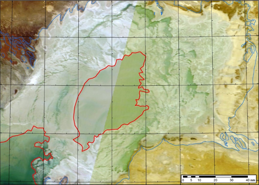 Figure 2: MODIS satellite imagery December 5th 2022 showing the ice edge (red line). Saddle area closed in by new ice from Volga Delta in the NW and Kulaly islands from the south-east, leaving an area of open water in the central part of the northern Caspian Sea.
Freeze-up forecast
This year’s (2023) fall has been relatively warm, and the sea surface temperatures consequently remain at a relatively high level for the time of the year. Looking at the actual mid-term weather forecasts (temperature ensemble, see Figure 3), the risk of an early freeze-up in the next 10 days is negligible, as no significant cold air outbreak with temperatures well below freezing point is in sight.The long-term forecasts continue to lean towards warmer conditions for the region, suggesting that an early proper freeze-up of the north-east Caspian Sea is not expected to occur this month. However, it's important to note that weather forecasts are subject to change. Therefore, it's advisable to stay updated with the latest Infoplaza weather forecasts for any potential shifts in weather patterns.
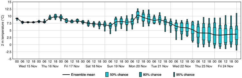
Figure 3: The latest Infoplaza 10-day temperature ensemble forecast for the north-east Caspian Sea, issued Wednesday November 15th 2023.
Next month, we will have a look at the ice situation in the Caspian Sea again. Will there be a freeze-up? One way to be kept in the loop, is to be subscribed to the Infoplaza marine weather operations newsletter.